


Garmin GPSMAP 1643xsv SideVü, ClearVü and Traditional CHIRP Sonar with Mapping (010-02919-03)
Garmin GPSMAP 1643xsv SideVü, ClearVü and Traditional CHIRP Sonar with Mapping (010-02919-03)
SKU: 010-02919-03
En stock
 WhatsApp
 SMS - Text us!
 Email Us!
 Help Desk
Avis
Spécifications

Dans la boîte
microSD™ card preinstalled
8-pin transducer to 12-pin sounder adapter cable
Power cable
Flush mount kit with gasket
Protective cover
Trim piece snap covers
Backbone/drop cable (2 meters) and T-connector for the NMEA 2000® network
Documentation
Vous avez un vieux GPS qui traîne ? Le programme Trade In and Up de GPS Nation est un excellent moyen d'échanger votre ancien GPS usagé contre un crédit pour l'achat d'un nouveau GPS. Le choix vous appartient entièrement ! Nous avons simplifié et rationalisé le processus. Suivez ces étapes simples et vous serez sur la bonne voie pour recevoir un crédit pour votre tout nouveau GPS !
1. Obtenez un devis
Pour obtenir votre devis gratuit, indiquez le type, le fabricant, le modèle et l'état de votre GPS. Dans les 24 heures, vous recevrez un devis correspondant à la valeur de reprise de votre produit actuel. Le formulaire de reprise/d'échange de GPS se trouve au bas de cette page.
2. Expédiez votre/vos produit(s) pour le commerce
Après avoir accepté notre offre, emballez votre ou vos produits en toute sécurité et expédiez-les-nous à l'aide de l'étiquette d'expédition prépayée qui vous a été fournie. Nous vous enverrons un e-mail de confirmation lorsque votre échange arrivera à notre entrepôt. Vous disposez de 30 jours à compter de la date à laquelle vous avez terminé votre échange en ligne pour expédier le produit à GPS Nation.
3. Effectuez votre achat
Une fois que nous aurons reçu votre produit à notre entrepôt et que nous aurons validé l'état indiqué, nous vous enverrons un e-mail de confirmation. Si vous choisissez de recevoir un crédit pour un nouveau GPS sur gpsnation.com, votre crédit de magasin sera émis et vous serez libre de procéder à votre achat.
Manuel et garantie
 Garmin Warranty
Avis
Poser une question
Spécifications
Dans la boîte
microSD™ card preinstalled
8-pin transducer to 12-pin sounder adapter cable
Power cable
Flush mount kit with gasket
Protective cover
Trim piece snap covers
Backbone/drop cable (2 meters) and T-connector for the NMEA 2000® network
Documentation
Programme d'échange
Vous avez un vieux GPS qui traîne ? Le programme Trade In and Up de GPS Nation est un excellent moyen d'échanger votre ancien GPS usagé contre un crédit pour l'achat d'un nouveau GPS. Le choix vous appartient entièrement ! Nous avons simplifié et rationalisé le processus. Suivez ces étapes simples et vous serez sur la bonne voie pour recevoir un crédit pour votre tout nouveau GPS !
1. Obtenez un devis
Pour obtenir votre devis gratuit, indiquez le type, le fabricant, le modèle et l'état de votre GPS. Dans les 24 heures, vous recevrez un devis correspondant à la valeur de reprise de votre produit actuel. Le formulaire de reprise/d'échange de GPS se trouve au bas de cette page.
2. Expédiez votre/vos produit(s) pour le commerce
Après avoir accepté notre offre, emballez votre ou vos produits en toute sécurité et expédiez-les-nous à l'aide de l'étiquette d'expédition prépayée qui vous a été fournie. Nous vous enverrons un e-mail de confirmation lorsque votre échange arrivera à notre entrepôt. Vous disposez de 30 jours à compter de la date à laquelle vous avez terminé votre échange en ligne pour expédier le produit à GPS Nation.
3. Effectuez votre achat
Une fois que nous aurons reçu votre produit à notre entrepôt et que nous aurons validé l'état indiqué, nous vous enverrons un e-mail de confirmation. Si vous choisissez de recevoir un crédit pour un nouveau GPS sur gpsnation.com, votre crédit de magasin sera émis et vous serez libre de procéder à votre achat.
Manuel et garantie
Aperçu
Garmin GPSMAP 1643xsv SideVü, ClearVü and Traditional CHIRP Sonar with Mapping (010-02919-03)
Introduction
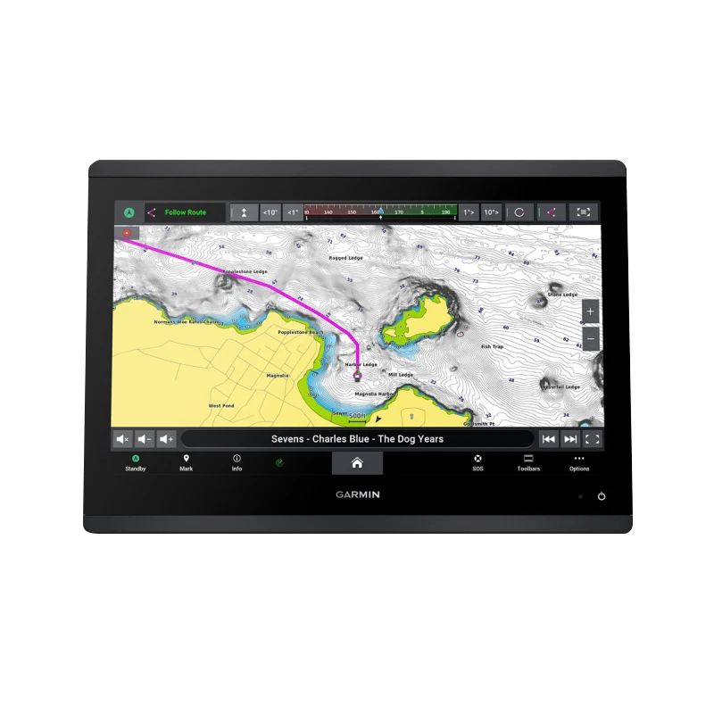
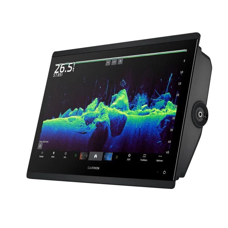
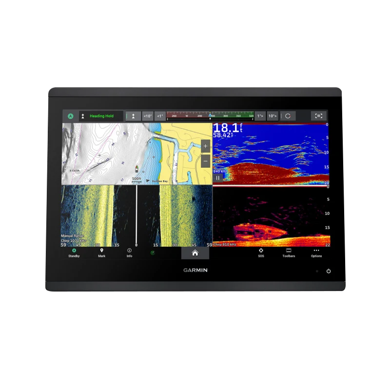
The Garmin GPSMAP 1643xsv is a 16-inch marine chartplotter that combines three distinct sonar technologies—SideVü, ClearVü, and 1 kW CHIRP—into a single integrated system. Built for anglers and professional mariners who demand precise fish location capabilities and detailed underwater structure identification, this device delivers real-time sonar imagery alongside preloaded navigation charts. The integration of IPS display technology with edge-to-edge glass creates a modern helm interface that maintains clarity in full sunlight while reducing on-screen glare. This chartplotter addresses the core frustration serious boaters face: distinguishing actual fish from rock formations, structure shadows, and bottom debris—a challenge that claims 40% better target separation through its advanced CHIRP architecture.
Key Features
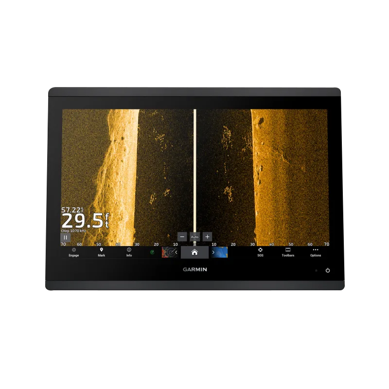
- SideVü sonar with real-time imaging up to 240 feet to the sides of the vessel
- ClearVü sonar providing forward-facing 2D imaging for bottom and structure detail
- 1 kW CHIRP traditional sonar with frequency capability for both shallow and deep water fishing
- 16-inch IPS display with improved sunlight readability at 100% brightness
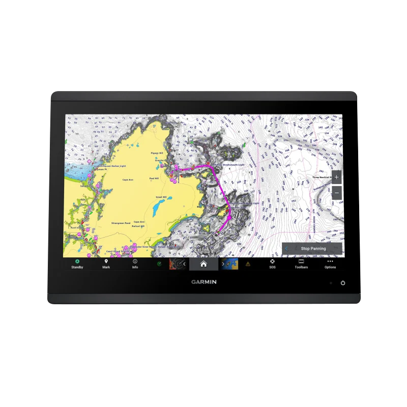
- Garmin Navionics+ preloaded charts with 1-year daily update subscription included
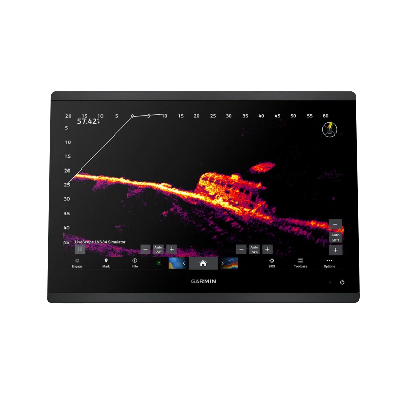
- Panoptix LiveScope compatibility for optional real-time 360-degree underwater viewing
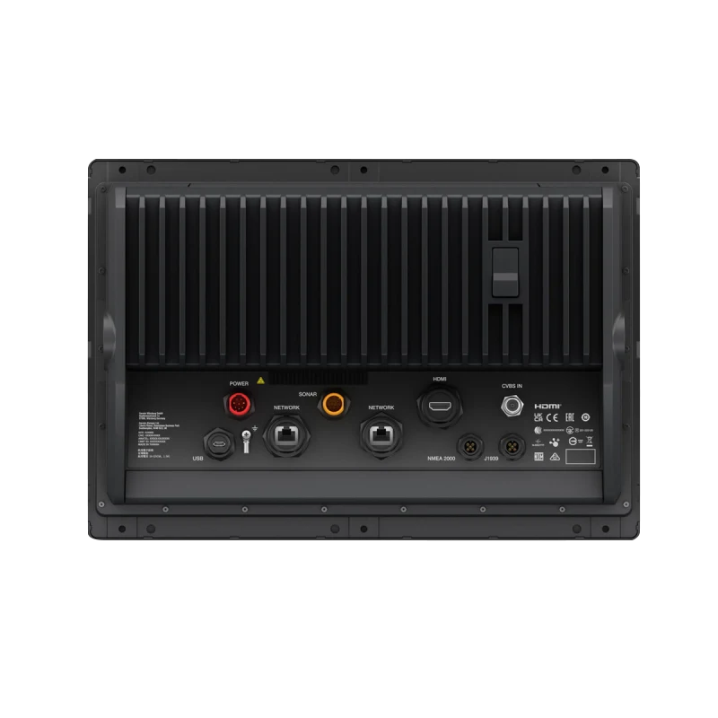
- NMEA 2000 and NMEA 0183 connectivity supporting autopilot integration and third-party device control
- Auto Guidance+ route optimization technology reducing transit time by calculating efficient waterway paths
Data Insights
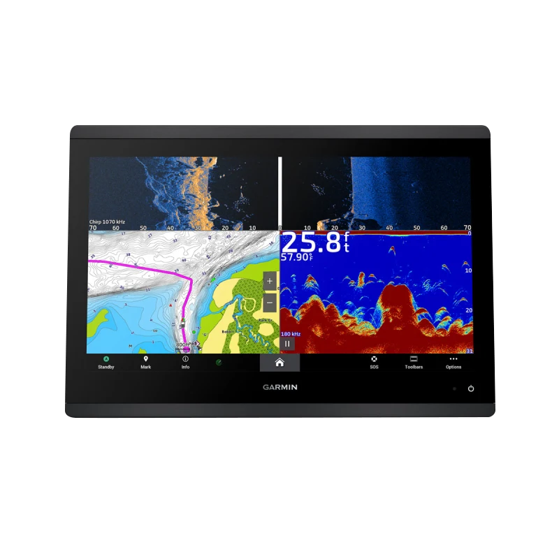
CHIRP sonar technology delivers approximately 40% improved target separation compared to traditional single-frequency sonar systems, enabling anglers to distinguish individual fish and structure types with greater accuracy. The combination of SideVü and ClearVü imagery alongside traditional sonar creates a three-dimensional understanding of underwater environments, improving catch success rates and reducing time spent searching unproductive water. Operators report that the Auto Guidance+ feature reduces average route planning time by minimizing manual waypoint entry and identifying the safest deep-water navigation corridors automatically.
Usage Instructions
Begin by calibrating the device to your specific water depth and salinity conditions using the setup wizard. Deploy the included transducers and verify sonar signal strength through the diagnostics menu. Load Navionics+ charts and create routes using Auto Guidance+ for optimal navigation corridors. Switch between SideVü, ClearVü, and traditional CHIRP displays based on your fishing scenario—use SideVü for structure scanning while trolling, ClearVü for identifying bottom composition, and CHIRP for suspended fish detection at varying depths. Enable NMEA 2000 connectivity in settings to establish autopilot and audio system integration.
Design & Material
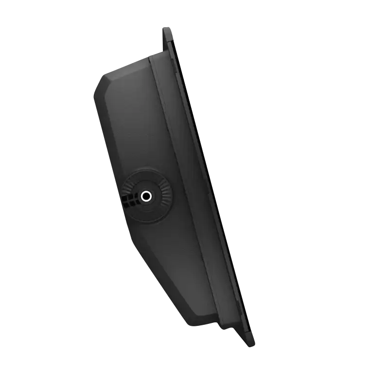
The GPSMAP 1643xsv features a slimline profile that integrates seamlessly into existing helm installations without consuming excessive console space. The design prioritizes functionality through a logical button layout and responsive touchscreen interface, while aesthetic choices—including the edge-to-edge glass panel and black casing—maintain a professional appearance compatible with modern vessel aesthetics.
- Edge-to-edge tempered glass faceplate providing durability and modern styling with minimal frame intrusion
- Weather-resistant housing rated for saltwater spray and extended UV exposure typical of coastal environments
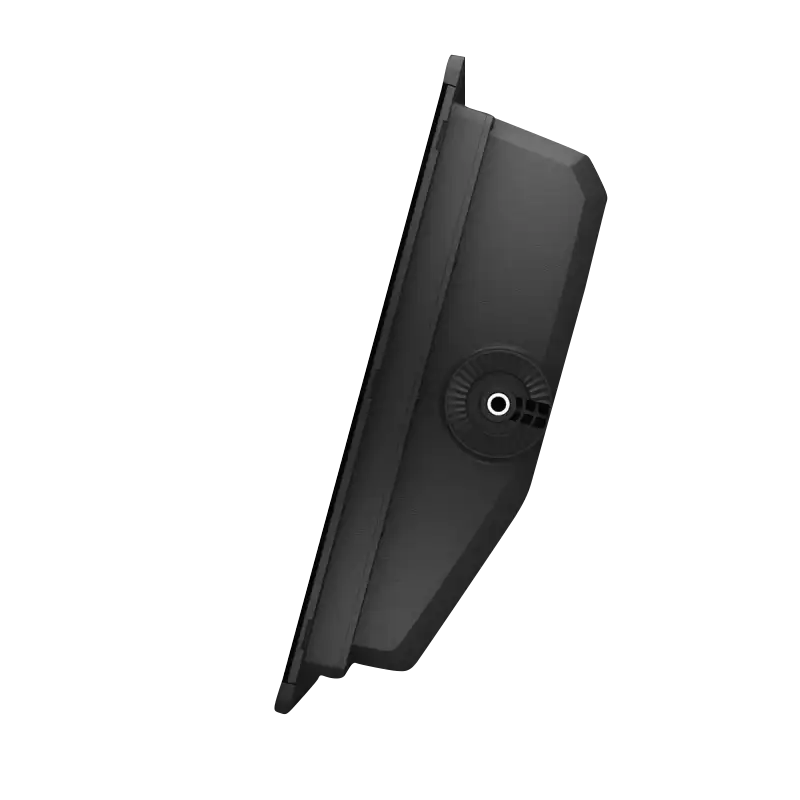
- Compact footprint measuring 16 inches diagonally, designed for easy flush-mounting or pedestal installation on existing brackets
- Lightweight construction reducing installation burden and helm load without sacrificing structural rigidity
- IPS panel technology maintaining color saturation and contrast across wide viewing angles, essential for crew positions away from center console
- Stainless steel hardware and corrosion-resistant internal components engineered for 5+ years of marine environment exposure
Final Verdict
The Garmin GPSMAP 1643xsv stands as the definitive choice for fishing-focused operators and professional mariners requiring integrated sonar and mapping on a single platform. The combination of three distinct sonar imaging types, preloaded daily-updated charts, and proven Auto Guidance+ technology eliminates the complexity of managing separate fish-finding and navigation systems. If you're making underwater decisions based on sonar data daily, or rely on navigation precision in unfamiliar waterways, this chartplotter is the investment that transforms how you interact with the water beneath your hull.


