


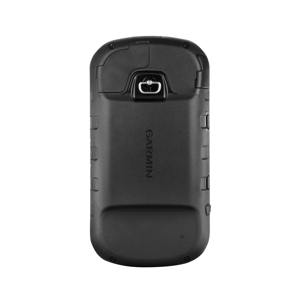
Garmin Montana 610t Camo, Handheld Touchscreen Outdoor/Trail GPS with TOPO Maps (Garmin Certified Refurbished)
Garmin Montana 610t Camo, Handheld Touchscreen Outdoor/Trail GPS with TOPO Maps (Garmin Certified Refurbished)
Model Number: 010-N1534-01
Out of stock
 WhatsApp
 SMS - Text us!
 Email Us!
 Help Desk

Tech Specs
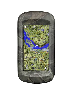
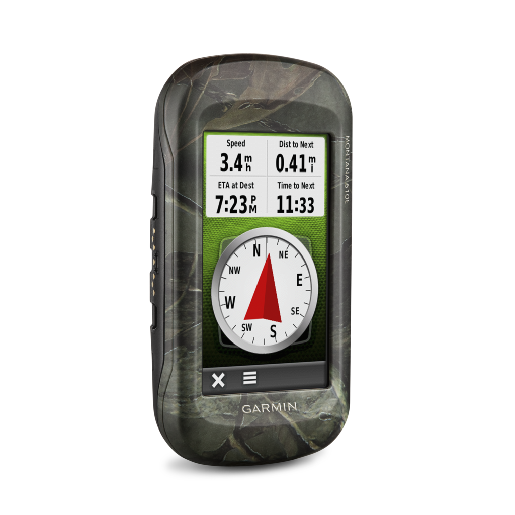
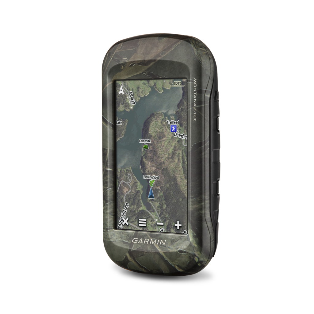
Garmin Montana 610t Camo Handheld GPS: Rugged Touchscreen Navigation with Preloaded Topographic Maps
Introduction
The Garmin Montana 610t Camo is a professional-grade handheld GPS device built for backcountry navigation, trail exploration, and outdoor navigation where accuracy and durability matter. Unlike smartphone-based mapping solutions, this certified refurbished unit delivers independent positioning through dual satellite system support, operates reliably in remote areas without cellular coverage, and maintains precise location data even when moving. Its 4-inch color touchscreen combines readability in direct sunlight with intuitive controls for quick route planning and waypoint marking during active outdoor pursuits.
Key Features
- 4-inch sunlight-readable color touchscreen with dual-orientation display (landscape and portrait modes)
- Preloaded TOPO U.S. 100K topographic maps for terrain visualization and route planning across the continental United States
- Dual GPS and GLONASS satellite receiver improving positioning accuracy by up to 20% and reducing location fix acquisition time
- BIRDEYE satellite imagery with 1-year included subscription providing detailed overhead views for area reconnaissance
- 3-axis tilt-compensated electronic compass delivering accurate heading data during stationary use or motion
- Barometric altimeter with 0.5-meter elevation accuracy for tracking vertical gain and pressure-based weather forecasting
- 8-megapixel integrated camera with automatic geotagging to embed GPS coordinates into every image
Data Insights
The combination of GPS and GLONASS satellite systems reduces positioning error and accelerates initial satellite acquisition—a measurable advantage when navigating canyons, dense forest canopy, or terrain with significant natural obstacles. The 20% improvement in location fix speed translates to faster waypoint collection and reduced time waiting for positioning when you need to move quickly. TOPO 100K map detail renders 1:100,000 terrain resolution, providing sufficient contour accuracy for route planning and elevation profiling across major wilderness areas and trail systems.
Usage Instructions
Power on the device and allow the dual-satellite receiver 30 to 60 seconds to acquire initial position. Use the touchscreen to select your preloaded TOPO maps, then mark waypoints by tapping the map or using the crosshair to record specific locations. Create routes by linking waypoints in sequence, and track your movement in real time by selecting your preferred map orientation. Review altitude data from the barometric altimeter to verify terrain passage, and use the 3-axis compass for bearing confirmation when navigating ridge lines or open terrain.
Design & Material
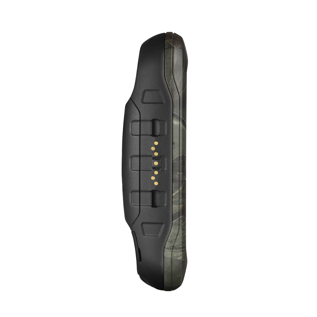
The Montana 610t Camo features a camouflage-patterned exterior engineered for field durability and visual discretion in outdoor environments. Its compact, ergonomic form factor prioritizes one-handed operation and gloved usability, while the robust construction handles the impacts and environmental stress inherent to wilderness navigation.
- Durable rubberized exterior casing with camouflage finish to resist impacts, abrasion, and environmental damage
- Weather-sealed design with resistance to moisture, dust, and splash events typical of trail and backcountry conditions
- Lightweight construction at approximately 8.2 ounces (232 grams) for minimal load burden during extended hiking
- Ergonomic grip and button layout optimized for use with gloves and tactile feedback in cold conditions
- Customizable display settings including map color schemes, font sizes, and widget arrangements for individual preference
- Integrated tripod mount allowing hands-free setup for base camp navigation or multi-hour stationary use
Final Verdict
The Garmin Montana 610t Camo as a certified refurbished unit delivers professional navigation capability at a reduced entry point without compromise on satellite precision, map coverage, or rugged construction. For backcountry hikers, trail runners, geocachers, and wilderness explorers who require independent positioning away from cellular networks, this handheld GPS eliminates the navigation uncertainty that paper maps and smartphone applications cannot reliably resolve. Choose the Montana 610t Camo to gain the positioning redundancy and field-tested durability that outdoor professionals depend on—order today and navigate with confidence in any terrain.
In The Box
- Montana 610t Camo
- Lithium-ion battery pack
- USB cable
- AC charger
- Manuals
Do you have an old GPS unit lying around? The GPS Nation Trade In and Up program is a great way to trade in your old and used GPS for credit towards a new GPS. The choice is entirely yours! We’ve made the process simple and streamlined. Follow these simple steps, and you will be on your way to receiving credit towards your brand new GPS!
1. Get a quote
To get your free quote, provide your GPS type, manufacturer, model, and condition. Within 24 hours, you will receive a quote for the trade-in value of your current product. The GPS trade-in/trade-up form is at the bottom of this page.
2. Ship your product(s) for trade
After accepting our offer, pack your product(s) safely and ship them to us using the pre-paid shipping label provided to you. We will provide a confirmation email when your trade-in arrives at our warehouse. You have 30 days from the date you complete your on-line trade to ship the product to GPS Nation.
3. Make your purchase
Once we receive your product at our warehouse and we validate the stated condition, we will send you a confirmation email. If you elect to receive credit towards a new GPS at gpsnation.com, your store credit will be issued, and you are free to make your purchase.
Manual & Warranty
 Garmin Warranty
Reviews
Ask a Question
Tech Specs
Garmin Montana 610t Camo Handheld GPS: Rugged Touchscreen Navigation with Preloaded Topographic Maps
Introduction
The Garmin Montana 610t Camo is a professional-grade handheld GPS device built for backcountry navigation, trail exploration, and outdoor navigation where accuracy and durability matter. Unlike smartphone-based mapping solutions, this certified refurbished unit delivers independent positioning through dual satellite system support, operates reliably in remote areas without cellular coverage, and maintains precise location data even when moving. Its 4-inch color touchscreen combines readability in direct sunlight with intuitive controls for quick route planning and waypoint marking during active outdoor pursuits.
Key Features
- 4-inch sunlight-readable color touchscreen with dual-orientation display (landscape and portrait modes)
- Preloaded TOPO U.S. 100K topographic maps for terrain visualization and route planning across the continental United States
- Dual GPS and GLONASS satellite receiver improving positioning accuracy by up to 20% and reducing location fix acquisition time
- BIRDEYE satellite imagery with 1-year included subscription providing detailed overhead views for area reconnaissance
- 3-axis tilt-compensated electronic compass delivering accurate heading data during stationary use or motion
- Barometric altimeter with 0.5-meter elevation accuracy for tracking vertical gain and pressure-based weather forecasting
- 8-megapixel integrated camera with automatic geotagging to embed GPS coordinates into every image
Data Insights
The combination of GPS and GLONASS satellite systems reduces positioning error and accelerates initial satellite acquisition—a measurable advantage when navigating canyons, dense forest canopy, or terrain with significant natural obstacles. The 20% improvement in location fix speed translates to faster waypoint collection and reduced time waiting for positioning when you need to move quickly. TOPO 100K map detail renders 1:100,000 terrain resolution, providing sufficient contour accuracy for route planning and elevation profiling across major wilderness areas and trail systems.
Usage Instructions
Power on the device and allow the dual-satellite receiver 30 to 60 seconds to acquire initial position. Use the touchscreen to select your preloaded TOPO maps, then mark waypoints by tapping the map or using the crosshair to record specific locations. Create routes by linking waypoints in sequence, and track your movement in real time by selecting your preferred map orientation. Review altitude data from the barometric altimeter to verify terrain passage, and use the 3-axis compass for bearing confirmation when navigating ridge lines or open terrain.
Design & Material
The Montana 610t Camo features a camouflage-patterned exterior engineered for field durability and visual discretion in outdoor environments. Its compact, ergonomic form factor prioritizes one-handed operation and gloved usability, while the robust construction handles the impacts and environmental stress inherent to wilderness navigation.
- Durable rubberized exterior casing with camouflage finish to resist impacts, abrasion, and environmental damage
- Weather-sealed design with resistance to moisture, dust, and splash events typical of trail and backcountry conditions
- Lightweight construction at approximately 8.2 ounces (232 grams) for minimal load burden during extended hiking
- Ergonomic grip and button layout optimized for use with gloves and tactile feedback in cold conditions
- Customizable display settings including map color schemes, font sizes, and widget arrangements for individual preference
- Integrated tripod mount allowing hands-free setup for base camp navigation or multi-hour stationary use
Final Verdict
The Garmin Montana 610t Camo as a certified refurbished unit delivers professional navigation capability at a reduced entry point without compromise on satellite precision, map coverage, or rugged construction. For backcountry hikers, trail runners, geocachers, and wilderness explorers who require independent positioning away from cellular networks, this handheld GPS eliminates the navigation uncertainty that paper maps and smartphone applications cannot reliably resolve. Choose the Montana 610t Camo to gain the positioning redundancy and field-tested durability that outdoor professionals depend on—order today and navigate with confidence in any terrain.
In The Box
- Montana 610t Camo
- Lithium-ion battery pack
- USB cable
- AC charger
- Manuals
Trade-In
Do you have an old GPS unit lying around? The GPS Nation Trade In and Up program is a great way to trade in your old and used GPS for credit towards a new GPS. The choice is entirely yours! We’ve made the process simple and streamlined. Follow these simple steps, and you will be on your way to receiving credit towards your brand new GPS!
1. Get a quote
To get your free quote, provide your GPS type, manufacturer, model, and condition. Within 24 hours, you will receive a quote for the trade-in value of your current product. The GPS trade-in/trade-up form is at the bottom of this page.
2. Ship your product(s) for trade
After accepting our offer, pack your product(s) safely and ship them to us using the pre-paid shipping label provided to you. We will provide a confirmation email when your trade-in arrives at our warehouse. You have 30 days from the date you complete your on-line trade to ship the product to GPS Nation.
3. Make your purchase
Once we receive your product at our warehouse and we validate the stated condition, we will send you a confirmation email. If you elect to receive credit towards a new GPS at gpsnation.com, your store credit will be issued, and you are free to make your purchase.
Manual & Warranty
Overview
Garmin Montana 610t Camo Handheld GPS: Rugged Touchscreen Navigation with Preloaded Topographic Maps
Introduction
The Garmin Montana 610t Camo is a professional-grade handheld GPS device built for backcountry navigation, trail exploration, and outdoor navigation where accuracy and durability matter. Unlike smartphone-based mapping solutions, this certified refurbished unit delivers independent positioning through dual satellite system support, operates reliably in remote areas without cellular coverage, and maintains precise location data even when moving. Its 4-inch color touchscreen combines readability in direct sunlight with intuitive controls for quick route planning and waypoint marking during active outdoor pursuits.
Key Features
- 4-inch sunlight-readable color touchscreen with dual-orientation display (landscape and portrait modes)
- Preloaded TOPO U.S. 100K topographic maps for terrain visualization and route planning across the continental United States
- Dual GPS and GLONASS satellite receiver improving positioning accuracy by up to 20% and reducing location fix acquisition time
- BIRDEYE satellite imagery with 1-year included subscription providing detailed overhead views for area reconnaissance
- 3-axis tilt-compensated electronic compass delivering accurate heading data during stationary use or motion
- Barometric altimeter with 0.5-meter elevation accuracy for tracking vertical gain and pressure-based weather forecasting
- 8-megapixel integrated camera with automatic geotagging to embed GPS coordinates into every image
Data Insights
The combination of GPS and GLONASS satellite systems reduces positioning error and accelerates initial satellite acquisition—a measurable advantage when navigating canyons, dense forest canopy, or terrain with significant natural obstacles. The 20% improvement in location fix speed translates to faster waypoint collection and reduced time waiting for positioning when you need to move quickly. TOPO 100K map detail renders 1:100,000 terrain resolution, providing sufficient contour accuracy for route planning and elevation profiling across major wilderness areas and trail systems.
Usage Instructions
Power on the device and allow the dual-satellite receiver 30 to 60 seconds to acquire initial position. Use the touchscreen to select your preloaded TOPO maps, then mark waypoints by tapping the map or using the crosshair to record specific locations. Create routes by linking waypoints in sequence, and track your movement in real time by selecting your preferred map orientation. Review altitude data from the barometric altimeter to verify terrain passage, and use the 3-axis compass for bearing confirmation when navigating ridge lines or open terrain.
Design & Material
The Montana 610t Camo features a camouflage-patterned exterior engineered for field durability and visual discretion in outdoor environments. Its compact, ergonomic form factor prioritizes one-handed operation and gloved usability, while the robust construction handles the impacts and environmental stress inherent to wilderness navigation.
- Durable rubberized exterior casing with camouflage finish to resist impacts, abrasion, and environmental damage
- Weather-sealed design with resistance to moisture, dust, and splash events typical of trail and backcountry conditions
- Lightweight construction at approximately 8.2 ounces (232 grams) for minimal load burden during extended hiking
- Ergonomic grip and button layout optimized for use with gloves and tactile feedback in cold conditions
- Customizable display settings including map color schemes, font sizes, and widget arrangements for individual preference
- Integrated tripod mount allowing hands-free setup for base camp navigation or multi-hour stationary use
Final Verdict
The Garmin Montana 610t Camo as a certified refurbished unit delivers professional navigation capability at a reduced entry point without compromise on satellite precision, map coverage, or rugged construction. For backcountry hikers, trail runners, geocachers, and wilderness explorers who require independent positioning away from cellular networks, this handheld GPS eliminates the navigation uncertainty that paper maps and smartphone applications cannot reliably resolve. Choose the Montana 610t Camo to gain the positioning redundancy and field-tested durability that outdoor professionals depend on—order today and navigate with confidence in any terrain.


