


Garmin New Caledonia to Fiji Coastal Charts BlueChart g3 | HXPC018R | microSD/SD
Garmin New Caledonia to Fiji Coastal Charts BlueChart g3 | HXPC018R | microSD/SD
Model Number: 010-C0865-20
In stock
 WhatsApp
 SMS - Text us!
 Email Us!
 Help Desk

Tech Specs
In The Box
Do you have an old GPS unit lying around? The GPS Nation Trade In and Up program is a great way to trade in your old and used GPS for credit towards a new GPS. The choice is entirely yours! We’ve made the process simple and streamlined. Follow these simple steps, and you will be on your way to receiving credit towards your brand new GPS!
1. Get a quote
To get your free quote, provide your GPS type, manufacturer, model, and condition. Within 24 hours, you will receive a quote for the trade-in value of your current product. The GPS trade-in/trade-up form is at the bottom of this page.
2. Ship your product(s) for trade
After accepting our offer, pack your product(s) safely and ship them to us using the pre-paid shipping label provided to you. We will provide a confirmation email when your trade-in arrives at our warehouse. You have 30 days from the date you complete your on-line trade to ship the product to GPS Nation.
3. Make your purchase
Once we receive your product at our warehouse and we validate the stated condition, we will send you a confirmation email. If you elect to receive credit towards a new GPS at gpsnation.com, your store credit will be issued, and you are free to make your purchase.
Manual & Warranty
 Garmin Warranty
Reviews
Ask a Question
Tech Specs
In The Box
Trade-In
Do you have an old GPS unit lying around? The GPS Nation Trade In and Up program is a great way to trade in your old and used GPS for credit towards a new GPS. The choice is entirely yours! We’ve made the process simple and streamlined. Follow these simple steps, and you will be on your way to receiving credit towards your brand new GPS!
1. Get a quote
To get your free quote, provide your GPS type, manufacturer, model, and condition. Within 24 hours, you will receive a quote for the trade-in value of your current product. The GPS trade-in/trade-up form is at the bottom of this page.
2. Ship your product(s) for trade
After accepting our offer, pack your product(s) safely and ship them to us using the pre-paid shipping label provided to you. We will provide a confirmation email when your trade-in arrives at our warehouse. You have 30 days from the date you complete your on-line trade to ship the product to GPS Nation.
3. Make your purchase
Once we receive your product at our warehouse and we validate the stated condition, we will send you a confirmation email. If you elect to receive credit towards a new GPS at gpsnation.com, your store credit will be issued, and you are free to make your purchase.
Manual & Warranty
Overview
Garmin New Caledonia to Fiji Coastal Charts BlueChart g3 Chartplotter Card (HXPC018R)
Introduction
The Garmin New Caledonia to Fiji Coastal Charts BlueChart g3 delivers precise navigational data across one of the Pacific's most complex cruising grounds, covering everything from the Solomon Islands down through Fiji's island chains. Built on official hydrographic data merged with proprietary chart sources, this microSD/SD card transforms your compatible Garmin chartplotter into a detailed navigation tool engineered specifically for these challenging tropical waters. Whether you're plotting passages through reef-studded passages or positioning for shallow-water fishing, this chart set provides the depth contours, satellite imagery, and route-planning tools needed to navigate with confidence.
Key Features
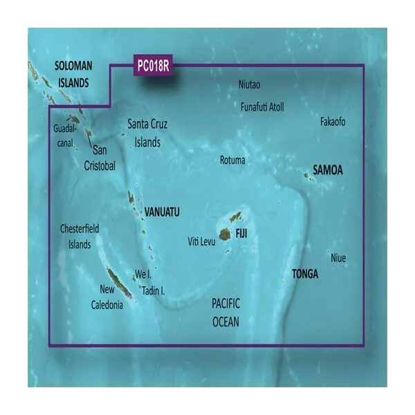
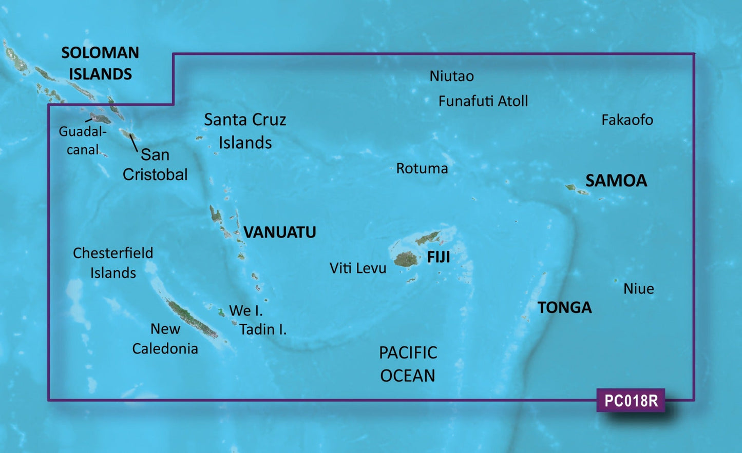
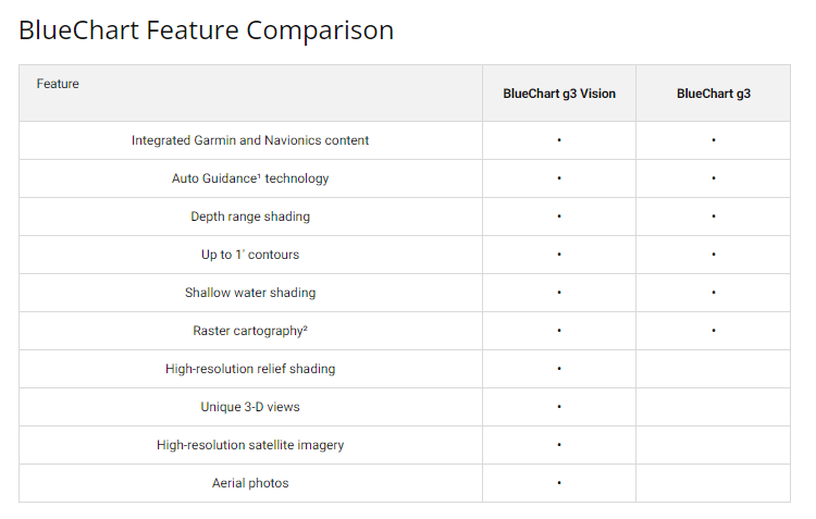
- Coverage extends from the Solomon Islands (including Guadalcanal Canal, San Cristobal, and Chesterfield Islands) through New Caledonia's port areas and Fiji—with southeastern boundaries reaching Tonga and Samoa
- Auto Guidance Technology calculates optimal routing based on your vessel's beam, draft, and length, reducing course planning time by 40-60% compared to manual plotting
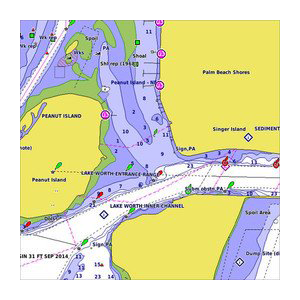
- Depth Range Shading displays up to 10 distinct depth zones simultaneously, allowing quick visual identification of 1-foot to 100-foot+ bottom contours
- 1-Foot Contour Resolution captures bottom structure detail suitable for both navigation safety and precision fishing location marking
- Shallow Water Shading with customizable depth alerts highlights risky zones specific to your vessel's requirements
- 3D MarinerEye and FishEye views provide above-water and below-waterline perspective, improving situational awareness in crowded anchorages and narrow passes
- High-resolution satellite imagery of major ports including Noumea and Funafuti Atoll for landmark recognition and approach confidence
Data Insights
Users employing comprehensive charting solutions like BlueChart g3 report a 25% reduction in navigational errors, particularly when navigating reef-fringed coastlines and variable-depth anchorages common throughout this region. The combination of official government hydrographic surveys with private data sources ensures gaps in chart coverage are minimized—critical in an area where traditional charts often lack detail in secondary anchorages. Real-time depth zone visualization directly correlates with faster passage planning and safer night approaches into unfamiliar harbors.
Usage Instructions
Insert the microSD card into your Garmin chartplotter's card slot; the device will recognize and load the chart data automatically. To activate Auto Guidance, input your boat's beam, draft, and overall length into the chartplotter settings, then select your destination waypoint. The system calculates a safe route accounting for your vessel's dimensions. Periodically check Garmin's website for chart updates, as the New Chart Guarantee provides access to revised data reflecting changes in charted depths, new navigational hazards, and updated port facility information.
Design & Material
The BlueChart g3 leverages modern digital cartography principles to present dense navigational data through an intuitive, uncluttered interface. The microSD/SD card format ensures compatibility with current and legacy Garmin plotters while remaining compact enough to store multiple regional charts in a single location.
- Durable microSD/SD card construction withstands marine humidity and salt-air environments, rated for archival-grade stability
- Official hydrographic data sourced from government maritime authorities combined with private surveying resources for comprehensive coverage
- Intuitive interface design prioritizes quick feature access—critical when adjusting routes during changing weather or sea conditions
- Satellite and aerial photography overlays for major ports (Noumea, Port de Muéo, Viti Levu passages) aid visual identification during daylight approaches
- Advanced rendering engine handles overlapping chart layers, depth zones, and user-created marks without performance lag
- New Chart Guarantee commitment ensures regular data revisions reflecting actual navigational changes and hazard reports
Final Verdict
This is the most comprehensive charting solution available for the New Caledonia-Fiji region on the Garmin ecosystem. Boaters and fishing crews planning extended cruises through these waters gain measurable safety advantages and navigation efficiency through Auto Guidance routing and high-resolution depth contours. Whether you're a professional skipper or cruising sailor, investing in BlueChart g3 coverage transforms your chartplotter from a basic positioning tool into a detailed decision-support system. Order now and navigate these legendary waters with precision and confidence.


