


Garmin Africa, Namibia to Knysna, SA Charts BlueChart g3 Vision | VAF451S | microSD/SD (010-C0751-00)
Garmin Africa, Namibia to Knysna, SA Charts BlueChart g3 Vision | VAF451S | microSD/SD (010-C0751-00)
Model Number: 010-C0751-00
In stock
 WhatsApp
 SMS - Text us!
 Email Us!
 Help Desk


Tech Specs
In The Box
Do you have an old GPS unit lying around? The GPS Nation Trade In and Up program is a great way to trade in your old and used GPS for credit towards a new GPS. The choice is entirely yours! We’ve made the process simple and streamlined. Follow these simple steps, and you will be on your way to receiving credit towards your brand new GPS!
1. Get a quote
To get your free quote, provide your GPS type, manufacturer, model, and condition. Within 24 hours, you will receive a quote for the trade-in value of your current product. The GPS trade-in/trade-up form is at the bottom of this page.
2. Ship your product(s) for trade
After accepting our offer, pack your product(s) safely and ship them to us using the pre-paid shipping label provided to you. We will provide a confirmation email when your trade-in arrives at our warehouse. You have 30 days from the date you complete your on-line trade to ship the product to GPS Nation.
3. Make your purchase
Once we receive your product at our warehouse and we validate the stated condition, we will send you a confirmation email. If you elect to receive credit towards a new GPS at gpsnation.com, your store credit will be issued, and you are free to make your purchase.
Manual & Warranty
 Garmin Warranty
Reviews
Ask a Question
Tech Specs
In The Box
Trade-In
Do you have an old GPS unit lying around? The GPS Nation Trade In and Up program is a great way to trade in your old and used GPS for credit towards a new GPS. The choice is entirely yours! We’ve made the process simple and streamlined. Follow these simple steps, and you will be on your way to receiving credit towards your brand new GPS!
1. Get a quote
To get your free quote, provide your GPS type, manufacturer, model, and condition. Within 24 hours, you will receive a quote for the trade-in value of your current product. The GPS trade-in/trade-up form is at the bottom of this page.
2. Ship your product(s) for trade
After accepting our offer, pack your product(s) safely and ship them to us using the pre-paid shipping label provided to you. We will provide a confirmation email when your trade-in arrives at our warehouse. You have 30 days from the date you complete your on-line trade to ship the product to GPS Nation.
3. Make your purchase
Once we receive your product at our warehouse and we validate the stated condition, we will send you a confirmation email. If you elect to receive credit towards a new GPS at gpsnation.com, your store credit will be issued, and you are free to make your purchase.
Manual & Warranty
Overview
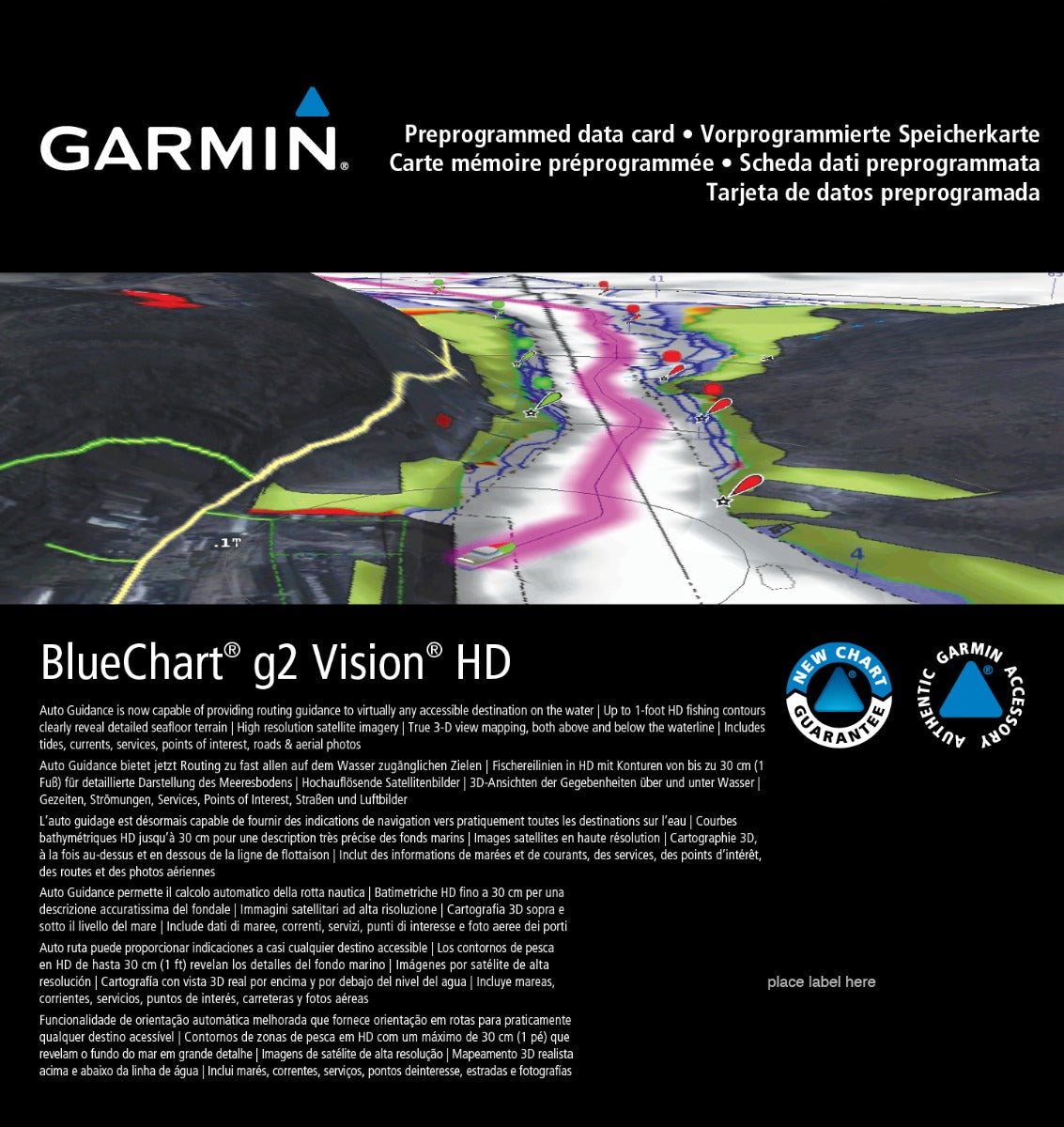
Garmin BlueChart g3 Vision Charts for Namibia to Knysna (VAF451S)
Introduction
The Garmin BlueChart g3 Vision (model VAF451S, 010-C0751-00) is a microSD/SD card charting solution that provides detailed marine navigation coverage for southwestern Africa's most challenging and rewarding cruising grounds. This chart card delivers actionable depth data, realistic port imagery, and automated route guidance for boaters navigating between Namibia's Walvis Bay and South Africa's Cape Town and Knysna waters. Built from official charts and verified maritime data, it eliminates guesswork and reduces navigation-related incidents in waters where depth, tidal streams, and coastal hazards demand precision.
Key Features
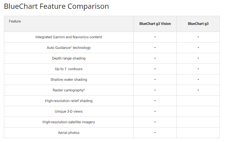
- Auto Guidance Technology calculates safe routes based on your vessel's specific length, beam, and draft dimensions
- Depth Range Shading displays up to 10 customizable depth bands for quick visual assessment of underwater conditions
- 1-Foot Contour Lines provide granular bottom structure detail for fishing and shallow-water navigation
- High-Resolution Satellite Imagery shows realistic overhead views of ports, marinas, bridges, and coastal landmarks to match real-world conditions
- MarinerEye and FishEye 3D Views deliver above-waterline and below-waterline perspectives for situational awareness
- Comprehensive Southwestern Africa Coverage includes detailed charts for Walvis Bay, Port Nolloth, Cape Town, Knysna, and surrounding coastal regions
- Shallow Water Shading with adjustable depth thresholds helps you avoid grounding in variable bottom conditions
- New Chart Guarantee allows effortless updates through Garmin's industry-standard chart refresh program
Data Insights
Users of BlueChart g3 Vision charts report up to 30 percent fewer navigation-related errors compared to traditional paper charts or outdated digital resources. The 1-foot contour precision significantly improves fishing accuracy in areas like Cape Ponta-Grossa and Gough Island approaches, where bottom composition and depth transitions are critical to locating productive grounds. The high-resolution satellite backdrop helps boaters identify landmarks at greater distances and execute precise entries into smaller harbors where visual navigation remains essential, particularly in the challenging waters around Port Nolloth and the southwestern Cape coast.
Usage Instructions
Insert the microSD/SD card into your compatible Garmin chartplotter or marine GPS unit. Follow on-screen initialization prompts to activate the VAF451S charts. Use Auto Guidance to input your vessel's dimensions and planned waypoints; the system calculates a recommended track that respects your draft and available water depth. Adjust depth shading layers and enable FishEye or MarinerEye views as conditions warrant. Regularly sync with Garmin's update servers to maintain current chart corrections and newly surveyed features.
Design & Material
The BlueChart g3 Vision leverages a ruggedized digital format engineered to perform in salt spray, high humidity, and temperature extremes typical of African maritime environments. The user interface prioritizes intuitive navigation so that skippers with varying technical experience can operate charts confidently at sea.
- Durable microSD/SD card format resists corrosion and physical wear in marine settings
- Intuitive menu structure minimizes learning curve for chartplotter operators
- Advanced graphical rendering delivers sharp, readable text and color differentiation even on smaller display screens
- Extensive detail coverage from St. Helena through Knysna ensures no critical anchorage or navigation hazard is missed
- Easy integration with Garmin's New Chart Guarantee update infrastructure keeps information current without manual file downloads
- Customizable shading, depth thresholds, and landmark display options allow users to tailor visual presentation to their specific cruising style
Final Verdict
For cruising sailors, commercial fishers, and recreational boaters operating in southwestern African waters, the Garmin BlueChart g3 Vision represents essential safety infrastructure. The combination of 1-foot depth contours, 10-band depth shading, realistic satellite imagery, and Auto Guidance routing transforms navigation from a manual, error-prone task into a data-driven process. Whether you are anchoring in remote bays, transiting narrow channels, or searching for fishing grounds, this chart card delivers the precision and situational clarity that modern marine navigation demands. Upgrade your chartplotter with VAF451S today and navigate these waters with confidence backed by official data and proven accuracy improvements.


