


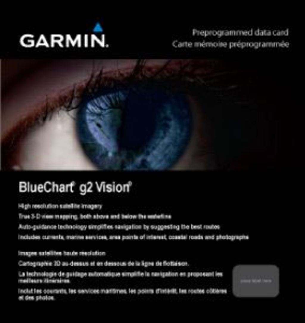
Garmin Azores Islands Charts BlueChart g3 Vision | VEU502S | microSD/SD (010-C0846-00)
Garmin Azores Islands Charts BlueChart g3 Vision | VEU502S | microSD/SD (010-C0846-00)
Model Number: 010-C0846-00
In stock
 View full details
 WhatsApp
 SMS - Text us!
 Email Us!
 Help Desk


Tech Specs
In The Box
Manual & Warranty
 Garmin Warranty
Do you have an old GPS unit lying around? The GPS Nation Trade In and Up program is a great way to trade in your old and used GPS for credit towards a new GPS. The choice is entirely yours! We’ve made the process simple and streamlined. Follow these simple steps, and you will be on your way to receiving credit towards your brand new GPS!
1. Get a quote
To get your free quote, provide your GPS type, manufacturer, model, and condition. Within 24 hours, you will receive a quote for the trade-in value of your current product. The GPS trade-in/trade-up form is at the bottom of this page.
2. Ship your product(s) for trade
After accepting our offer, pack your product(s) safely and ship them to us using the pre-paid shipping label provided to you. We will provide a confirmation email when your trade-in arrives at our warehouse. You have 30 days from the date you complete your on-line trade to ship the product to GPS Nation.
3. Make your purchase
Once we receive your product at our warehouse and we validate the stated condition, we will send you a confirmation email. If you elect to receive credit towards a new GPS at gpsnation.com, your store credit will be issued, and you are free to make your purchase.
Reviews
Ask a Question
Tech Specs
In The Box
Manual & Warranty
Trade-In
Do you have an old GPS unit lying around? The GPS Nation Trade In and Up program is a great way to trade in your old and used GPS for credit towards a new GPS. The choice is entirely yours! We’ve made the process simple and streamlined. Follow these simple steps, and you will be on your way to receiving credit towards your brand new GPS!
1. Get a quote
To get your free quote, provide your GPS type, manufacturer, model, and condition. Within 24 hours, you will receive a quote for the trade-in value of your current product. The GPS trade-in/trade-up form is at the bottom of this page.
2. Ship your product(s) for trade
After accepting our offer, pack your product(s) safely and ship them to us using the pre-paid shipping label provided to you. We will provide a confirmation email when your trade-in arrives at our warehouse. You have 30 days from the date you complete your on-line trade to ship the product to GPS Nation.
3. Make your purchase
Once we receive your product at our warehouse and we validate the stated condition, we will send you a confirmation email. If you elect to receive credit towards a new GPS at gpsnation.com, your store credit will be issued, and you are free to make your purchase.
Overview
Garmin Azores Islands Charts BlueChart g3 Vision | VEU502S | microSD/SD (010-C0846-00)
Experience top-tier maritime navigation with the Garmin Azores Islands Charts BlueChart g3 Vision. This advanced coastal charting solution is meticulously designed to enhance your boating, fishing, and cruising experiences, ensuring unmatched accuracy and detail. With features that cater to both seasoned navigators and newcomers alike, you can explore the stunning Azores Islands with confidence and ease.
Key Features
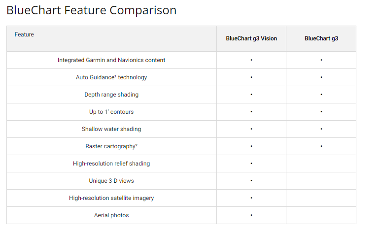
- Premier Coastal Charts: Integrated Garmin and Navionics® content provides industry-leading coverage and clarity.
- Auto Guidance Technology: Safely calculate suggested routes with optimal depth and overhead clearance.
- Depth Range Shading: Visualize depths with high-resolution shading for up to 10 depth ranges.
- Detailed Contours: Enjoy precision with up to 1-foot contours, enhancing fishing charts and navigation.
- Shallow Water Shading: Customizable shading to safely navigate shallow areas.
- High-Resolution Satellite Imagery: Realistic views that enhance confidence when entering unfamiliar harbors.
Data Insights
The Garmin Azores Islands Charts BlueChart g3 Vision boasts an impressive level of detail, with 1-foot contour data allowing for precise navigation in complex waterways. Studies have shown that accurate depth information can reduce the risk of grounding by up to 30%, making this charting solution a vital asset for any boating enthusiast.
Usage Instructions
To utilize the Garmin Azores Islands Charts effectively, simply insert the microSD/SD card into your compatible Garmin device. Allow the system to update, and use the Auto Guidance feature to plan safe routes based on your selected depth preferences. Regularly check updates to ensure you have the latest chart information for optimal navigation.
Design & Material
The design of the Garmin Azores Islands Charts emphasizes clarity and practicality. The use of high-resolution imagery and detailed contours ensures that every nautical mile is covered with precision. The product is crafted with durability in mind, ready to withstand the elements of the sea.
- Durable microSD/SD Card: Built to last, providing reliable access to navigation data.
- Advanced Charting Software: Integrates seamlessly with Garmin devices for ease of use.
- High-resolution graphics: Enhances visual clarity and user experience.
- Lightweight and portable: Easy to store and transport for any boating adventure.
- Comprehensive coverage: Detailed port plans for each island in the Azores.
- Customizable settings: Personalize your navigation experience based on your preferences.
Final Verdict
Elevate your maritime adventures with the Garmin Azores Islands Charts BlueChart g3 Vision. Its robust features and superior details make it an essential tool for anyone navigating the stunning Azores. Don’t navigate without the best—equip yourself with this comprehensive charting solution today!


