


Garmin Bluechart G2 Indian Subcontinent (010-C0755-20)
Garmin Bluechart G2 Indian Subcontinent (010-C0755-20)
Model Number: 010-C0755-20
In stock
 View full details
 WhatsApp
 SMS - Text us!
 Email Us!
 Help Desk


Tech Specs
Garmin Bluechart G2 Indian Subcontinent (010-C0755-20)
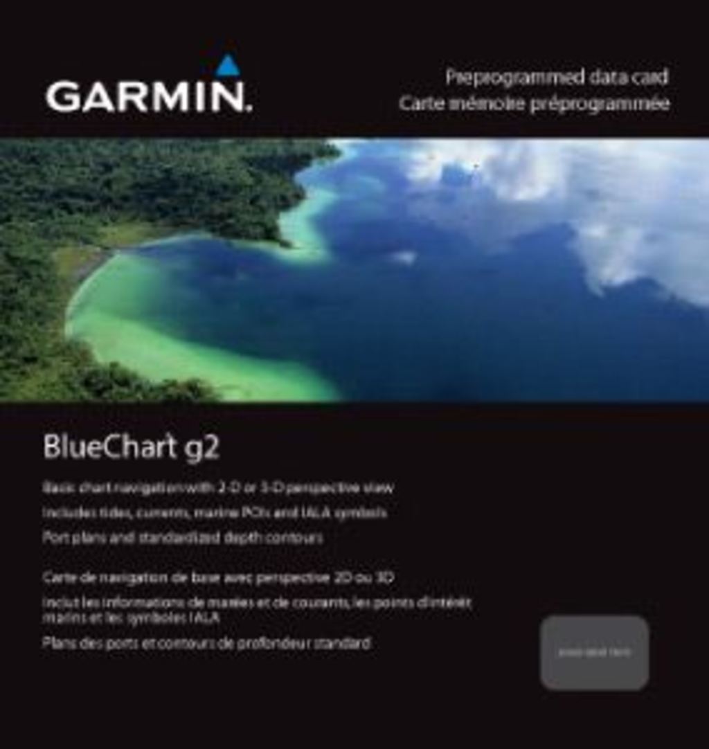
Experience the ultimate in marine navigation with the Garmin Bluechart G2 Indian Subcontinent (010-C0755-20). This advanced marine chart is engineered to transform your navigation experience, ensuring you explore the vast and diverse waters of the Indian subcontinent with confidence. Whether you're a seasoned sailor or embarking on a weekend adventure, this chart is your essential companion, providing you with critical information for safe and effective navigation.
Key Features
- Shaded Depth Contours: Visualize underwater topography with detailed shading for safe navigation.
- Comprehensive Coverage: Spanning from Pasni, Pakistan, to Sandoway, Myanmar, covering major Indian cities.
- Safety Shading: Define safe depths, automatically shading all contours shallower than your specified limit.
- Fishing Charts: Reduced visual clutter focuses on bottom contours and depth soundings for effective fishing.
- Seamless Transitions: Smooth transitions between zoom levels maintain detail across chart boundaries.
- Multiple Viewing Perspectives: Options include 2-D direct overhead and 3-D “over the bow” map perspectives.
Data Insights
The Garmin Bluechart G2 Indian Subcontinent provides extensive geographical coverage that includes vital areas such as Sri Lanka, the Andaman and Nicobar Islands, the Chagos Archipelago, and the Maldives (excluding detailed coverage of the Male Atoll). With up to 20% better detail in coastal areas compared to previous models, this chart ensures you are well-equipped for a safe journey.
Usage Instructions
For best results, simply insert the Garmin Bluechart G2 into your compatible Garmin device. Utilize the HomePort™ software (sold separately) to plan and organize your routes conveniently from your computer. Ensure to familiarize yourself with the shading features to set safe depth limits before embarking on your marine adventures.
Design & Material
The Garmin Bluechart G2 is designed for durability and ease of use. Its intuitive layout allows for quick reference while navigating. The precision mapping technology ensures superior performance in both coastal and open waters.
- High-Quality Mapping: Uses advanced cartography for accurate and detailed charting.
- Durable Construction: Designed to withstand tough marine environments.
- Easy Navigation: User-friendly interface for effortless access to information.
- Lightweight Design: Compact size for convenient storage and handling.
- Vibrant Colors: Enhanced visual clarity for better map reading.
- Comprehensive Data: Includes tide tables and marine points of interest for enhanced planning.
Final Verdict
If you are looking to enhance your maritime exploration, the Garmin Bluechart G2 Indian Subcontinent is a must-have tool. With its comprehensive features and reliable performance, you'll navigate new waters with ease and confidence. Don’t miss out on this essential addition to your marine equipment—unlock the potential of your adventures today!
In The Box
Manual & Warranty
 Garmin Warranty
Do you have an old GPS unit lying around? The GPS Nation Trade In and Up program is a great way to trade in your old and used GPS for credit towards a new GPS. The choice is entirely yours! We’ve made the process simple and streamlined. Follow these simple steps, and you will be on your way to receiving credit towards your brand new GPS!
1. Get a quote
To get your free quote, provide your GPS type, manufacturer, model, and condition. Within 24 hours, you will receive a quote for the trade-in value of your current product. The GPS trade-in/trade-up form is at the bottom of this page.
2. Ship your product(s) for trade
After accepting our offer, pack your product(s) safely and ship them to us using the pre-paid shipping label provided to you. We will provide a confirmation email when your trade-in arrives at our warehouse. You have 30 days from the date you complete your on-line trade to ship the product to GPS Nation.
3. Make your purchase
Once we receive your product at our warehouse and we validate the stated condition, we will send you a confirmation email. If you elect to receive credit towards a new GPS at gpsnation.com, your store credit will be issued, and you are free to make your purchase.
Reviews
Ask a Question
Tech Specs
Garmin Bluechart G2 Indian Subcontinent (010-C0755-20)
Experience the ultimate in marine navigation with the Garmin Bluechart G2 Indian Subcontinent (010-C0755-20). This advanced marine chart is engineered to transform your navigation experience, ensuring you explore the vast and diverse waters of the Indian subcontinent with confidence. Whether you're a seasoned sailor or embarking on a weekend adventure, this chart is your essential companion, providing you with critical information for safe and effective navigation.
Key Features
- Shaded Depth Contours: Visualize underwater topography with detailed shading for safe navigation.
- Comprehensive Coverage: Spanning from Pasni, Pakistan, to Sandoway, Myanmar, covering major Indian cities.
- Safety Shading: Define safe depths, automatically shading all contours shallower than your specified limit.
- Fishing Charts: Reduced visual clutter focuses on bottom contours and depth soundings for effective fishing.
- Seamless Transitions: Smooth transitions between zoom levels maintain detail across chart boundaries.
- Multiple Viewing Perspectives: Options include 2-D direct overhead and 3-D “over the bow” map perspectives.
Data Insights
The Garmin Bluechart G2 Indian Subcontinent provides extensive geographical coverage that includes vital areas such as Sri Lanka, the Andaman and Nicobar Islands, the Chagos Archipelago, and the Maldives (excluding detailed coverage of the Male Atoll). With up to 20% better detail in coastal areas compared to previous models, this chart ensures you are well-equipped for a safe journey.
Usage Instructions
For best results, simply insert the Garmin Bluechart G2 into your compatible Garmin device. Utilize the HomePort™ software (sold separately) to plan and organize your routes conveniently from your computer. Ensure to familiarize yourself with the shading features to set safe depth limits before embarking on your marine adventures.
Design & Material
The Garmin Bluechart G2 is designed for durability and ease of use. Its intuitive layout allows for quick reference while navigating. The precision mapping technology ensures superior performance in both coastal and open waters.
- High-Quality Mapping: Uses advanced cartography for accurate and detailed charting.
- Durable Construction: Designed to withstand tough marine environments.
- Easy Navigation: User-friendly interface for effortless access to information.
- Lightweight Design: Compact size for convenient storage and handling.
- Vibrant Colors: Enhanced visual clarity for better map reading.
- Comprehensive Data: Includes tide tables and marine points of interest for enhanced planning.
Final Verdict
If you are looking to enhance your maritime exploration, the Garmin Bluechart G2 Indian Subcontinent is a must-have tool. With its comprehensive features and reliable performance, you'll navigate new waters with ease and confidence. Don’t miss out on this essential addition to your marine equipment—unlock the potential of your adventures today!
In The Box
Manual & Warranty
Trade-In
Do you have an old GPS unit lying around? The GPS Nation Trade In and Up program is a great way to trade in your old and used GPS for credit towards a new GPS. The choice is entirely yours! We’ve made the process simple and streamlined. Follow these simple steps, and you will be on your way to receiving credit towards your brand new GPS!
1. Get a quote
To get your free quote, provide your GPS type, manufacturer, model, and condition. Within 24 hours, you will receive a quote for the trade-in value of your current product. The GPS trade-in/trade-up form is at the bottom of this page.
2. Ship your product(s) for trade
After accepting our offer, pack your product(s) safely and ship them to us using the pre-paid shipping label provided to you. We will provide a confirmation email when your trade-in arrives at our warehouse. You have 30 days from the date you complete your on-line trade to ship the product to GPS Nation.
3. Make your purchase
Once we receive your product at our warehouse and we validate the stated condition, we will send you a confirmation email. If you elect to receive credit towards a new GPS at gpsnation.com, your store credit will be issued, and you are free to make your purchase.
Overview
Garmin Bluechart G2 Indian Subcontinent (010-C0755-20)
Experience the ultimate in marine navigation with the Garmin Bluechart G2 Indian Subcontinent (010-C0755-20). This advanced marine chart is engineered to transform your navigation experience, ensuring you explore the vast and diverse waters of the Indian subcontinent with confidence. Whether you're a seasoned sailor or embarking on a weekend adventure, this chart is your essential companion, providing you with critical information for safe and effective navigation.
Key Features
- Shaded Depth Contours: Visualize underwater topography with detailed shading for safe navigation.
- Comprehensive Coverage: Spanning from Pasni, Pakistan, to Sandoway, Myanmar, covering major Indian cities.
- Safety Shading: Define safe depths, automatically shading all contours shallower than your specified limit.
- Fishing Charts: Reduced visual clutter focuses on bottom contours and depth soundings for effective fishing.
- Seamless Transitions: Smooth transitions between zoom levels maintain detail across chart boundaries.
- Multiple Viewing Perspectives: Options include 2-D direct overhead and 3-D “over the bow” map perspectives.
Data Insights
The Garmin Bluechart G2 Indian Subcontinent provides extensive geographical coverage that includes vital areas such as Sri Lanka, the Andaman and Nicobar Islands, the Chagos Archipelago, and the Maldives (excluding detailed coverage of the Male Atoll). With up to 20% better detail in coastal areas compared to previous models, this chart ensures you are well-equipped for a safe journey.
Usage Instructions
For best results, simply insert the Garmin Bluechart G2 into your compatible Garmin device. Utilize the HomePort™ software (sold separately) to plan and organize your routes conveniently from your computer. Ensure to familiarize yourself with the shading features to set safe depth limits before embarking on your marine adventures.
Design & Material
The Garmin Bluechart G2 is designed for durability and ease of use. Its intuitive layout allows for quick reference while navigating. The precision mapping technology ensures superior performance in both coastal and open waters.
- High-Quality Mapping: Uses advanced cartography for accurate and detailed charting.
- Durable Construction: Designed to withstand tough marine environments.
- Easy Navigation: User-friendly interface for effortless access to information.
- Lightweight Design: Compact size for convenient storage and handling.
- Vibrant Colors: Enhanced visual clarity for better map reading.
- Comprehensive Data: Includes tide tables and marine points of interest for enhanced planning.
Final Verdict
If you are looking to enhance your maritime exploration, the Garmin Bluechart G2 Indian Subcontinent is a must-have tool. With its comprehensive features and reliable performance, you'll navigate new waters with ease and confidence. Don’t miss out on this essential addition to your marine equipment—unlock the potential of your adventures today!


