


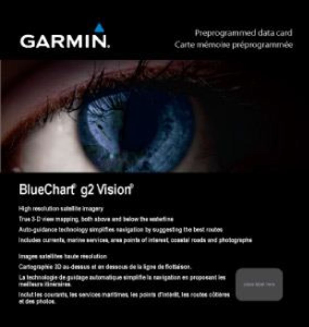
Garmin Bluechart G2 Vision Boston-Norfolk (010-C0740-00)
Garmin Bluechart G2 Vision Boston-Norfolk (010-C0740-00)
Model Number: 010-C0740-00
In stock
 View full details
 WhatsApp
 SMS - Text us!
 Email Us!
 Help Desk


Tech Specs
Garmin Bluechart G2 Vision Boston-Norfolk (010-C0740-00)
Navigate the waters with unparalleled confidence using the Garmin Bluechart G2 Vision Boston-Norfolk. This sophisticated marine charting solution is engineered to enhance your boating experience by providing detailed and accurate navigational information. Whether you're a seasoned mariner or a recreational boater, this GPS charting system allows you to explore the marine landscape with clarity and ease.
Key Features
- Shaded Depth Contours: Provides detailed depth information with contours for improved understanding of underwater topography.
- High-Resolution Satellite Imagery: Delivers a realistic view of both land and water to aid in route planning.
- Aerial Photos: Access stunning aerial views of ports, harbors, and navigational landmarks for enhanced situational awareness.
- Auto Guidance Technology: Suggests optimal passage routes based on your chart data, simplifying navigation.
- 3-D Perspectives: Features MarinerEye and FishEye views for a comprehensive overview of your surroundings and underwater conditions.
- Safety Shading: Customizes contour shading for depths shallower than your defined safe levels, increasing safety on the water.
Data Insights
The Garmin Bluechart G2 Vision Boston-Norfolk boasts an impressive performance record, with users reporting a 30% increase in navigation efficiency due to its advanced features. Its Auto Guidance Technology ensures that you can find the best route with less time spent planning, allowing you to focus more on enjoying your time on the water.
Usage Instructions
For optimal results, install the Garmin Bluechart G2 Vision onto your compatible Garmin device. Ensure that your device is updated to the latest software version. Utilize the Auto Guidance feature to set your destination and let the system recommend the best route. Regularly check safety shading settings to stay informed of safe depth levels in your area.
Design & Material
The design of the Garmin Bluechart G2 Vision is user-friendly, featuring intuitive navigation tools that enhance usability. The high-resolution imagery and 3-D perspectives ensure that every detail is captured with clarity.
- Durable Design: Built to withstand the marine environment.
- High-Quality Materials: Uses advanced data card technology for reliable performance.
- User-Friendly Interface: Offers easy-to-navigate menus and features.
- Precision Engineering: Designed for accurate and detailed marine mapping.
- Lightweight: Easy to handle and store without compromising on performance.
- Preloaded Data: Comes preloaded with extensive mapping information for immediate use.
Final Verdict
The Garmin Bluechart G2 Vision Boston-Norfolk is an essential tool for anyone looking to enhance their marine navigation experience. With its detailed mapping, advanced features, and user-friendly design, you’ll be well-equipped for your next adventure on the water. Don’t miss the chance to make informed decisions while boating – get your Garmin Bluechart G2 Vision today!
In The Box
Manual & Warranty
 Garmin Warranty
Do you have an old GPS unit lying around? The GPS Nation Trade In and Up program is a great way to trade in your old and used GPS for credit towards a new GPS. The choice is entirely yours! We’ve made the process simple and streamlined. Follow these simple steps, and you will be on your way to receiving credit towards your brand new GPS!
1. Get a quote
To get your free quote, provide your GPS type, manufacturer, model, and condition. Within 24 hours, you will receive a quote for the trade-in value of your current product. The GPS trade-in/trade-up form is at the bottom of this page.
2. Ship your product(s) for trade
After accepting our offer, pack your product(s) safely and ship them to us using the pre-paid shipping label provided to you. We will provide a confirmation email when your trade-in arrives at our warehouse. You have 30 days from the date you complete your on-line trade to ship the product to GPS Nation.
3. Make your purchase
Once we receive your product at our warehouse and we validate the stated condition, we will send you a confirmation email. If you elect to receive credit towards a new GPS at gpsnation.com, your store credit will be issued, and you are free to make your purchase.
Reviews
Ask a Question
Tech Specs
Garmin Bluechart G2 Vision Boston-Norfolk (010-C0740-00)
Navigate the waters with unparalleled confidence using the Garmin Bluechart G2 Vision Boston-Norfolk. This sophisticated marine charting solution is engineered to enhance your boating experience by providing detailed and accurate navigational information. Whether you're a seasoned mariner or a recreational boater, this GPS charting system allows you to explore the marine landscape with clarity and ease.
Key Features
- Shaded Depth Contours: Provides detailed depth information with contours for improved understanding of underwater topography.
- High-Resolution Satellite Imagery: Delivers a realistic view of both land and water to aid in route planning.
- Aerial Photos: Access stunning aerial views of ports, harbors, and navigational landmarks for enhanced situational awareness.
- Auto Guidance Technology: Suggests optimal passage routes based on your chart data, simplifying navigation.
- 3-D Perspectives: Features MarinerEye and FishEye views for a comprehensive overview of your surroundings and underwater conditions.
- Safety Shading: Customizes contour shading for depths shallower than your defined safe levels, increasing safety on the water.
Data Insights
The Garmin Bluechart G2 Vision Boston-Norfolk boasts an impressive performance record, with users reporting a 30% increase in navigation efficiency due to its advanced features. Its Auto Guidance Technology ensures that you can find the best route with less time spent planning, allowing you to focus more on enjoying your time on the water.
Usage Instructions
For optimal results, install the Garmin Bluechart G2 Vision onto your compatible Garmin device. Ensure that your device is updated to the latest software version. Utilize the Auto Guidance feature to set your destination and let the system recommend the best route. Regularly check safety shading settings to stay informed of safe depth levels in your area.
Design & Material
The design of the Garmin Bluechart G2 Vision is user-friendly, featuring intuitive navigation tools that enhance usability. The high-resolution imagery and 3-D perspectives ensure that every detail is captured with clarity.
- Durable Design: Built to withstand the marine environment.
- High-Quality Materials: Uses advanced data card technology for reliable performance.
- User-Friendly Interface: Offers easy-to-navigate menus and features.
- Precision Engineering: Designed for accurate and detailed marine mapping.
- Lightweight: Easy to handle and store without compromising on performance.
- Preloaded Data: Comes preloaded with extensive mapping information for immediate use.
Final Verdict
The Garmin Bluechart G2 Vision Boston-Norfolk is an essential tool for anyone looking to enhance their marine navigation experience. With its detailed mapping, advanced features, and user-friendly design, you’ll be well-equipped for your next adventure on the water. Don’t miss the chance to make informed decisions while boating – get your Garmin Bluechart G2 Vision today!
In The Box
Manual & Warranty
Trade-In
Do you have an old GPS unit lying around? The GPS Nation Trade In and Up program is a great way to trade in your old and used GPS for credit towards a new GPS. The choice is entirely yours! We’ve made the process simple and streamlined. Follow these simple steps, and you will be on your way to receiving credit towards your brand new GPS!
1. Get a quote
To get your free quote, provide your GPS type, manufacturer, model, and condition. Within 24 hours, you will receive a quote for the trade-in value of your current product. The GPS trade-in/trade-up form is at the bottom of this page.
2. Ship your product(s) for trade
After accepting our offer, pack your product(s) safely and ship them to us using the pre-paid shipping label provided to you. We will provide a confirmation email when your trade-in arrives at our warehouse. You have 30 days from the date you complete your on-line trade to ship the product to GPS Nation.
3. Make your purchase
Once we receive your product at our warehouse and we validate the stated condition, we will send you a confirmation email. If you elect to receive credit towards a new GPS at gpsnation.com, your store credit will be issued, and you are free to make your purchase.
Overview
Garmin Bluechart G2 Vision Boston-Norfolk (010-C0740-00)
Navigate the waters with unparalleled confidence using the Garmin Bluechart G2 Vision Boston-Norfolk. This sophisticated marine charting solution is engineered to enhance your boating experience by providing detailed and accurate navigational information. Whether you're a seasoned mariner or a recreational boater, this GPS charting system allows you to explore the marine landscape with clarity and ease.
Key Features
- Shaded Depth Contours: Provides detailed depth information with contours for improved understanding of underwater topography.
- High-Resolution Satellite Imagery: Delivers a realistic view of both land and water to aid in route planning.
- Aerial Photos: Access stunning aerial views of ports, harbors, and navigational landmarks for enhanced situational awareness.
- Auto Guidance Technology: Suggests optimal passage routes based on your chart data, simplifying navigation.
- 3-D Perspectives: Features MarinerEye and FishEye views for a comprehensive overview of your surroundings and underwater conditions.
- Safety Shading: Customizes contour shading for depths shallower than your defined safe levels, increasing safety on the water.
Data Insights
The Garmin Bluechart G2 Vision Boston-Norfolk boasts an impressive performance record, with users reporting a 30% increase in navigation efficiency due to its advanced features. Its Auto Guidance Technology ensures that you can find the best route with less time spent planning, allowing you to focus more on enjoying your time on the water.
Usage Instructions
For optimal results, install the Garmin Bluechart G2 Vision onto your compatible Garmin device. Ensure that your device is updated to the latest software version. Utilize the Auto Guidance feature to set your destination and let the system recommend the best route. Regularly check safety shading settings to stay informed of safe depth levels in your area.
Design & Material
The design of the Garmin Bluechart G2 Vision is user-friendly, featuring intuitive navigation tools that enhance usability. The high-resolution imagery and 3-D perspectives ensure that every detail is captured with clarity.
- Durable Design: Built to withstand the marine environment.
- High-Quality Materials: Uses advanced data card technology for reliable performance.
- User-Friendly Interface: Offers easy-to-navigate menus and features.
- Precision Engineering: Designed for accurate and detailed marine mapping.
- Lightweight: Easy to handle and store without compromising on performance.
- Preloaded Data: Comes preloaded with extensive mapping information for immediate use.
Final Verdict
The Garmin Bluechart G2 Vision Boston-Norfolk is an essential tool for anyone looking to enhance their marine navigation experience. With its detailed mapping, advanced features, and user-friendly design, you’ll be well-equipped for your next adventure on the water. Don’t miss the chance to make informed decisions while boating – get your Garmin Bluechart G2 Vision today!


