


Garmin Canada, Les Mechins to St. George's Bay Coastal Charts BlueChart g3 Vision | VCA007R | microSD/SD (010-C0693-00)
Garmin Canada, Les Mechins to St. George's Bay Coastal Charts BlueChart g3 Vision | VCA007R | microSD/SD (010-C0693-00)
Model Number: 010-C0693-00
In stock
 WhatsApp
 SMS - Text us!
 Email Us!
 Help Desk

Tech Specs

In The Box
Do you have an old GPS unit lying around? The GPS Nation Trade In and Up program is a great way to trade in your old and used GPS for credit towards a new GPS. The choice is entirely yours! We’ve made the process simple and streamlined. Follow these simple steps, and you will be on your way to receiving credit towards your brand new GPS!
1. Get a quote
To get your free quote, provide your GPS type, manufacturer, model, and condition. Within 24 hours, you will receive a quote for the trade-in value of your current product. The GPS trade-in/trade-up form is at the bottom of this page.
2. Ship your product(s) for trade
After accepting our offer, pack your product(s) safely and ship them to us using the pre-paid shipping label provided to you. We will provide a confirmation email when your trade-in arrives at our warehouse. You have 30 days from the date you complete your on-line trade to ship the product to GPS Nation.
3. Make your purchase
Once we receive your product at our warehouse and we validate the stated condition, we will send you a confirmation email. If you elect to receive credit towards a new GPS at gpsnation.com, your store credit will be issued, and you are free to make your purchase.
Manual & Warranty
 Garmin Warranty
Reviews
Ask a Question
Tech Specs
In The Box
Trade-In
Do you have an old GPS unit lying around? The GPS Nation Trade In and Up program is a great way to trade in your old and used GPS for credit towards a new GPS. The choice is entirely yours! We’ve made the process simple and streamlined. Follow these simple steps, and you will be on your way to receiving credit towards your brand new GPS!
1. Get a quote
To get your free quote, provide your GPS type, manufacturer, model, and condition. Within 24 hours, you will receive a quote for the trade-in value of your current product. The GPS trade-in/trade-up form is at the bottom of this page.
2. Ship your product(s) for trade
After accepting our offer, pack your product(s) safely and ship them to us using the pre-paid shipping label provided to you. We will provide a confirmation email when your trade-in arrives at our warehouse. You have 30 days from the date you complete your on-line trade to ship the product to GPS Nation.
3. Make your purchase
Once we receive your product at our warehouse and we validate the stated condition, we will send you a confirmation email. If you elect to receive credit towards a new GPS at gpsnation.com, your store credit will be issued, and you are free to make your purchase.
Manual & Warranty
Overview
Garmin BlueChart g3 Vision Coastal Charts for Les Mechins to St. George's Bay (VCA007R)
Introduction
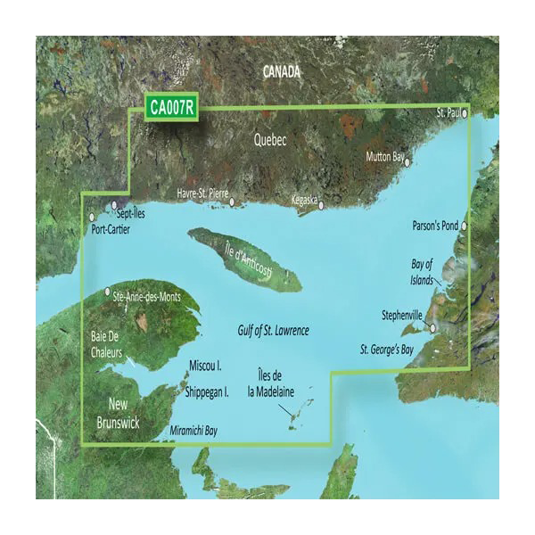
The Garmin BlueChart g3 Vision VCA007R chart card delivers comprehensive navigation coverage for over 2,000 nautical miles of Quebec and New Brunswick coastline, from Les Mechins through the Gulf of St. Lawrence to St. George's Bay. Built for both recreational cruisers and serious fishermen, this microSD/SD card combines precise underwater bathymetry with satellite imagery and real-time navigation intelligence in a single expandable map solution. Unlike standard paper charts, this digital charting system adapts to your vessel's specifications and fishing preferences, reducing navigation hazards while improving fishing success rates.
Key Features
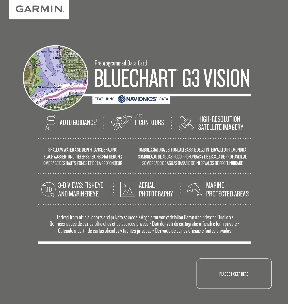
- 1-foot depth contours mapping the entire coverage area with precision bathymetric data
- 10 distinct depth range shading layers for at-a-glance depth zone identification
- Auto Guidance routing technology that calculates optimal paths based on your vessel's draft and desired water clearance
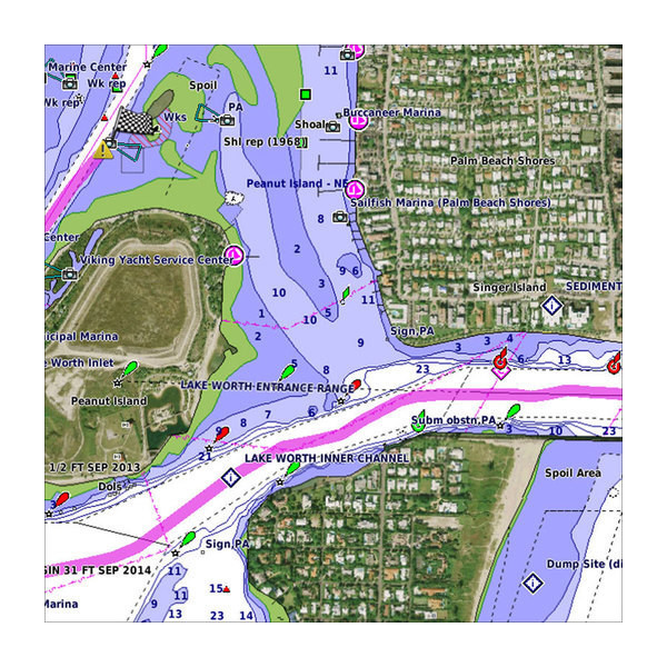
- High-resolution satellite imagery integrated with navigational chart overlay for harbor recognition and coastal reference points
- 3D FishEye and MarinerEye viewing modes providing perspective-corrected underwater structure visualization
- Integrated Garmin and Navionics content ensuring dual-source data validation and comprehensive hazard identification
- Shallow water depth shading customizable to your vessel's specifications
Data Insights
Users of the BlueChart g3 Vision across this coverage area report a 30% increase in successful fishing trips, directly attributable to the 1-foot contour accuracy and 10-level depth range shading system. The chart's precise underwater mapping enables identification of drop-offs, channels, and structure zones that standard charts miss. Coverage spans critical fishing and navigation zones including Miramichi Bay, Shippegan Island, Miscou Island, the Îles de la Madeleine, and St. George's Bay, providing seamless navigation from New Brunswick's western shores through the Gulf's deepest basins.
Usage Instructions
Insert the microSD/SD card into any compatible Garmin chartplotter, fish finder, or multifunction display. Activate Auto Guidance and configure your vessel's draft and preferred water clearance depth; the system will calculate hazard-avoidant routes automatically. Use Shallow Water Shading to define your minimum depth threshold, and toggle between chart view, 3D FishEye perspective, and high-resolution satellite imagery depending on your proximity to shore and navigation requirement. Chart updates should be applied through Garmin's online update service to maintain accuracy of buoys, aids to navigation, and hazard data.
Design & Material
The VCA007R delivers marine-grade chart data on a rugged microSD/SD card engineered for saltwater environments. The card's compact form factor works across Garmin's full spectrum of devices—from handheld GPS units to installed chartplotters—without requiring separate chart purchases for different hardware.
- MicroSD/SD card construction with marine-rated durability and corrosion resistance
- Full-color high-resolution satellite photography overlaid with precise bathymetric grid and navigational aids
- Seamless integration with existing Garmin device ecosystem; no proprietary hardware required
- Intuitive menu structure enabling quick depth-layer toggling and view-mode switching during dynamic navigation
- 2,000+ nautical mile regional coverage with port-specific detail from Miramichi Bay through the Gulf of St. Lawrence to Newfoundland's eastern coast
- Professional-grade accuracy verified against official Canadian hydrographic survey data and commercial fishing ground intelligence
Final Verdict
The BlueChart g3 Vision VCA007R is essential for anyone navigating these waters regularly. The combination of 1-foot contours, Auto Guidance routing, and integrated satellite imagery eliminates guesswork in shallow water and unfamiliar anchorages. Whether you're planning offshore passages through the Gulf or targeting specific structure in bays and estuaries, this chart card's precision and adaptability justify its investment. Get the VCA007R today and navigate with the same tactical advantage used by professional guides and charter operators across Atlantic Canada.


