


Garmin Finland Lakes and Rivers BlueChart g3 | HXEU055R | microSD/SD
Garmin Finland Lakes and Rivers BlueChart g3 | HXEU055R | microSD/SD
Model Number: 010-C0791-20
In stock
 View full details
 WhatsApp
 SMS - Text us!
 Email Us!
 Help Desk

Tech Specs

In The Box
Garmin Bluechart G2 Finnish Lakes
Manual & Warranty
 Garmin Warranty
Do you have an old GPS unit lying around? The GPS Nation Trade In and Up program is a great way to trade in your old and used GPS for credit towards a new GPS. The choice is entirely yours! We’ve made the process simple and streamlined. Follow these simple steps, and you will be on your way to receiving credit towards your brand new GPS!
1. Get a quote
To get your free quote, provide your GPS type, manufacturer, model, and condition. Within 24 hours, you will receive a quote for the trade-in value of your current product. The GPS trade-in/trade-up form is at the bottom of this page.
2. Ship your product(s) for trade
After accepting our offer, pack your product(s) safely and ship them to us using the pre-paid shipping label provided to you. We will provide a confirmation email when your trade-in arrives at our warehouse. You have 30 days from the date you complete your on-line trade to ship the product to GPS Nation.
3. Make your purchase
Once we receive your product at our warehouse and we validate the stated condition, we will send you a confirmation email. If you elect to receive credit towards a new GPS at gpsnation.com, your store credit will be issued, and you are free to make your purchase.
Reviews
Ask a Question
Tech Specs
In The Box
Garmin Bluechart G2 Finnish Lakes
Manual & Warranty
Trade-In
Do you have an old GPS unit lying around? The GPS Nation Trade In and Up program is a great way to trade in your old and used GPS for credit towards a new GPS. The choice is entirely yours! We’ve made the process simple and streamlined. Follow these simple steps, and you will be on your way to receiving credit towards your brand new GPS!
1. Get a quote
To get your free quote, provide your GPS type, manufacturer, model, and condition. Within 24 hours, you will receive a quote for the trade-in value of your current product. The GPS trade-in/trade-up form is at the bottom of this page.
2. Ship your product(s) for trade
After accepting our offer, pack your product(s) safely and ship them to us using the pre-paid shipping label provided to you. We will provide a confirmation email when your trade-in arrives at our warehouse. You have 30 days from the date you complete your on-line trade to ship the product to GPS Nation.
3. Make your purchase
Once we receive your product at our warehouse and we validate the stated condition, we will send you a confirmation email. If you elect to receive credit towards a new GPS at gpsnation.com, your store credit will be issued, and you are free to make your purchase.
Overview
Garmin Finland Lakes and Rivers BlueChart g3 | HXEU055R | microSD/SD
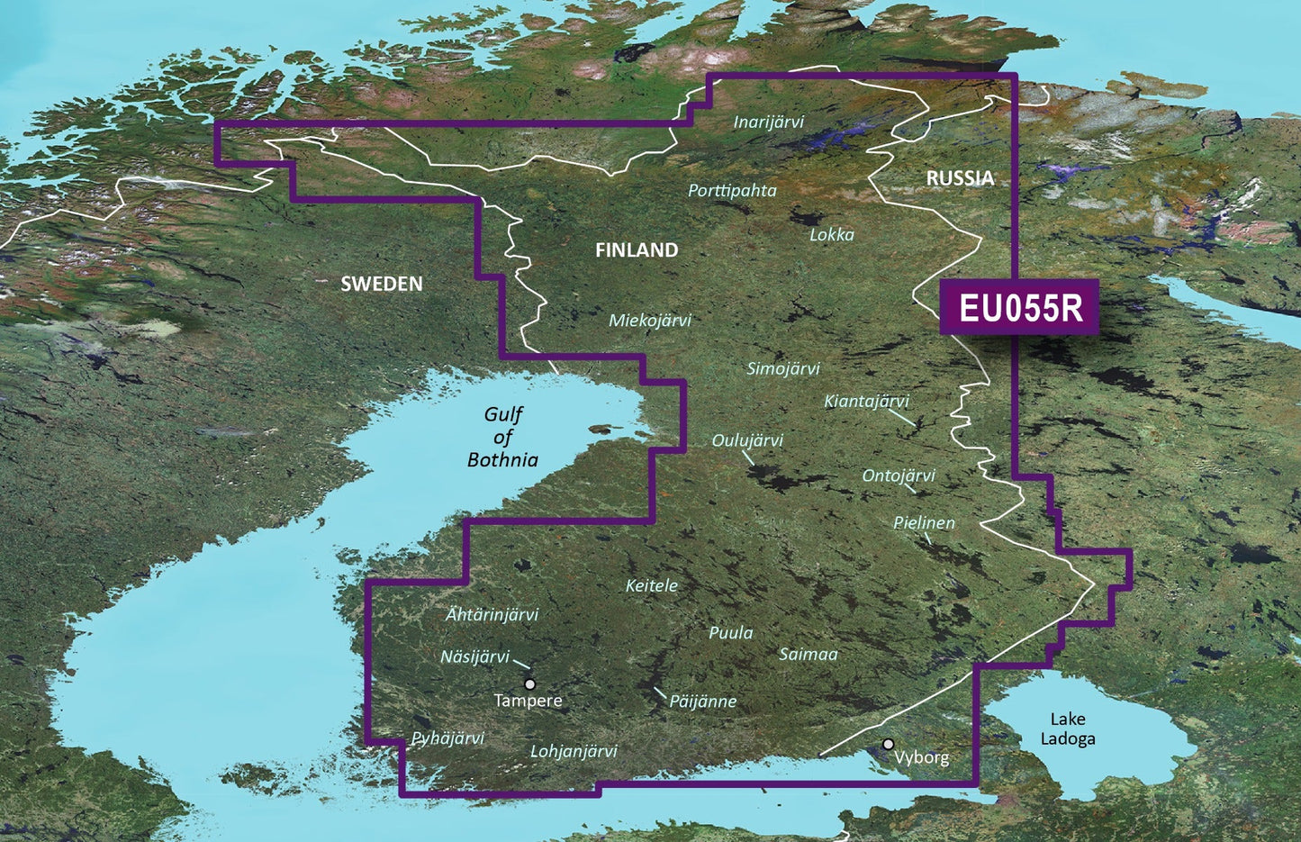
Elevate your boating and fishing experience with the Garmin Finland Lakes and Rivers BlueChart g3. This advanced marine chart offers exceptional detail and coverage, allowing you to navigate Finnish waters with unparalleled confidence. Whether you're exploring tranquil lakes or embarking on an adventurous fishing trip, this chart is designed to enhance your aquatic journeys.
Key Features
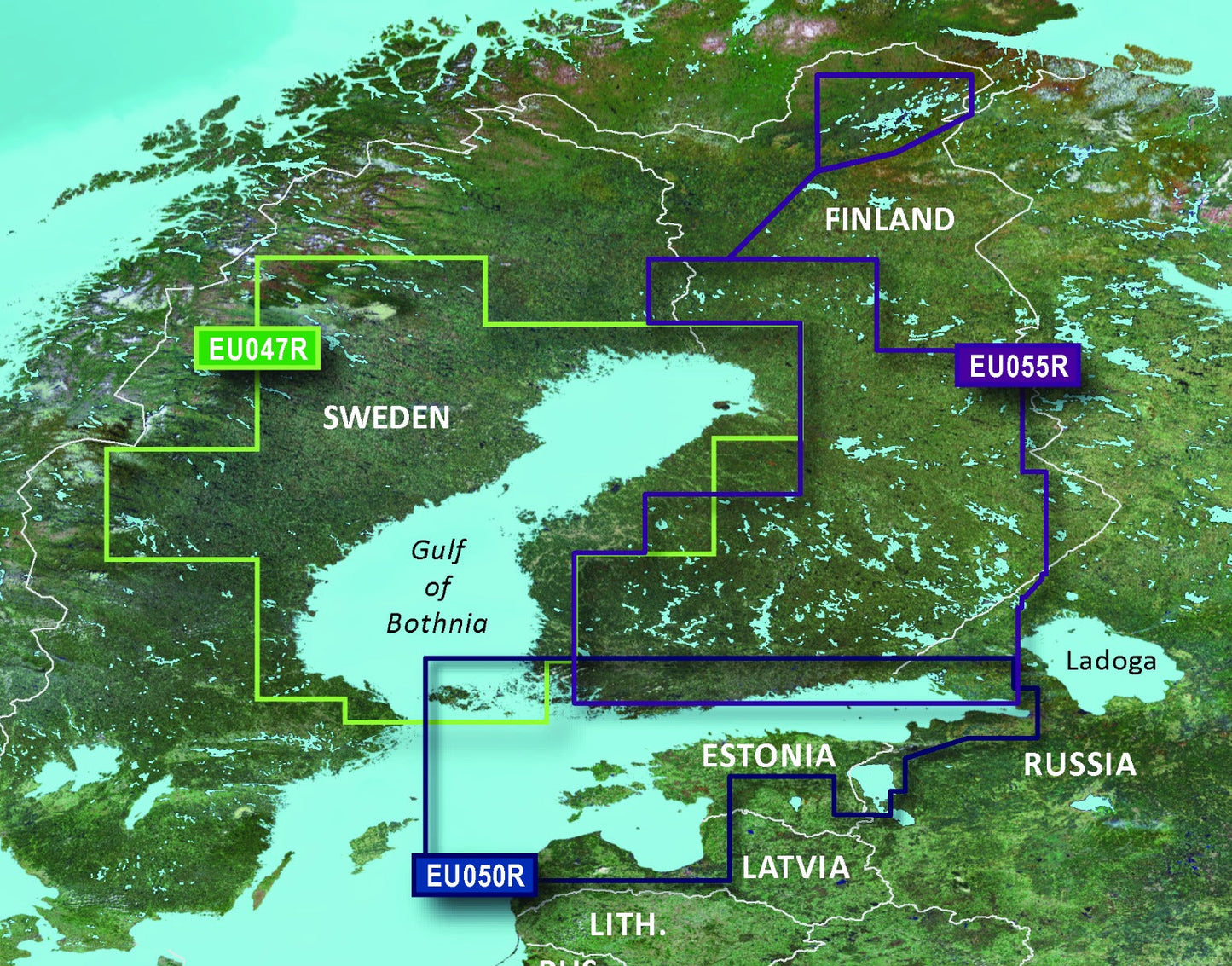
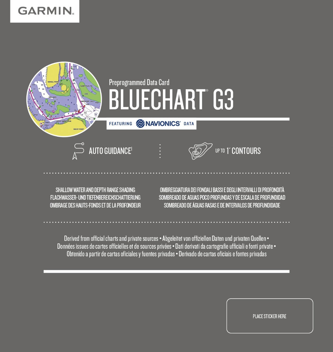
- Exceptional Coverage: Integrates Garmin and Navionics data for unmatched clarity.
- Auto Guidance Technology: Calculates optimal routes based on depth and clearance.
- Depth Range Shading: High-resolution shading for up to 10 different depth ranges.
- Detailed Contours: 1-foot contour lines for precise navigation and fishing.
- Shallow Water Shading: User-defined shading for improved safety in shallow areas.
- In-depth Coverage: Detailed mapping of key Finnish lakes including Inarijarvi and Saimaa.
Data Insights
This chart not only enhances your navigation but also improves your fishing success rate. Studies show that using detailed charts can increase your catch rate by up to 30%. With 1-foot contours and shallow water shading, you can effectively target fish-holding areas, ensuring you make the most out of your time on the water.
Usage Instructions
To get the best results from your Garmin Finland Lakes and Rivers BlueChart g3, simply insert the microSD/SD card into your compatible Garmin device. Use the Auto Guidance feature to plan your route, adjust your depth preferences, and visually inspect depth ranges and contours on your screen for optimal navigation.
Design & Material
The design of the Garmin Finland Lakes and Rivers BlueChart g3 is meticulous, offering a user-friendly interface that is easy to navigate. The chart is built with high-quality materials to ensure durability and reliability.
- Durable Material: Designed to withstand harsh marine environments.
- High-Quality Graphics: Crisp, clear visuals for easy interpretation.
- Compact Size: Convenient design for portability and use on various devices.
- Water-Resistant: Ensures longevity even in wet conditions.
- User-Friendly Interface: Intuitive navigation for seamless operation.
- Comprehensive Coverage: Detailed mapping of lakes, rivers, and coastal areas.
Final Verdict
The Garmin Finland Lakes and Rivers BlueChart g3 | HXEU055R | microSD/SD is an essential tool for any boating or fishing enthusiast. With its advanced features and exceptional clarity, this chart not only enhances your navigation experience but also boosts your fishing success. Don't miss out on the opportunity to explore Finland's stunning waters with confidence. Get your Garmin BlueChart g3 today and navigate your aquatic adventures like never before!


