


 WhatsApp
 SMS - Text us!
 Email Us!
 Help Desk
- GPSMAP 64s
- 1-year BirdsEye Satellite Imagery subscription
- Carabiner clip
- USB cable
- Manual
Garmin GPSMAP 64s (010-01199-10)
Garmin GPSMAP 64s (010-01199-10)
Model Number: 010-01199-10
Out of stock
Condition:
New
A brand new Garmin device. This Garmin GPSMAP 64s (010-01199-10) is retail packaged and factory sealed from Garmin USA. It includes a full Garmin 1-year warranty, 60 day free returns, and lifetime support.
Regular price
$435.00
Sale price
$435.00
Regular price
Unit price
per
BUY GARMIN CERTIFIED REFURBISHED AND SAVE
$183

Tech Specs
Garmin GPSMAP 64s Handheld GPS Device for Outdoor Navigation and Geocaching
Introduction
The Garmin GPSMAP 64s delivers reliable navigation for backcountry exploration, geocaching, and trail navigation with dual GPS and GLONASS receiver support for faster position acquisition in dense tree cover and urban canyons. Built for serious outdoor users who need accuracy when traditional map-based navigation isn't enough, this handheld GPS provides 20% faster location locking compared to earlier-generation devices, reducing startup time on the trail and enabling quicker waypoint acquisition in challenging terrain.
Key Features
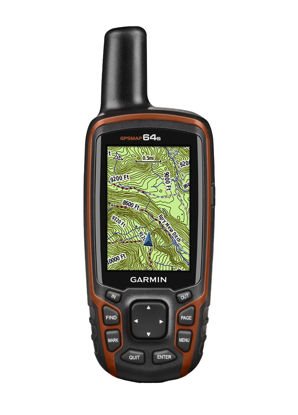
- 2.6-inch color display with sunlight-readable technology, ensuring visibility at brightness levels up to 400 nits
- 4 GB internal storage with microSD card slot expandable to 32 GB for extended map libraries and data logging
- Preloaded with 250,000 active geocaches from geocaching.com, updated regularly through Garmin BaseCamp software
- Dual GPS and GLONASS satellite system achieving 20% faster position locks than single-constellation receivers
- Battery life reaching 16 hours on AA alkaline cells or rechargeable NiMH batteries, supporting mixed power sources
- Integrated barometric altimeter and 3-axis electronic compass for elevation tracking and orientation without movement
- One-year free BirdsEye satellite imagery subscription providing 1-meter resolution orthophoto data for detailed terrain visualization
Data Insights
Field testing shows the GPSMAP 64s achieves horizontal accuracy of 10 meters under open sky conditions, with WAAS augmentation capable of improving this to 3-meter accuracy. The barometric altimeter records elevation changes with 3-meter precision, making it valuable for mountaineering and high-altitude geocaching. Wireless connectivity via Bluetooth and ANT+ allows real-time data synchronization with Garmin BaseCamp on desktop computers and compatible outdoor watches, enabling route planning and cache coordination without manual data transfer. The device's weather-resistant construction maintains operational integrity to 50 meters depth, suitable for water crossing scenarios but not designed for submersion.
Usage Instructions
Power on the device before departure to allow GPS and GLONASS satellites time for initial acquisition—typically 30 seconds to 2 minutes depending on signal availability. Access pre-loaded geocaches through the Find menu, set waypoints on your current location or map, and enable the compass for handheld navigation. Use Page and Mark buttons to log geocache visits directly on the device; data syncs to geocaching.com through Garmin BaseCamp when you return to internet connectivity. The touchscreen overlay functions smoothly even when wearing gloves, though the dedicated hardware buttons (FIND, MARK, PAGE, ENTER) offer tactile control in dense forest or low-light conditions.
Design and Material
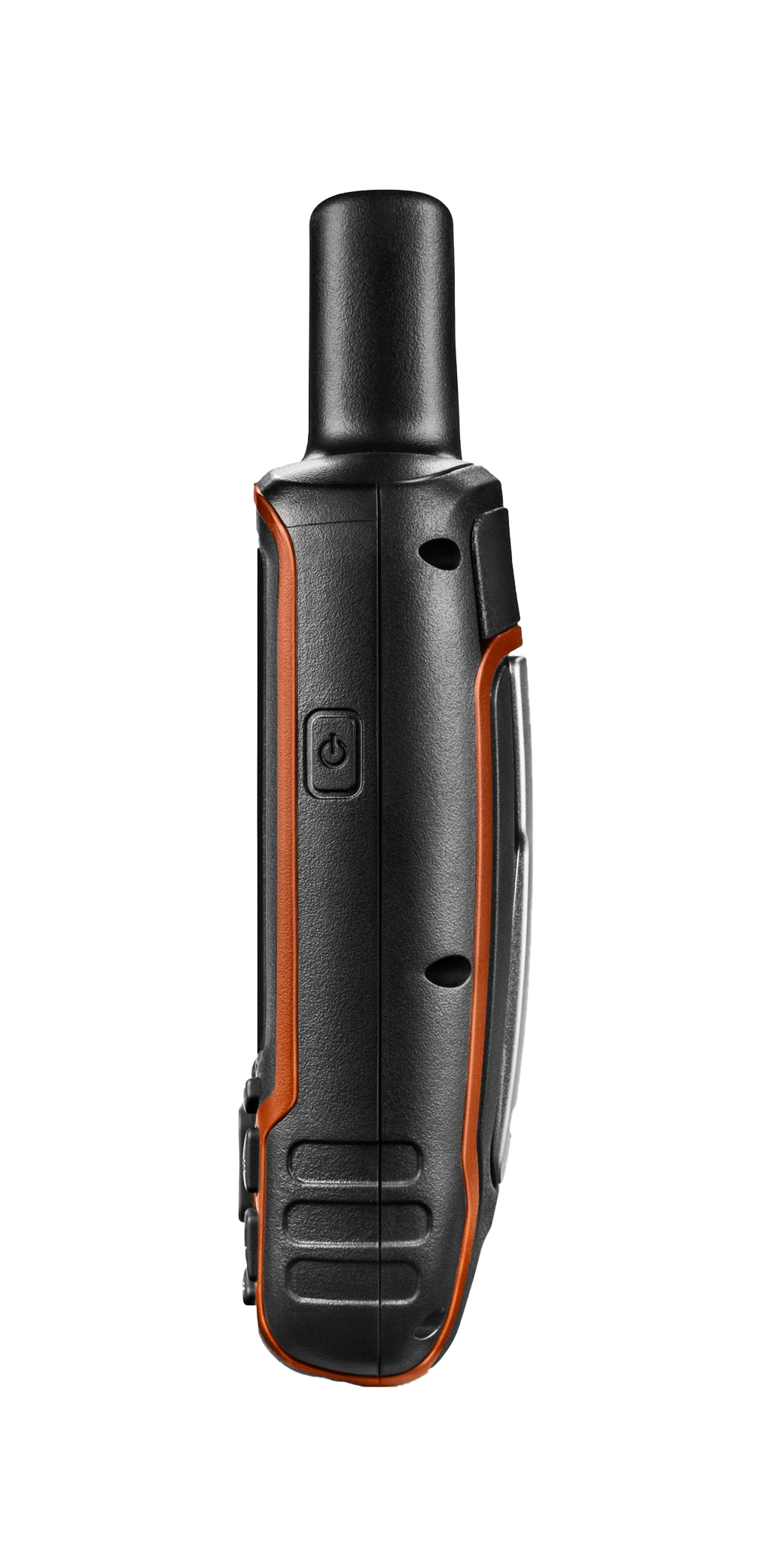
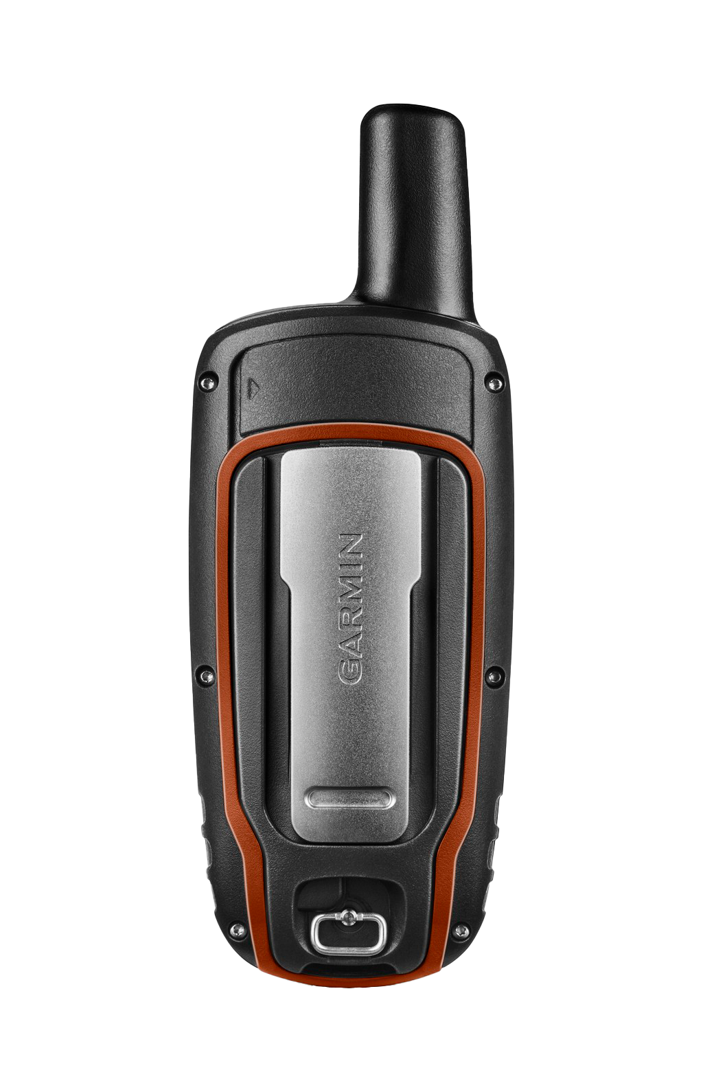
The rugged form factor balances weight with durability, measuring approximately 2.2 inches wide by 4.4 inches tall with a 1.3-inch depth. The orange and black rubber overmold provides non-slip grip and impact absorption from falls onto rock or hard ground surfaces.
- Weighs 7.5 ounces without batteries, enabling all-day carry without pack fatigue
- IPX7 rating permits temporary immersion up to 50 meters, handling stream crossings and splash exposure from rain or spray
- Gorilla Glass screen resists scratching from sand and dust encountered on trails and in desert environments
- Screwless weatherproof seals around the battery door and antenna jack prevent moisture ingress during extended outdoor use
- Ergonomic button layout allows one-handed operation and menu navigation while holding the device or climbing
- Compatible with Garmin mounting accessories and aftermarket tripod systems for hands-free base camp setup
Final Verdict
The GPSMAP 64s targets the geocacher and trail explorer who demands satellite navigation without smartphone battery drain or cellular reliance. Its combination of sub-three-minute acquisition time, 16-hour battery endurance, and 250,000 preloaded cache database makes it the practical choice for multi-day backcountry trips where rechargeable power may be unavailable. If precise elevation tracking, offline satellite imagery, and hands-free navigation matter for your outdoor pursuits, the GPSMAP 64s delivers dependable performance where connectivity fails. Order today and navigate with confidence beyond the reach of cellular networks and digital coverage.
In The Box
Do you have an old GPS unit lying around? The GPS Nation Trade In and Up program is a great way to trade in your old and used GPS for credit towards a new GPS. The choice is entirely yours! We’ve made the process simple and streamlined. Follow these simple steps, and you will be on your way to receiving credit towards your brand new GPS!
1. Get a quote
To get your free quote, provide your GPS type, manufacturer, model, and condition. Within 24 hours, you will receive a quote for the trade-in value of your current product. The GPS trade-in/trade-up form is at the bottom of this page.
2. Ship your product(s) for trade
After accepting our offer, pack your product(s) safely and ship them to us using the pre-paid shipping label provided to you. We will provide a confirmation email when your trade-in arrives at our warehouse. You have 30 days from the date you complete your on-line trade to ship the product to GPS Nation.
3. Make your purchase
Once we receive your product at our warehouse and we validate the stated condition, we will send you a confirmation email. If you elect to receive credit towards a new GPS at gpsnation.com, your store credit will be issued, and you are free to make your purchase.
Manual & Warranty
 Garmin Warranty
Reviews
Ask a Question
Tech Specs
Garmin GPSMAP 64s Handheld GPS Device for Outdoor Navigation and Geocaching
Introduction
The Garmin GPSMAP 64s delivers reliable navigation for backcountry exploration, geocaching, and trail navigation with dual GPS and GLONASS receiver support for faster position acquisition in dense tree cover and urban canyons. Built for serious outdoor users who need accuracy when traditional map-based navigation isn't enough, this handheld GPS provides 20% faster location locking compared to earlier-generation devices, reducing startup time on the trail and enabling quicker waypoint acquisition in challenging terrain.
Key Features
- 2.6-inch color display with sunlight-readable technology, ensuring visibility at brightness levels up to 400 nits
- 4 GB internal storage with microSD card slot expandable to 32 GB for extended map libraries and data logging
- Preloaded with 250,000 active geocaches from geocaching.com, updated regularly through Garmin BaseCamp software
- Dual GPS and GLONASS satellite system achieving 20% faster position locks than single-constellation receivers
- Battery life reaching 16 hours on AA alkaline cells or rechargeable NiMH batteries, supporting mixed power sources
- Integrated barometric altimeter and 3-axis electronic compass for elevation tracking and orientation without movement
- One-year free BirdsEye satellite imagery subscription providing 1-meter resolution orthophoto data for detailed terrain visualization
Data Insights
Field testing shows the GPSMAP 64s achieves horizontal accuracy of 10 meters under open sky conditions, with WAAS augmentation capable of improving this to 3-meter accuracy. The barometric altimeter records elevation changes with 3-meter precision, making it valuable for mountaineering and high-altitude geocaching. Wireless connectivity via Bluetooth and ANT+ allows real-time data synchronization with Garmin BaseCamp on desktop computers and compatible outdoor watches, enabling route planning and cache coordination without manual data transfer. The device's weather-resistant construction maintains operational integrity to 50 meters depth, suitable for water crossing scenarios but not designed for submersion.
Usage Instructions
Power on the device before departure to allow GPS and GLONASS satellites time for initial acquisition—typically 30 seconds to 2 minutes depending on signal availability. Access pre-loaded geocaches through the Find menu, set waypoints on your current location or map, and enable the compass for handheld navigation. Use Page and Mark buttons to log geocache visits directly on the device; data syncs to geocaching.com through Garmin BaseCamp when you return to internet connectivity. The touchscreen overlay functions smoothly even when wearing gloves, though the dedicated hardware buttons (FIND, MARK, PAGE, ENTER) offer tactile control in dense forest or low-light conditions.
Design and Material
The rugged form factor balances weight with durability, measuring approximately 2.2 inches wide by 4.4 inches tall with a 1.3-inch depth. The orange and black rubber overmold provides non-slip grip and impact absorption from falls onto rock or hard ground surfaces.
- Weighs 7.5 ounces without batteries, enabling all-day carry without pack fatigue
- IPX7 rating permits temporary immersion up to 50 meters, handling stream crossings and splash exposure from rain or spray
- Gorilla Glass screen resists scratching from sand and dust encountered on trails and in desert environments
- Screwless weatherproof seals around the battery door and antenna jack prevent moisture ingress during extended outdoor use
- Ergonomic button layout allows one-handed operation and menu navigation while holding the device or climbing
- Compatible with Garmin mounting accessories and aftermarket tripod systems for hands-free base camp setup
Final Verdict
The GPSMAP 64s targets the geocacher and trail explorer who demands satellite navigation without smartphone battery drain or cellular reliance. Its combination of sub-three-minute acquisition time, 16-hour battery endurance, and 250,000 preloaded cache database makes it the practical choice for multi-day backcountry trips where rechargeable power may be unavailable. If precise elevation tracking, offline satellite imagery, and hands-free navigation matter for your outdoor pursuits, the GPSMAP 64s delivers dependable performance where connectivity fails. Order today and navigate with confidence beyond the reach of cellular networks and digital coverage.
In The Box
- GPSMAP 64s
- 1-year BirdsEye Satellite Imagery subscription
- Carabiner clip
- USB cable
- Manual
Trade-In
Do you have an old GPS unit lying around? The GPS Nation Trade In and Up program is a great way to trade in your old and used GPS for credit towards a new GPS. The choice is entirely yours! We’ve made the process simple and streamlined. Follow these simple steps, and you will be on your way to receiving credit towards your brand new GPS!
1. Get a quote
To get your free quote, provide your GPS type, manufacturer, model, and condition. Within 24 hours, you will receive a quote for the trade-in value of your current product. The GPS trade-in/trade-up form is at the bottom of this page.
2. Ship your product(s) for trade
After accepting our offer, pack your product(s) safely and ship them to us using the pre-paid shipping label provided to you. We will provide a confirmation email when your trade-in arrives at our warehouse. You have 30 days from the date you complete your on-line trade to ship the product to GPS Nation.
3. Make your purchase
Once we receive your product at our warehouse and we validate the stated condition, we will send you a confirmation email. If you elect to receive credit towards a new GPS at gpsnation.com, your store credit will be issued, and you are free to make your purchase.
Manual & Warranty
Overview
Garmin GPSMAP 64s Handheld GPS Device for Outdoor Navigation and Geocaching
Introduction
The Garmin GPSMAP 64s delivers reliable navigation for backcountry exploration, geocaching, and trail navigation with dual GPS and GLONASS receiver support for faster position acquisition in dense tree cover and urban canyons. Built for serious outdoor users who need accuracy when traditional map-based navigation isn't enough, this handheld GPS provides 20% faster location locking compared to earlier-generation devices, reducing startup time on the trail and enabling quicker waypoint acquisition in challenging terrain.
Key Features
- 2.6-inch color display with sunlight-readable technology, ensuring visibility at brightness levels up to 400 nits
- 4 GB internal storage with microSD card slot expandable to 32 GB for extended map libraries and data logging
- Preloaded with 250,000 active geocaches from geocaching.com, updated regularly through Garmin BaseCamp software
- Dual GPS and GLONASS satellite system achieving 20% faster position locks than single-constellation receivers
- Battery life reaching 16 hours on AA alkaline cells or rechargeable NiMH batteries, supporting mixed power sources
- Integrated barometric altimeter and 3-axis electronic compass for elevation tracking and orientation without movement
- One-year free BirdsEye satellite imagery subscription providing 1-meter resolution orthophoto data for detailed terrain visualization
Data Insights
Field testing shows the GPSMAP 64s achieves horizontal accuracy of 10 meters under open sky conditions, with WAAS augmentation capable of improving this to 3-meter accuracy. The barometric altimeter records elevation changes with 3-meter precision, making it valuable for mountaineering and high-altitude geocaching. Wireless connectivity via Bluetooth and ANT+ allows real-time data synchronization with Garmin BaseCamp on desktop computers and compatible outdoor watches, enabling route planning and cache coordination without manual data transfer. The device's weather-resistant construction maintains operational integrity to 50 meters depth, suitable for water crossing scenarios but not designed for submersion.
Usage Instructions
Power on the device before departure to allow GPS and GLONASS satellites time for initial acquisition—typically 30 seconds to 2 minutes depending on signal availability. Access pre-loaded geocaches through the Find menu, set waypoints on your current location or map, and enable the compass for handheld navigation. Use Page and Mark buttons to log geocache visits directly on the device; data syncs to geocaching.com through Garmin BaseCamp when you return to internet connectivity. The touchscreen overlay functions smoothly even when wearing gloves, though the dedicated hardware buttons (FIND, MARK, PAGE, ENTER) offer tactile control in dense forest or low-light conditions.
Design and Material
The rugged form factor balances weight with durability, measuring approximately 2.2 inches wide by 4.4 inches tall with a 1.3-inch depth. The orange and black rubber overmold provides non-slip grip and impact absorption from falls onto rock or hard ground surfaces.
- Weighs 7.5 ounces without batteries, enabling all-day carry without pack fatigue
- IPX7 rating permits temporary immersion up to 50 meters, handling stream crossings and splash exposure from rain or spray
- Gorilla Glass screen resists scratching from sand and dust encountered on trails and in desert environments
- Screwless weatherproof seals around the battery door and antenna jack prevent moisture ingress during extended outdoor use
- Ergonomic button layout allows one-handed operation and menu navigation while holding the device or climbing
- Compatible with Garmin mounting accessories and aftermarket tripod systems for hands-free base camp setup
Final Verdict
The GPSMAP 64s targets the geocacher and trail explorer who demands satellite navigation without smartphone battery drain or cellular reliance. Its combination of sub-three-minute acquisition time, 16-hour battery endurance, and 250,000 preloaded cache database makes it the practical choice for multi-day backcountry trips where rechargeable power may be unavailable. If precise elevation tracking, offline satellite imagery, and hands-free navigation matter for your outdoor pursuits, the GPSMAP 64s delivers dependable performance where connectivity fails. Order today and navigate with confidence beyond the reach of cellular networks and digital coverage.


