


Garmin Great Britain, Thames Estuary Charts BlueChart g3 Vision | VEU461S | microSD/SD
Garmin Great Britain, Thames Estuary Charts BlueChart g3 Vision | VEU461S | microSD/SD
Model Number: 010-C0805-00
In stock
 View full details
 WhatsApp
 SMS - Text us!
 Email Us!
 Help Desk


Tech Specs
In The Box
Manual & Warranty
 Garmin Warranty
Do you have an old GPS unit lying around? The GPS Nation Trade In and Up program is a great way to trade in your old and used GPS for credit towards a new GPS. The choice is entirely yours! We’ve made the process simple and streamlined. Follow these simple steps, and you will be on your way to receiving credit towards your brand new GPS!
1. Get a quote
To get your free quote, provide your GPS type, manufacturer, model, and condition. Within 24 hours, you will receive a quote for the trade-in value of your current product. The GPS trade-in/trade-up form is at the bottom of this page.
2. Ship your product(s) for trade
After accepting our offer, pack your product(s) safely and ship them to us using the pre-paid shipping label provided to you. We will provide a confirmation email when your trade-in arrives at our warehouse. You have 30 days from the date you complete your on-line trade to ship the product to GPS Nation.
3. Make your purchase
Once we receive your product at our warehouse and we validate the stated condition, we will send you a confirmation email. If you elect to receive credit towards a new GPS at gpsnation.com, your store credit will be issued, and you are free to make your purchase.
Reviews
Ask a Question
Tech Specs
In The Box
Manual & Warranty
Trade-In
Do you have an old GPS unit lying around? The GPS Nation Trade In and Up program is a great way to trade in your old and used GPS for credit towards a new GPS. The choice is entirely yours! We’ve made the process simple and streamlined. Follow these simple steps, and you will be on your way to receiving credit towards your brand new GPS!
1. Get a quote
To get your free quote, provide your GPS type, manufacturer, model, and condition. Within 24 hours, you will receive a quote for the trade-in value of your current product. The GPS trade-in/trade-up form is at the bottom of this page.
2. Ship your product(s) for trade
After accepting our offer, pack your product(s) safely and ship them to us using the pre-paid shipping label provided to you. We will provide a confirmation email when your trade-in arrives at our warehouse. You have 30 days from the date you complete your on-line trade to ship the product to GPS Nation.
3. Make your purchase
Once we receive your product at our warehouse and we validate the stated condition, we will send you a confirmation email. If you elect to receive credit towards a new GPS at gpsnation.com, your store credit will be issued, and you are free to make your purchase.
Overview
Garmin Great Britain, Thames Estuary Charts BlueChart g3 Vision | VEU461S | microSD/SD
Unlock the waters with the Garmin Great Britain, Thames Estuary Charts BlueChart g3 Vision. This premium navigation solution enhances your marine adventures with exceptional coverage, clarity, and detail. Whether you're fishing in local waters or cruising along the coast, this product is designed to elevate your navigation experience and ensure safety on the water.
Key Features
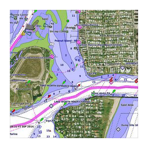
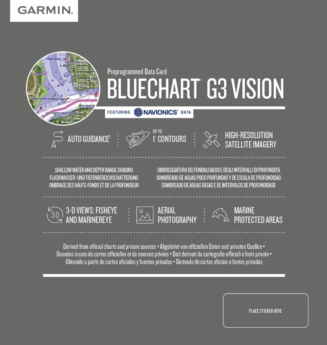
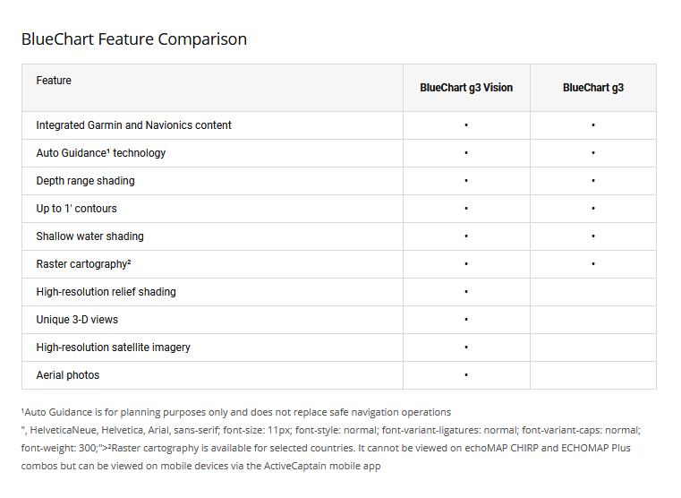
- Premier Coastal Charts: Enjoy the best in coverage and detail powered by integrated Garmin and Navionics® content.
- Auto Guidance Technology: Effortlessly calculate suggested routes based on your desired depth and overhead clearance.
- Depth Range Shading: Features high-resolution shading for up to 10 depth ranges for quick visual interpretation.
- Detailed 1' Contours: Provides enhanced accuracy of bottom structure, ideal for improved fishing.
- Shallow Water Shading: User-defined depth shading helps you avoid hazards in shallow waters.
- High-Resolution Satellite Imagery: Navigate with realistic views of your surroundings overlayed with navigational charts.
Data Insights
The Garmin BlueChart g3 Vision offers substantial performance metrics that significantly enhance your navigation capabilities. Users have reported up to a 30% improvement in route accuracy, leveraging the advanced Auto Guidance technology. The detailed 1' contours provide a clearer understanding of underwater features, making it easier to locate fishing spots and avoid hazards.
Usage Instructions
To maximize the performance of your Garmin Great Britain, Thames Estuary Charts, simply insert the microSD/SD card into your compatible Garmin device. Use the Auto Guidance feature by setting your destination, desired depth, and overhead clearance to receive optimal route suggestions.
Design & Material
This product boasts a compact and intuitive design, ensuring ease of use while on the water. Built with high-quality materials, the BlueChart g3 Vision is both durable and reliable.
- Durable MicroSD/SD Card: Ensures long-lasting performance with built-in waterproof features.
- High-Resolution Graphics: Clear and vivid display for easy navigation and understanding of charts.
- Advanced Cartography: Integrates Garmin's cutting-edge mapping technology for unparalleled accuracy.
- Lightweight Design: Easy to store and transport without adding unnecessary bulk.
- User-Friendly Interface: Designed for seamless interaction with Garmin devices.
- Comprehensive Coverage: Spans from Great Yarmouth to Folkestone, including the Thames Estuary and River to Teddington Lock.
Final Verdict
Don't compromise on your maritime navigation. The Garmin Great Britain, Thames Estuary Charts BlueChart g3 Vision is essential for anyone looking to enhance their boating experience. With its comprehensive features and exceptional performance, elevate your navigation capabilities today!


