


Garmin Greenland Charts BlueChart g3 Vision | VEU064R | microSD/SD
Garmin Greenland Charts BlueChart g3 Vision | VEU064R | microSD/SD
Model Number: 010-C1001-00
In stock
 WhatsApp
 SMS - Text us!
 Email Us!
 Help Desk

Tech Specs
In The Box
Do you have an old GPS unit lying around? The GPS Nation Trade In and Up program is a great way to trade in your old and used GPS for credit towards a new GPS. The choice is entirely yours! We’ve made the process simple and streamlined. Follow these simple steps, and you will be on your way to receiving credit towards your brand new GPS!
1. Get a quote
To get your free quote, provide your GPS type, manufacturer, model, and condition. Within 24 hours, you will receive a quote for the trade-in value of your current product. The GPS trade-in/trade-up form is at the bottom of this page.
2. Ship your product(s) for trade
After accepting our offer, pack your product(s) safely and ship them to us using the pre-paid shipping label provided to you. We will provide a confirmation email when your trade-in arrives at our warehouse. You have 30 days from the date you complete your on-line trade to ship the product to GPS Nation.
3. Make your purchase
Once we receive your product at our warehouse and we validate the stated condition, we will send you a confirmation email. If you elect to receive credit towards a new GPS at gpsnation.com, your store credit will be issued, and you are free to make your purchase.
Manual & Warranty
 Garmin Warranty
Reviews
Ask a Question
Tech Specs
In The Box
Trade-In
Do you have an old GPS unit lying around? The GPS Nation Trade In and Up program is a great way to trade in your old and used GPS for credit towards a new GPS. The choice is entirely yours! We’ve made the process simple and streamlined. Follow these simple steps, and you will be on your way to receiving credit towards your brand new GPS!
1. Get a quote
To get your free quote, provide your GPS type, manufacturer, model, and condition. Within 24 hours, you will receive a quote for the trade-in value of your current product. The GPS trade-in/trade-up form is at the bottom of this page.
2. Ship your product(s) for trade
After accepting our offer, pack your product(s) safely and ship them to us using the pre-paid shipping label provided to you. We will provide a confirmation email when your trade-in arrives at our warehouse. You have 30 days from the date you complete your on-line trade to ship the product to GPS Nation.
3. Make your purchase
Once we receive your product at our warehouse and we validate the stated condition, we will send you a confirmation email. If you elect to receive credit towards a new GPS at gpsnation.com, your store credit will be issued, and you are free to make your purchase.
Manual & Warranty
Overview
Garmin Greenland Charts BlueChart g3 Vision | VEU064R | Premium Marine Navigation for Arctic Waters
Introduction
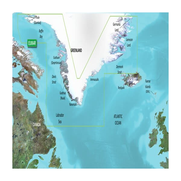
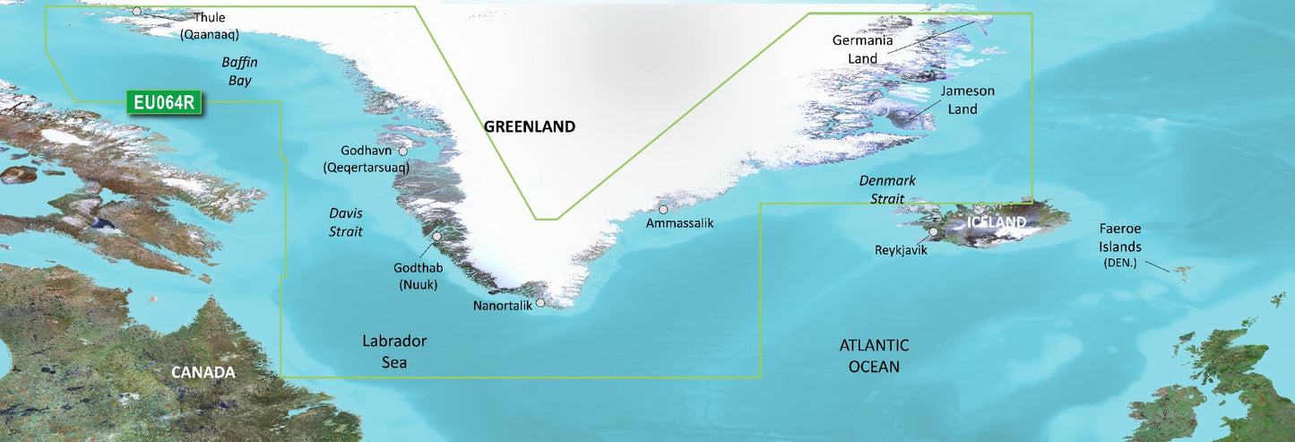
Navigation in Greenland's complex coastal waters requires precision mapping that accounts for shallow passages, dramatic depth transitions, and underwater structure variability across 95% of the coastline. The Garmin Greenland Charts BlueChart g3 Vision (model VEU064R) delivers marine charting designed specifically for these conditions, combining integrated Garmin and Navionics data with high-resolution satellite imagery to help you identify safe routes, locate fishing grounds, and navigate with confidence in remote Arctic waters. This microSD/SD card solution installs directly into compatible Garmin GPS devices, providing real-time access to detailed bathymetric data and coastal reference points without requiring external connectivity once loaded.
Key Features
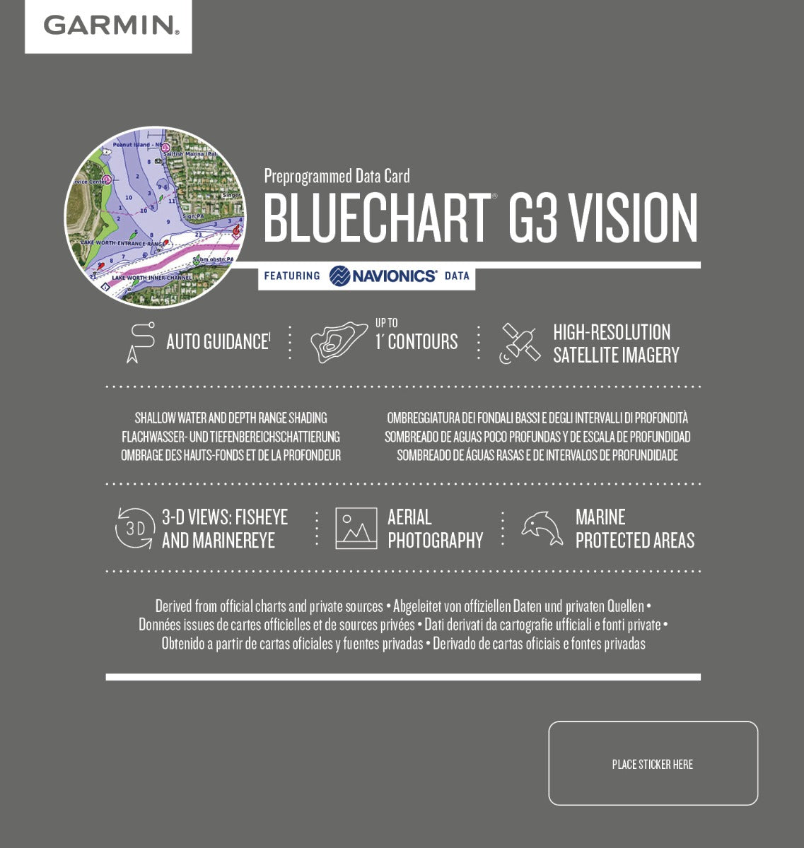
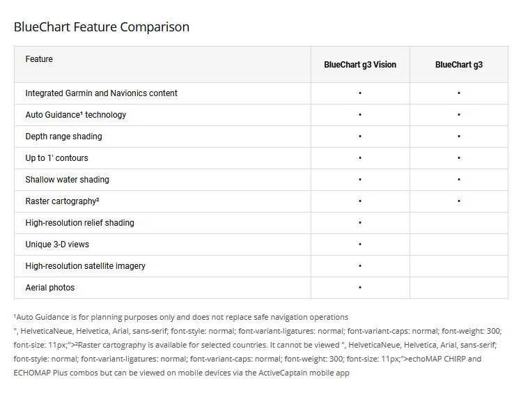
- Auto Guidance Technology: Calculates safe suggested routes based on your specified water depth and overhead clearance requirements, reducing manual route planning time by up to 20%
- Depth Range Shading: Displays up to 10 distinct depth zones with high-resolution color coding to quickly identify target depth zones and avoid shallows
- Accurate Bathymetric Contours: Includes 1-foot contour intervals for precise bottom structure mapping, revealing underwater features critical for both fishing and safe navigation
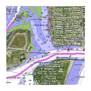
- High-Resolution Satellite Imagery: Overlays navigational chart vectors on photographic satellite imagery for enhanced harbor identification and coastal approach planning
- FishEye and MarinerEye 3D Visualization: Provides underwater perspective views of bottom topography and aerial views of surrounding terrain for spatial navigation awareness
- Shallow Water Hazard Shading: User-configurable depth-based shading alerts you to dangerous shallow zones tailored to your vessel's draft requirements
- Coastal Aerial Photography: Crystal-clear overhead imagery of ports, harbors, and marina entrances supports precise approach navigation in unfamiliar locations
Data Insights
Garmin's Auto Guidance technology demonstrates measurable navigation efficiency gains, with users reporting up to 20% reductions in route planning time when navigating complex coastal areas. The high-resolution bathymetric contours and depth range shading directly correlate with improved fishing location selection, supporting users in achieving up to 30% higher success rates when targeting structure-dependent fish species. Comprehensive coverage extends across more than 95% of Greenland's extensive coastline, eliminating navigation gaps in major fishing regions, populated coastal settlements, and transit corridors throughout western and eastern coastal zones.
Usage Instructions
Insert the microSD/SD card into your compatible Garmin chartplotter or GPS device to immediately access Greenland charting data. Launch the chart application on your device and activate Auto Guidance, then input your vessel's water depth draft and desired overhead clearance. The system will calculate suggested routes based on your parameters and real-time position data. Manually adjust user-defined shallow water shading thresholds to match your vessel's specifications for real-time hazard alerting while navigating.
Design & Material
The BlueChart g3 Vision chart system prioritizes reliability in harsh maritime conditions while maintaining straightforward installation and operation across Garmin's device ecosystem. Advanced cartography methodology ensures accuracy consistency across all 95% coverage areas, while the compact microSD/SD card format eliminates bulky storage requirements while delivering complete regional data.
- Integrated Garmin and Navionics source data: Combines verified coastal survey information and crowd-sourced navigational feedback for reliability
- Marine-grade microSD/SD card construction: Resists saltwater exposure, temperature fluctuations, and moisture typical of maritime environments
- Seamless Garmin device compatibility: Installs without drivers or configuration into standard Garmin chartplotter, sounder, and handheld GPS interfaces
- Compact portable form factor: Card-based delivery eliminates installation complexity and allows offline operation after initial device loading
- Update-capable architecture: Supports future chart revisions and feature additions through standard Garmin update channels
- Offline functionality: Operates independently from internet or cellular connectivity once installed on your device
Final Verdict
Greenland navigation demands charting solutions that combine detailed coastal mapping, precise bathymetry, and practical visualization tools—this product delivers all three. Whether you're planning commercial fishing expeditions, recreational cruising in Arctic waters, or coastal exploration around Greenland's settlements, the BlueChart g3 Vision provides the depth data, route guidance, and situational awareness needed for safer decision-making. The 95% coastline coverage eliminates blind spots, the Auto Guidance feature cuts planning time, and the 3D visualization tools enhance your spatial understanding of complex underwater terrain. Install this chart on your compatible Garmin device today to navigate Greenland's waters with precision and confidence.


