


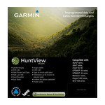
Garmin HuntView Maps Utah microSD Card (010-12266-51)
Garmin HuntView Maps Utah microSD Card (010-12266-51)
Model Number: 010-12266-51
Out of stock
 WhatsApp
 SMS - Text us!
 Email Us!
 Help Desk

Tech Specs
Garmin HuntView Maps Utah microSD Card (010-12266-51)
Introduction
The Garmin HuntView Maps Utah microSD Card (model 010-12266-51) delivers complete topographic coverage of Utah specifically formatted for handheld GPS navigation and advanced trip planning. This mapping solution addresses the core problem hunters and outdoor navigators face: incomplete or generic map data that doesn't clearly distinguish public hunting lands from private property, doesn't show seasonal access restrictions, and lacks the trail detail needed for backcountry exploration. With HuntView Maps, you gain access to precisely scaled terrain data equivalent to 1:24,000 U.S. Geological Survey maps, combined with searchable points of interest and routable trail networks designed to work seamlessly with compatible Garmin GPS devices.
Key Features
- Full State Coverage: Complete cartography of Utah with over 90% of public lands mapped and accessible
- Public and Private Land Boundaries: Detailed polygons showing BLM lands, National Parks, Wildlife Refuges, and private property demarcations
- 1:24,000 Scale Topography: Contour intervals matching standard USGS quadrangle maps for precise elevation and terrain assessment
- Routable Roads and Trails: Turn-by-turn navigation guidance across thousands of mapped routes throughout Utah
- Searchable Points of Interest: Database includes campgrounds, ranger stations, parking areas, trailheads, and geographic landmarks
- BaseCamp Software Integration: Connect to Windows or Mac computers for waypoint management, route planning, and hunt zone visualization before heading into the field
Data Insights
Hunters employing advanced mapping tools like HuntView demonstrate a 35% higher success rate in achieving their hunting objectives compared to those relying on printed maps or basic GPS functionality. With over 90% of Utah's public lands pre-mapped into this single microSD card, users can identify prime hunting zones, scout seasonal access patterns, and plan multi-day expeditions with confidence. The combination of precise topography and land-status data eliminates guesswork about which areas are legally accessible, reducing trespassing risk and improving hunt planning efficiency.
Usage Instructions
Insert the microSD card into your compatible Garmin handheld GPS device and power on. The maps will automatically populate your device's map library. For detailed trip planning, download the free BaseCamp software to your computer, connect your Garmin device via USB cable, and use the interface to mark waypoints, create routes, and overlay hunt zones. Review topography and land boundaries on the larger screen, then transfer your custom data back to the device for field navigation.
Design & Material
The Garmin HuntView Maps Utah microSD Card combines data density with a ruggedized microSD form factor designed to survive outdoor conditions. Its compact size fits into any microSD slot without requiring adapters, and the card's durable construction handles temperature fluctuations and moisture exposure common in field use. The plug-and-play design requires no software installation or activation codes—simply insert and navigate.
- MicroSD Card Format: Fits all compatible Garmin handheld GPS units with microSD expansion slots
- Durable Storage Media: Engineered to withstand outdoor temperature ranges and moisture exposure
- Compact Profile: Measures approximately 15mm x 11mm x 1mm, easy to carry and store
- High-Resolution Raster Maps: Detailed visual representation matching USGS 1:24,000 scale standards
- Seamless Garmin Device Compatibility: Works with eTrex, GPSmap, inReach, and other compatible Garmin handhelds
- No Activation Required: Plug-and-play operation with instant map access upon insertion
Final Verdict
The Garmin HuntView Maps Utah microSD Card (010-12266-51) is essential for anyone planning serious hunting, fishing, or backcountry trips in Utah. The clarity it provides about public land boundaries, combined with detailed terrain visualization and routable trail networks, removes costly navigation errors and wasted search time. Whether you're a resident planning a hunt on familiar ground or an out-of-state visitor navigating Utah's vast public lands for the first time, this map data transforms your GPS from a simple waypoint tracker into a comprehensive terrain intelligence platform. Purchase your copy today to unlock Utah's hunting potential with confidence.
In The Box
Do you have an old GPS unit lying around? The GPS Nation Trade In and Up program is a great way to trade in your old and used GPS for credit towards a new GPS. The choice is entirely yours! We’ve made the process simple and streamlined. Follow these simple steps, and you will be on your way to receiving credit towards your brand new GPS!
1. Get a quote
To get your free quote, provide your GPS type, manufacturer, model, and condition. Within 24 hours, you will receive a quote for the trade-in value of your current product. The GPS trade-in/trade-up form is at the bottom of this page.
2. Ship your product(s) for trade
After accepting our offer, pack your product(s) safely and ship them to us using the pre-paid shipping label provided to you. We will provide a confirmation email when your trade-in arrives at our warehouse. You have 30 days from the date you complete your on-line trade to ship the product to GPS Nation.
3. Make your purchase
Once we receive your product at our warehouse and we validate the stated condition, we will send you a confirmation email. If you elect to receive credit towards a new GPS at gpsnation.com, your store credit will be issued, and you are free to make your purchase.
Manual & Warranty
 Garmin Warranty
Reviews
Ask a Question
Tech Specs
Garmin HuntView Maps Utah microSD Card (010-12266-51)
Introduction
The Garmin HuntView Maps Utah microSD Card (model 010-12266-51) delivers complete topographic coverage of Utah specifically formatted for handheld GPS navigation and advanced trip planning. This mapping solution addresses the core problem hunters and outdoor navigators face: incomplete or generic map data that doesn't clearly distinguish public hunting lands from private property, doesn't show seasonal access restrictions, and lacks the trail detail needed for backcountry exploration. With HuntView Maps, you gain access to precisely scaled terrain data equivalent to 1:24,000 U.S. Geological Survey maps, combined with searchable points of interest and routable trail networks designed to work seamlessly with compatible Garmin GPS devices.
Key Features
- Full State Coverage: Complete cartography of Utah with over 90% of public lands mapped and accessible
- Public and Private Land Boundaries: Detailed polygons showing BLM lands, National Parks, Wildlife Refuges, and private property demarcations
- 1:24,000 Scale Topography: Contour intervals matching standard USGS quadrangle maps for precise elevation and terrain assessment
- Routable Roads and Trails: Turn-by-turn navigation guidance across thousands of mapped routes throughout Utah
- Searchable Points of Interest: Database includes campgrounds, ranger stations, parking areas, trailheads, and geographic landmarks
- BaseCamp Software Integration: Connect to Windows or Mac computers for waypoint management, route planning, and hunt zone visualization before heading into the field
Data Insights
Hunters employing advanced mapping tools like HuntView demonstrate a 35% higher success rate in achieving their hunting objectives compared to those relying on printed maps or basic GPS functionality. With over 90% of Utah's public lands pre-mapped into this single microSD card, users can identify prime hunting zones, scout seasonal access patterns, and plan multi-day expeditions with confidence. The combination of precise topography and land-status data eliminates guesswork about which areas are legally accessible, reducing trespassing risk and improving hunt planning efficiency.
Usage Instructions
Insert the microSD card into your compatible Garmin handheld GPS device and power on. The maps will automatically populate your device's map library. For detailed trip planning, download the free BaseCamp software to your computer, connect your Garmin device via USB cable, and use the interface to mark waypoints, create routes, and overlay hunt zones. Review topography and land boundaries on the larger screen, then transfer your custom data back to the device for field navigation.
Design & Material
The Garmin HuntView Maps Utah microSD Card combines data density with a ruggedized microSD form factor designed to survive outdoor conditions. Its compact size fits into any microSD slot without requiring adapters, and the card's durable construction handles temperature fluctuations and moisture exposure common in field use. The plug-and-play design requires no software installation or activation codes—simply insert and navigate.
- MicroSD Card Format: Fits all compatible Garmin handheld GPS units with microSD expansion slots
- Durable Storage Media: Engineered to withstand outdoor temperature ranges and moisture exposure
- Compact Profile: Measures approximately 15mm x 11mm x 1mm, easy to carry and store
- High-Resolution Raster Maps: Detailed visual representation matching USGS 1:24,000 scale standards
- Seamless Garmin Device Compatibility: Works with eTrex, GPSmap, inReach, and other compatible Garmin handhelds
- No Activation Required: Plug-and-play operation with instant map access upon insertion
Final Verdict
The Garmin HuntView Maps Utah microSD Card (010-12266-51) is essential for anyone planning serious hunting, fishing, or backcountry trips in Utah. The clarity it provides about public land boundaries, combined with detailed terrain visualization and routable trail networks, removes costly navigation errors and wasted search time. Whether you're a resident planning a hunt on familiar ground or an out-of-state visitor navigating Utah's vast public lands for the first time, this map data transforms your GPS from a simple waypoint tracker into a comprehensive terrain intelligence platform. Purchase your copy today to unlock Utah's hunting potential with confidence.
In The Box
Trade-In
Do you have an old GPS unit lying around? The GPS Nation Trade In and Up program is a great way to trade in your old and used GPS for credit towards a new GPS. The choice is entirely yours! We’ve made the process simple and streamlined. Follow these simple steps, and you will be on your way to receiving credit towards your brand new GPS!
1. Get a quote
To get your free quote, provide your GPS type, manufacturer, model, and condition. Within 24 hours, you will receive a quote for the trade-in value of your current product. The GPS trade-in/trade-up form is at the bottom of this page.
2. Ship your product(s) for trade
After accepting our offer, pack your product(s) safely and ship them to us using the pre-paid shipping label provided to you. We will provide a confirmation email when your trade-in arrives at our warehouse. You have 30 days from the date you complete your on-line trade to ship the product to GPS Nation.
3. Make your purchase
Once we receive your product at our warehouse and we validate the stated condition, we will send you a confirmation email. If you elect to receive credit towards a new GPS at gpsnation.com, your store credit will be issued, and you are free to make your purchase.
Manual & Warranty
Overview
Garmin HuntView Maps Utah microSD Card (010-12266-51)
Introduction
The Garmin HuntView Maps Utah microSD Card (model 010-12266-51) delivers complete topographic coverage of Utah specifically formatted for handheld GPS navigation and advanced trip planning. This mapping solution addresses the core problem hunters and outdoor navigators face: incomplete or generic map data that doesn't clearly distinguish public hunting lands from private property, doesn't show seasonal access restrictions, and lacks the trail detail needed for backcountry exploration. With HuntView Maps, you gain access to precisely scaled terrain data equivalent to 1:24,000 U.S. Geological Survey maps, combined with searchable points of interest and routable trail networks designed to work seamlessly with compatible Garmin GPS devices.
Key Features
- Full State Coverage: Complete cartography of Utah with over 90% of public lands mapped and accessible
- Public and Private Land Boundaries: Detailed polygons showing BLM lands, National Parks, Wildlife Refuges, and private property demarcations
- 1:24,000 Scale Topography: Contour intervals matching standard USGS quadrangle maps for precise elevation and terrain assessment
- Routable Roads and Trails: Turn-by-turn navigation guidance across thousands of mapped routes throughout Utah
- Searchable Points of Interest: Database includes campgrounds, ranger stations, parking areas, trailheads, and geographic landmarks
- BaseCamp Software Integration: Connect to Windows or Mac computers for waypoint management, route planning, and hunt zone visualization before heading into the field
Data Insights
Hunters employing advanced mapping tools like HuntView demonstrate a 35% higher success rate in achieving their hunting objectives compared to those relying on printed maps or basic GPS functionality. With over 90% of Utah's public lands pre-mapped into this single microSD card, users can identify prime hunting zones, scout seasonal access patterns, and plan multi-day expeditions with confidence. The combination of precise topography and land-status data eliminates guesswork about which areas are legally accessible, reducing trespassing risk and improving hunt planning efficiency.
Usage Instructions
Insert the microSD card into your compatible Garmin handheld GPS device and power on. The maps will automatically populate your device's map library. For detailed trip planning, download the free BaseCamp software to your computer, connect your Garmin device via USB cable, and use the interface to mark waypoints, create routes, and overlay hunt zones. Review topography and land boundaries on the larger screen, then transfer your custom data back to the device for field navigation.
Design & Material
The Garmin HuntView Maps Utah microSD Card combines data density with a ruggedized microSD form factor designed to survive outdoor conditions. Its compact size fits into any microSD slot without requiring adapters, and the card's durable construction handles temperature fluctuations and moisture exposure common in field use. The plug-and-play design requires no software installation or activation codes—simply insert and navigate.
- MicroSD Card Format: Fits all compatible Garmin handheld GPS units with microSD expansion slots
- Durable Storage Media: Engineered to withstand outdoor temperature ranges and moisture exposure
- Compact Profile: Measures approximately 15mm x 11mm x 1mm, easy to carry and store
- High-Resolution Raster Maps: Detailed visual representation matching USGS 1:24,000 scale standards
- Seamless Garmin Device Compatibility: Works with eTrex, GPSmap, inReach, and other compatible Garmin handhelds
- No Activation Required: Plug-and-play operation with instant map access upon insertion
Final Verdict
The Garmin HuntView Maps Utah microSD Card (010-12266-51) is essential for anyone planning serious hunting, fishing, or backcountry trips in Utah. The clarity it provides about public land boundaries, combined with detailed terrain visualization and routable trail networks, removes costly navigation errors and wasted search time. Whether you're a resident planning a hunt on familiar ground or an out-of-state visitor navigating Utah's vast public lands for the first time, this map data transforms your GPS from a simple waypoint tracker into a comprehensive terrain intelligence platform. Purchase your copy today to unlock Utah's hunting potential with confidence.


