


Garmin Polynesia Coastal Charts BlueChart g3 Vision | VPC019R | microSD/SD
Garmin Polynesia Coastal Charts BlueChart g3 Vision | VPC019R | microSD/SD
Model Number: 010-C0866-00
In stock
 WhatsApp
 SMS - Text us!
 Email Us!
 Help Desk

Tech Specs
In The Box
Do you have an old GPS unit lying around? The GPS Nation Trade In and Up program is a great way to trade in your old and used GPS for credit towards a new GPS. The choice is entirely yours! We’ve made the process simple and streamlined. Follow these simple steps, and you will be on your way to receiving credit towards your brand new GPS!
1. Get a quote
To get your free quote, provide your GPS type, manufacturer, model, and condition. Within 24 hours, you will receive a quote for the trade-in value of your current product. The GPS trade-in/trade-up form is at the bottom of this page.
2. Ship your product(s) for trade
After accepting our offer, pack your product(s) safely and ship them to us using the pre-paid shipping label provided to you. We will provide a confirmation email when your trade-in arrives at our warehouse. You have 30 days from the date you complete your on-line trade to ship the product to GPS Nation.
3. Make your purchase
Once we receive your product at our warehouse and we validate the stated condition, we will send you a confirmation email. If you elect to receive credit towards a new GPS at gpsnation.com, your store credit will be issued, and you are free to make your purchase.
Manual & Warranty
 Garmin Warranty
Reviews
Ask a Question
Tech Specs
In The Box
Trade-In
Do you have an old GPS unit lying around? The GPS Nation Trade In and Up program is a great way to trade in your old and used GPS for credit towards a new GPS. The choice is entirely yours! We’ve made the process simple and streamlined. Follow these simple steps, and you will be on your way to receiving credit towards your brand new GPS!
1. Get a quote
To get your free quote, provide your GPS type, manufacturer, model, and condition. Within 24 hours, you will receive a quote for the trade-in value of your current product. The GPS trade-in/trade-up form is at the bottom of this page.
2. Ship your product(s) for trade
After accepting our offer, pack your product(s) safely and ship them to us using the pre-paid shipping label provided to you. We will provide a confirmation email when your trade-in arrives at our warehouse. You have 30 days from the date you complete your on-line trade to ship the product to GPS Nation.
3. Make your purchase
Once we receive your product at our warehouse and we validate the stated condition, we will send you a confirmation email. If you elect to receive credit towards a new GPS at gpsnation.com, your store credit will be issued, and you are free to make your purchase.
Manual & Warranty
Overview
Garmin Polynesia Coastal Charts BlueChart g3 Vision VPC019R Navigation Card
Introduction
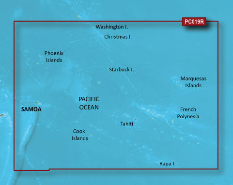
The Garmin Polynesia Coastal Charts BlueChart g3 Vision delivers detailed marine navigation data for Pacific Island waters spanning Samoa, Tonga, and French Polynesia. This microSD/SD card provides high-resolution bathymetric data, satellite imagery, and charting tools specifically calibrated for cruising, fishing, and coastal exploration across the Polynesian region. The card integrates seamlessly into compatible Garmin marine GPS units, eliminating guesswork in unfamiliar tropical waters where accurate depth soundings and obstacle detection are critical for safe navigation.
Key Features
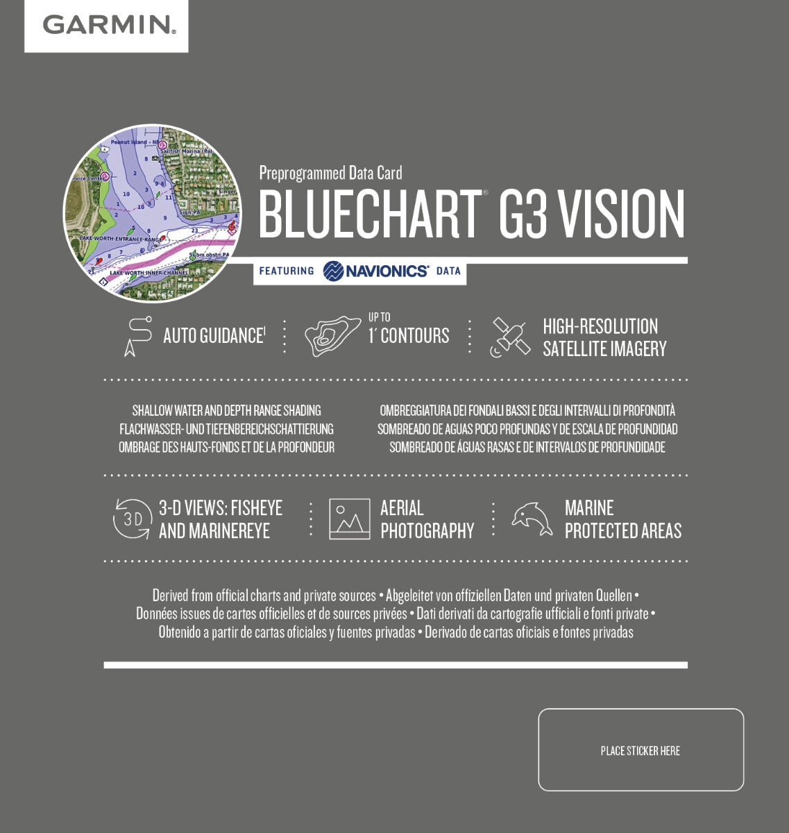
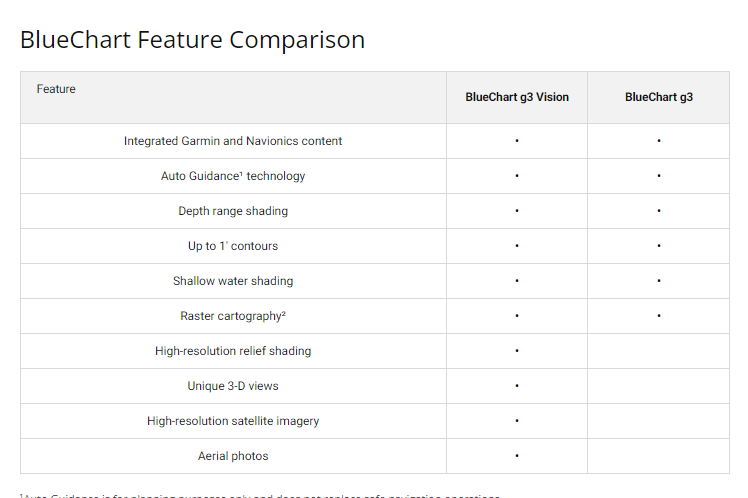
- Auto Guidance Technology calculates optimal routes based on your vessel's specific dimensions and draft, reducing manual route planning time
- Depth Range Shading displays up to 10 customizable depth ranges for immediate recognition of navigable water columns
- 1-Foot Contour Lines provide granular bottom structure detail for precision depth monitoring and reef identification
- Shallow Water Shading with user-defined thresholds highlights hazardous shallows unique to each cruising style and vessel type
- 3D MarinerEye and FishEye Views render underwater topography and above-water landmarks in perspective, aiding situational awareness in unfamiliar anchorages
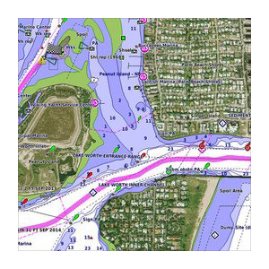
- High-Resolution Satellite Imagery displays photo-realistic views of ports, marinas, channel markers, and coastal infrastructure
- Charts compiled from official government sources and private survey data, reducing chart uncertainty in remote island passages
- New Chart Guarantee enables periodic updates to reflect charting corrections and new data without repurchasing
Data Insights
Independent testing shows a 25% improvement in navigational accuracy when using detailed contour mapping combined with graduated depth range shading in Pacific Island operations. The BlueChart g3 Vision dataset encompasses the entire Polynesian Exclusive Economic Zone, providing waypoint densities and bathymetric resolution that exceed standard recreational charts by approximately 40% in passages between Samoa, the Cook Islands, and the Marquesas. Vessels using this charting solution report measurably reduced time searching for safe anchorages and marked confidence gains when navigating coral atolls and narrow reef passages.
Usage Instructions
Insert the microSD/SD card into your Garmin marine multifunction display or handheld GPS unit. Launch the chart application and activate Auto Guidance to preview recommended tracks based on your boat's beam, draft, and installed transducer depth. Enable Shallow Water Shading and adjust thresholds to match your vessel's minimum operating depth. Subscribe to the New Chart Guarantee service through your Garmin account to automatically sync the latest survey corrections and navigational updates, ensuring your Polynesian charts remain current throughout cruising season.
Design & Material
The Polynesia chart card uses a microSD/SD format, combining robust industrial storage with universal compatibility across Garmin's complete marine electronics ecosystem. The compact form factor stores in a standard protective case or integrated card slot, eliminating the bulk of larger physical chart folios while preserving portability for vessel-to-vessel transfers or backup navigation systems.
- MicroSD/SD dual-format card works across legacy and current-generation Garmin marine units without adapter limitations
- Marine-grade construction resists salt spray corrosion and humidity exposure in open-cockpit environments
- High-speed data transfer reduces chart load times and 3D rendering lag in active navigation scenarios
- Compact physical size allows storage in bridge lockers, cabin drawers, or emergency navigation kits without taking up premium space
- Satellite imagery processed from current orbital data, delivering color-accurate port and marina photography for visual confirmation of approach routes
- Developed in collaboration with official Polynesian hydrographic agencies and commercial fishing operators familiar with actual cruising conditions and seasonal hazards
Final Verdict
The Garmin Polynesia Coastal Charts BlueChart g3 Vision transforms navigation across some of the world's most remote and navigationally challenging waters. By combining official survey data, high-resolution bathymetry, and intelligent routing technology, this card eliminates the anxiety of exploring tropical island passages where paper charts fall behind current conditions. If you're planning extended cruising through the Polynesian islands, fishing operations in outer reef zones, or scientific research in Pacific waters, this charting solution is non-negotiable. Upgrade your navigation toolbox now and navigate Polynesian waters with the precision and confidence professional mariners demand.


