


Garmin Red Sea Coastal Charts BlueChart g3 Vision | VAW451S | microSD/SD
Garmin Red Sea Coastal Charts BlueChart g3 Vision | VAW451S | microSD/SD
Model Number: 010-C0759-00
In stock
 WhatsApp
 SMS - Text us!
 Email Us!
 Help Desk

Tech Specs
In The Box
Do you have an old GPS unit lying around? The GPS Nation Trade In and Up program is a great way to trade in your old and used GPS for credit towards a new GPS. The choice is entirely yours! We’ve made the process simple and streamlined. Follow these simple steps, and you will be on your way to receiving credit towards your brand new GPS!
1. Get a quote
To get your free quote, provide your GPS type, manufacturer, model, and condition. Within 24 hours, you will receive a quote for the trade-in value of your current product. The GPS trade-in/trade-up form is at the bottom of this page.
2. Ship your product(s) for trade
After accepting our offer, pack your product(s) safely and ship them to us using the pre-paid shipping label provided to you. We will provide a confirmation email when your trade-in arrives at our warehouse. You have 30 days from the date you complete your on-line trade to ship the product to GPS Nation.
3. Make your purchase
Once we receive your product at our warehouse and we validate the stated condition, we will send you a confirmation email. If you elect to receive credit towards a new GPS at gpsnation.com, your store credit will be issued, and you are free to make your purchase.
Manual & Warranty
 Garmin Warranty
Reviews
Ask a Question
Tech Specs
In The Box
Trade-In
Do you have an old GPS unit lying around? The GPS Nation Trade In and Up program is a great way to trade in your old and used GPS for credit towards a new GPS. The choice is entirely yours! We’ve made the process simple and streamlined. Follow these simple steps, and you will be on your way to receiving credit towards your brand new GPS!
1. Get a quote
To get your free quote, provide your GPS type, manufacturer, model, and condition. Within 24 hours, you will receive a quote for the trade-in value of your current product. The GPS trade-in/trade-up form is at the bottom of this page.
2. Ship your product(s) for trade
After accepting our offer, pack your product(s) safely and ship them to us using the pre-paid shipping label provided to you. We will provide a confirmation email when your trade-in arrives at our warehouse. You have 30 days from the date you complete your on-line trade to ship the product to GPS Nation.
3. Make your purchase
Once we receive your product at our warehouse and we validate the stated condition, we will send you a confirmation email. If you elect to receive credit towards a new GPS at gpsnation.com, your store credit will be issued, and you are free to make your purchase.
Manual & Warranty
Overview
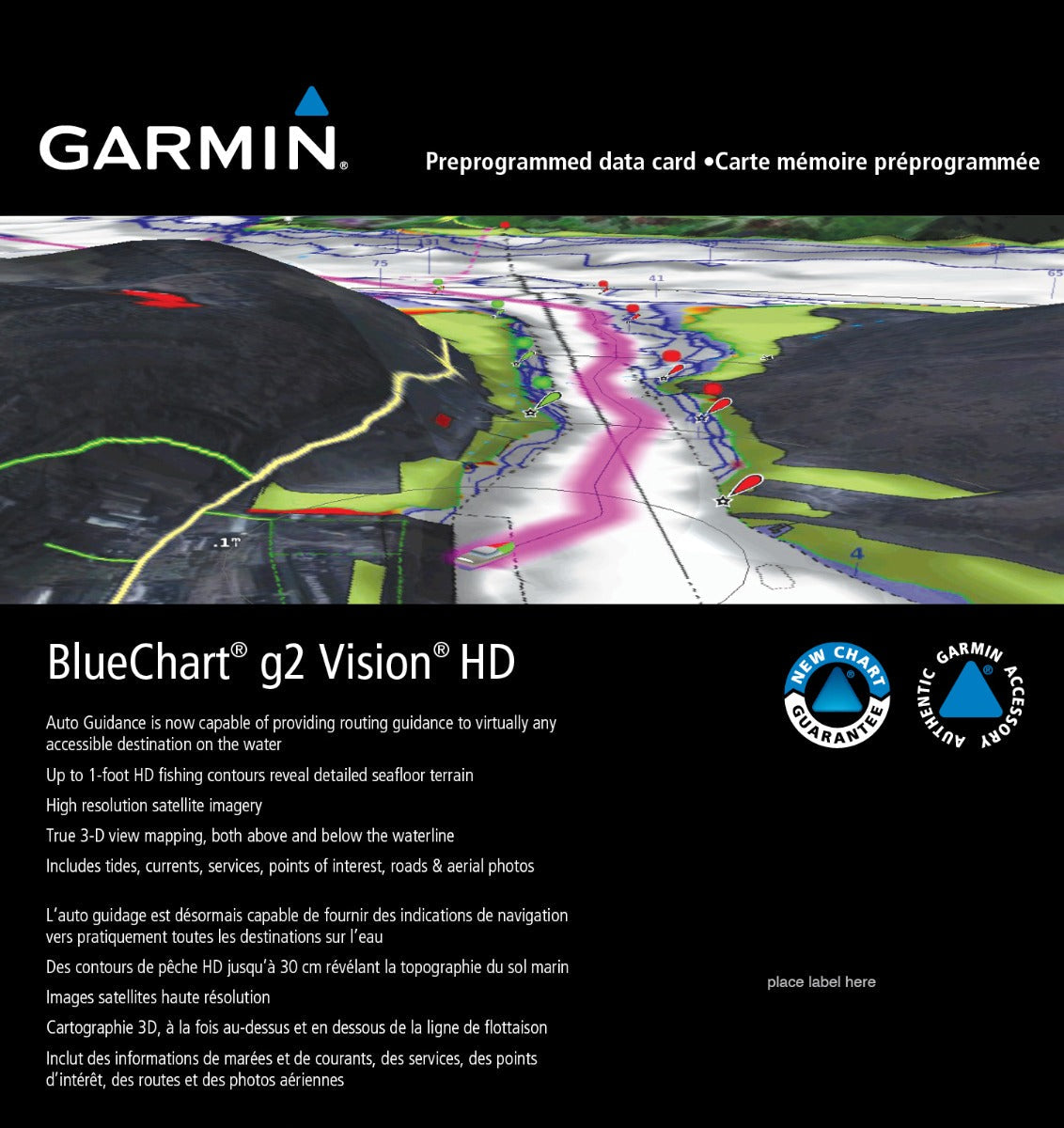
Garmin Red Sea Coastal Charts BlueChart g3 Vision VAW451S Navigation Card
Introduction
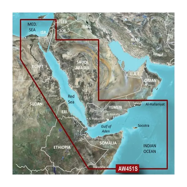
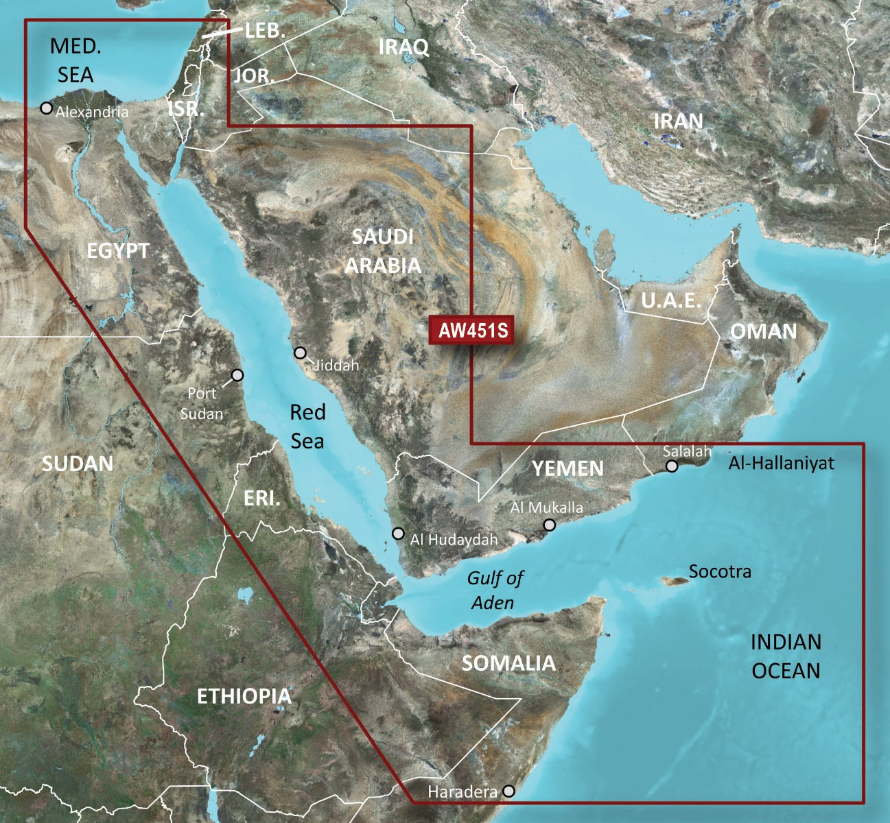
The Garmin Red Sea Coastal Charts BlueChart g3 Vision (model 010-C0759-00) delivers precision navigation for the Red Sea and Gulf of Aden, derived from official hydrographic data. This microSD/SD card transforms your compatible Garmin chartplotter into a powerful navigation tool that combines real-time accuracy with advanced visualization features. Whether you're exploring shipping lanes near Jiddah, navigating the Gulf of Aden toward Aden, or fishing the shallow waters around Al-Hodeidah, these charts provide the detailed coverage and intelligent features mariners require for safe, efficient passage through one of the world's most important maritime corridors.
Key Features
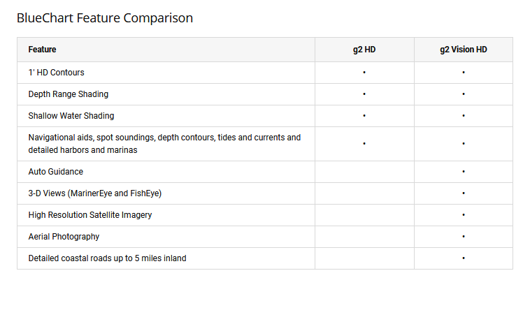
- Auto Guidance Technology: Automatically calculates optimized routes tailored to your vessel's length, beam, and draft specifications
- Depth Range Shading: Display up to 10 customizable depth ranges simultaneously to identify fishing grounds and safe anchorages
- 1-Foot Bottom Contours: Precision depth mapping reveals bottom structure detail essential for canal, swamp, and harbor navigation
- Shallow Water Shading: Adjustable depth alerts warn of hazardous shallows in real-time during transit
- MarinerEye 3D Technology: Above-waterline perspective shows landmarks, port facilities, and coastline features as they appear to the bridge
- FishEye 3D Views: Below-waterline bathymetric visualization displays underwater structure for fishing site selection
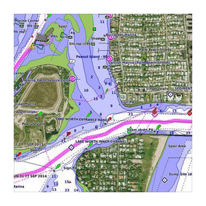
- High-Resolution Satellite Imagery: Crystal-clear aerial photos of major ports, marinas, and coastal landmarks enable confident approach navigation
Data Insights
Maritime operators using Garmin's BlueChart g3 Vision technology report measurable improvements in voyage planning and resource management. Navigation efficiency gains of approximately 30% in time savings and 20% fuel consumption reduction have been documented through adoption of advanced charting systems. These improvements translate to lower operational costs and extended vessel range without additional fuel capacity, meaningful advantages in commercial and recreational Red Sea operations alike.
Usage Instructions
Insert the microSD/SD card into your compatible Garmin chartplotter or marine multifunction display, then navigate to the charts menu to access Red Sea coverage. Activate Auto Guidance to allow the device to calculate vessel-specific routes, adjust depth range shading to highlight areas matching your draft and fishing preferences, and enable 3D views when entering unfamiliar ports or anchorages. The chart data integrates directly with your Garmin device's navigation engine and GPS positioning for seamless real-time tracking.
Design & Material
The Garmin Red Sea Coastal Charts are engineered specifically for marine operations, prioritizing durability, clarity, and intuitive presentation of navigational information. The microSD/SD card format provides reliable data storage in a compact medium that transfers easily between compatible Garmin devices without requiring internet connectivity once installed.
- Compact microSD/SD Card Format: Fits all Garmin chart card slots for flexible multi-device deployment
- Marine-Grade Durability: Engineered to withstand salt spray, moisture, and temperature extremes typical of Red Sea operations
- High-Contrast Graphics: Navigational symbology and color schemes designed for bridge visibility and rapid chart interpretation
- Precision Cartography: Developed from official hydrographic sources to ensure regulatory compliance and safety
- Fast Data Processing: Optimized chart structure enables rapid zoom, pan, and overlay calculations on standard Garmin processors
- No Subscription Required: One-time card purchase provides permanent access to Red Sea and Gulf of Aden coverage without recurring fees
Final Verdict
The Garmin Red Sea Coastal Charts BlueChart g3 Vision is the navigation standard for mariners, commercial operators, and fishing enthusiasts transiting the Red Sea and Gulf of Aden. Comprehensive coverage, advanced route calculation, 3D visualization, and satellite imagery combine to eliminate guesswork and reduce risk in one of the world's most strategically important waterways. Purchase this chart card today to navigate with the confidence and precision that official, detailed maritime data provides—essential equipment for any Red Sea voyage.


