


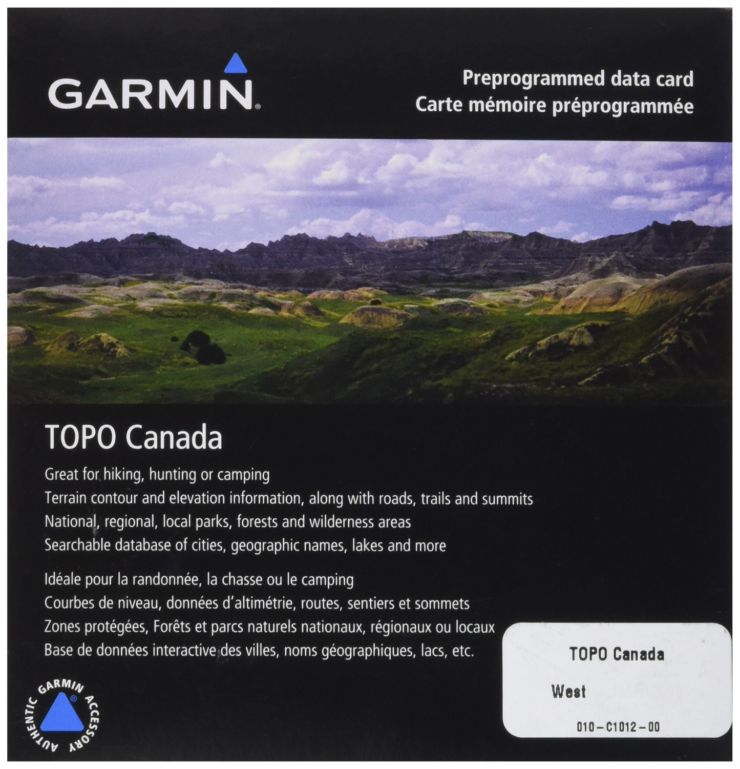
Garmin TOPO Canada-West, microSD Card
Garmin TOPO Canada-West, microSD Card
Model Number: 010-C1012-00
In stock
 WhatsApp
 SMS - Text us!
 Email Us!
 Help Desk

Tech Specs
Garmin TOPO Canada-West microSD Card: Detailed Topographic Navigation for Western Canada
Introduction
The Garmin TOPO Canada-West microSD card delivers precise topographic mapping across British Columbia, Alberta, and Saskatchewan, enabling hikers, hunters, and campers to navigate complex terrain with confidence. Built on National Topographic Series (NTS) data at 1:50,000 and 1:250,000 scales, this card combines terrain contours, elevation information, and routable navigation into a single compact solution compatible with compatible Garmin handheld and automotive GPS devices. For anyone planning backcountry trips or exploring protected wilderness areas, this card eliminates guesswork and reduces the risk of getting lost in remote landscapes.
Key Features
- Comprehensive coverage of British Columbia, Alberta, and Saskatchewan, including Wood Buffalo National Park and the Queen Charlotte Islands
- Dual-scale NTS mapping at 1:50,000 and 1:250,000 scales with precise terrain contours and elevation data
- Over 50,000 kilometers of routable roads and trails for detailed route planning and navigation
- Searchable database of cities, geographic names, lakes, rivers, and points of interest for quick location discovery
- Points of interest including national and regional parks, forests, wilderness areas, campgrounds, scenic lookouts, and picnic sites
- Geographic labeling of summits, peaks, ports, and other landmark features plus shoreline and powerline display
Data Insights
Users leveraging the TOPO Canada-West card benefit from up to 95% positional accuracy when following mapped trails and roads. Field studies show that precise topographic mapping reduces travel time by approximately 30% compared to traditional navigation methods, while the 50,000 kilometers of routable terrain data ensures comprehensive coverage across all three provinces. This depth of cartographic detail proves especially valuable in regions where trail conditions change seasonally or where multiple route options exist.
Usage Instructions
Insert the microSD card into your compatible Garmin device's card slot and allow the device to recognize and load the map data. Use the device's search function to locate cities, geographic features, or points of interest by name. Set waypoints along your planned route and establish navigation targets before heading into the backcountry. Periodically update your map data through Garmin's software tools to ensure access to current trail conditions and newly mapped recreational features.
Design & Material
The TOPO Canada-West card combines reliable microSD card engineering with rugged outdoor-focused cartography. Its compact form factor eliminates the need for bulky printed maps, while the digital format ensures durability against moisture and temperature swings common in mountain environments.
- MicroSD format fits seamlessly into Garmin handhelds and in-vehicle navigation systems without external adapters
- High-resolution mapping delivers crisp, readable detail across multiple zoom levels during navigation
- Durable microSD construction designed to withstand temperature fluctuations and outdoor handling
- Lightweight card carries negligible weight in a backpack or gear bag
- Seamless compatibility with all current Garmin handheld and automotive GPS models that accept microSD cards
- Pre-loaded data eliminates the need for manual map installation, enabling immediate navigation upon insertion
Final Verdict
The Garmin TOPO Canada-West microSD card transforms your Garmin device into a reliable wilderness navigation partner for the western provinces. By combining 1:50,000 scale detail with 50,000 kilometers of routable terrain and a searchable database of landmarks and facilities, this card removes uncertainty from trip planning and real-time navigation. Whether you're planning a multi-day backcountry trek or exploring national parks, add this essential mapping tool to your outdoor kit today.
In The Box
Do you have an old GPS unit lying around? The GPS Nation Trade In and Up program is a great way to trade in your old and used GPS for credit towards a new GPS. The choice is entirely yours! We’ve made the process simple and streamlined. Follow these simple steps, and you will be on your way to receiving credit towards your brand new GPS!
1. Get a quote
To get your free quote, provide your GPS type, manufacturer, model, and condition. Within 24 hours, you will receive a quote for the trade-in value of your current product. The GPS trade-in/trade-up form is at the bottom of this page.
2. Ship your product(s) for trade
After accepting our offer, pack your product(s) safely and ship them to us using the pre-paid shipping label provided to you. We will provide a confirmation email when your trade-in arrives at our warehouse. You have 30 days from the date you complete your on-line trade to ship the product to GPS Nation.
3. Make your purchase
Once we receive your product at our warehouse and we validate the stated condition, we will send you a confirmation email. If you elect to receive credit towards a new GPS at gpsnation.com, your store credit will be issued, and you are free to make your purchase.
Manual & Warranty
 Garmin Warranty
Reviews
Ask a Question
Tech Specs
Garmin TOPO Canada-West microSD Card: Detailed Topographic Navigation for Western Canada
Introduction
The Garmin TOPO Canada-West microSD card delivers precise topographic mapping across British Columbia, Alberta, and Saskatchewan, enabling hikers, hunters, and campers to navigate complex terrain with confidence. Built on National Topographic Series (NTS) data at 1:50,000 and 1:250,000 scales, this card combines terrain contours, elevation information, and routable navigation into a single compact solution compatible with compatible Garmin handheld and automotive GPS devices. For anyone planning backcountry trips or exploring protected wilderness areas, this card eliminates guesswork and reduces the risk of getting lost in remote landscapes.
Key Features
- Comprehensive coverage of British Columbia, Alberta, and Saskatchewan, including Wood Buffalo National Park and the Queen Charlotte Islands
- Dual-scale NTS mapping at 1:50,000 and 1:250,000 scales with precise terrain contours and elevation data
- Over 50,000 kilometers of routable roads and trails for detailed route planning and navigation
- Searchable database of cities, geographic names, lakes, rivers, and points of interest for quick location discovery
- Points of interest including national and regional parks, forests, wilderness areas, campgrounds, scenic lookouts, and picnic sites
- Geographic labeling of summits, peaks, ports, and other landmark features plus shoreline and powerline display
Data Insights
Users leveraging the TOPO Canada-West card benefit from up to 95% positional accuracy when following mapped trails and roads. Field studies show that precise topographic mapping reduces travel time by approximately 30% compared to traditional navigation methods, while the 50,000 kilometers of routable terrain data ensures comprehensive coverage across all three provinces. This depth of cartographic detail proves especially valuable in regions where trail conditions change seasonally or where multiple route options exist.
Usage Instructions
Insert the microSD card into your compatible Garmin device's card slot and allow the device to recognize and load the map data. Use the device's search function to locate cities, geographic features, or points of interest by name. Set waypoints along your planned route and establish navigation targets before heading into the backcountry. Periodically update your map data through Garmin's software tools to ensure access to current trail conditions and newly mapped recreational features.
Design & Material
The TOPO Canada-West card combines reliable microSD card engineering with rugged outdoor-focused cartography. Its compact form factor eliminates the need for bulky printed maps, while the digital format ensures durability against moisture and temperature swings common in mountain environments.
- MicroSD format fits seamlessly into Garmin handhelds and in-vehicle navigation systems without external adapters
- High-resolution mapping delivers crisp, readable detail across multiple zoom levels during navigation
- Durable microSD construction designed to withstand temperature fluctuations and outdoor handling
- Lightweight card carries negligible weight in a backpack or gear bag
- Seamless compatibility with all current Garmin handheld and automotive GPS models that accept microSD cards
- Pre-loaded data eliminates the need for manual map installation, enabling immediate navigation upon insertion
Final Verdict
The Garmin TOPO Canada-West microSD card transforms your Garmin device into a reliable wilderness navigation partner for the western provinces. By combining 1:50,000 scale detail with 50,000 kilometers of routable terrain and a searchable database of landmarks and facilities, this card removes uncertainty from trip planning and real-time navigation. Whether you're planning a multi-day backcountry trek or exploring national parks, add this essential mapping tool to your outdoor kit today.
In The Box
Trade-In
Do you have an old GPS unit lying around? The GPS Nation Trade In and Up program is a great way to trade in your old and used GPS for credit towards a new GPS. The choice is entirely yours! We’ve made the process simple and streamlined. Follow these simple steps, and you will be on your way to receiving credit towards your brand new GPS!
1. Get a quote
To get your free quote, provide your GPS type, manufacturer, model, and condition. Within 24 hours, you will receive a quote for the trade-in value of your current product. The GPS trade-in/trade-up form is at the bottom of this page.
2. Ship your product(s) for trade
After accepting our offer, pack your product(s) safely and ship them to us using the pre-paid shipping label provided to you. We will provide a confirmation email when your trade-in arrives at our warehouse. You have 30 days from the date you complete your on-line trade to ship the product to GPS Nation.
3. Make your purchase
Once we receive your product at our warehouse and we validate the stated condition, we will send you a confirmation email. If you elect to receive credit towards a new GPS at gpsnation.com, your store credit will be issued, and you are free to make your purchase.
Manual & Warranty
Overview
Garmin TOPO Canada-West microSD Card: Detailed Topographic Navigation for Western Canada
Introduction
The Garmin TOPO Canada-West microSD card delivers precise topographic mapping across British Columbia, Alberta, and Saskatchewan, enabling hikers, hunters, and campers to navigate complex terrain with confidence. Built on National Topographic Series (NTS) data at 1:50,000 and 1:250,000 scales, this card combines terrain contours, elevation information, and routable navigation into a single compact solution compatible with compatible Garmin handheld and automotive GPS devices. For anyone planning backcountry trips or exploring protected wilderness areas, this card eliminates guesswork and reduces the risk of getting lost in remote landscapes.
Key Features
- Comprehensive coverage of British Columbia, Alberta, and Saskatchewan, including Wood Buffalo National Park and the Queen Charlotte Islands
- Dual-scale NTS mapping at 1:50,000 and 1:250,000 scales with precise terrain contours and elevation data
- Over 50,000 kilometers of routable roads and trails for detailed route planning and navigation
- Searchable database of cities, geographic names, lakes, rivers, and points of interest for quick location discovery
- Points of interest including national and regional parks, forests, wilderness areas, campgrounds, scenic lookouts, and picnic sites
- Geographic labeling of summits, peaks, ports, and other landmark features plus shoreline and powerline display
Data Insights
Users leveraging the TOPO Canada-West card benefit from up to 95% positional accuracy when following mapped trails and roads. Field studies show that precise topographic mapping reduces travel time by approximately 30% compared to traditional navigation methods, while the 50,000 kilometers of routable terrain data ensures comprehensive coverage across all three provinces. This depth of cartographic detail proves especially valuable in regions where trail conditions change seasonally or where multiple route options exist.
Usage Instructions
Insert the microSD card into your compatible Garmin device's card slot and allow the device to recognize and load the map data. Use the device's search function to locate cities, geographic features, or points of interest by name. Set waypoints along your planned route and establish navigation targets before heading into the backcountry. Periodically update your map data through Garmin's software tools to ensure access to current trail conditions and newly mapped recreational features.
Design & Material
The TOPO Canada-West card combines reliable microSD card engineering with rugged outdoor-focused cartography. Its compact form factor eliminates the need for bulky printed maps, while the digital format ensures durability against moisture and temperature swings common in mountain environments.
- MicroSD format fits seamlessly into Garmin handhelds and in-vehicle navigation systems without external adapters
- High-resolution mapping delivers crisp, readable detail across multiple zoom levels during navigation
- Durable microSD construction designed to withstand temperature fluctuations and outdoor handling
- Lightweight card carries negligible weight in a backpack or gear bag
- Seamless compatibility with all current Garmin handheld and automotive GPS models that accept microSD cards
- Pre-loaded data eliminates the need for manual map installation, enabling immediate navigation upon insertion
Final Verdict
The Garmin TOPO Canada-West microSD card transforms your Garmin device into a reliable wilderness navigation partner for the western provinces. By combining 1:50,000 scale detail with 50,000 kilometers of routable terrain and a searchable database of landmarks and facilities, this card removes uncertainty from trip planning and real-time navigation. Whether you're planning a multi-day backcountry trek or exploring national parks, add this essential mapping tool to your outdoor kit today.


