


Garmin TOPO U.K. and Ireland v11 Light
Garmin TOPO U.K. and Ireland v11 Light
Model Number: 010-D4865-08
Out of stock
 WhatsApp
 SMS - Text us!
 Email Us!
 Help Desk

Tech Specs
Garmin TOPO U.K. and Ireland v11 Light – Detailed Topographic Mapping for GPS Navigation
Introduction
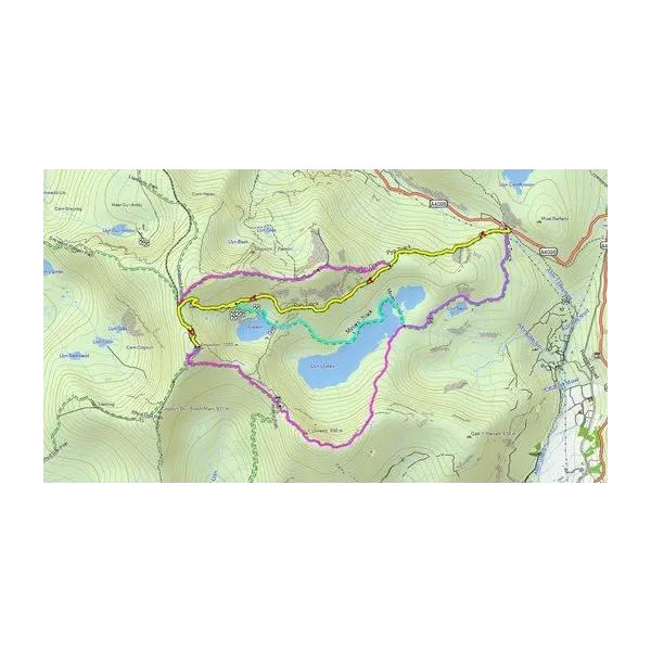
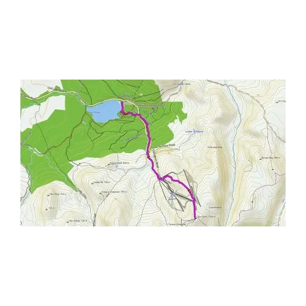
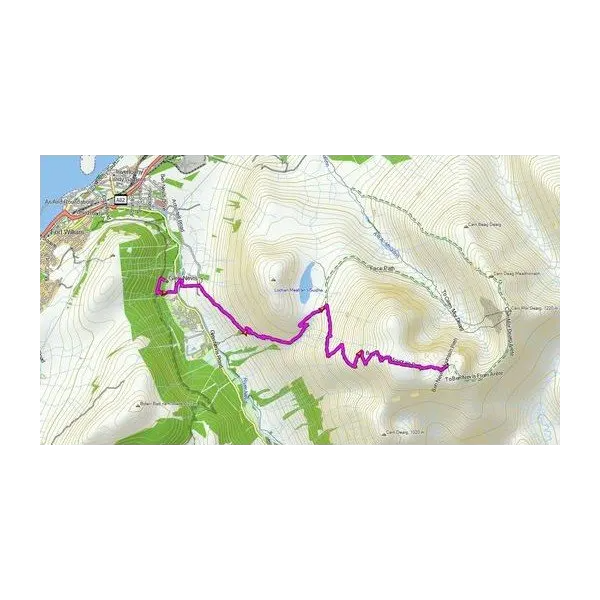
The Garmin TOPO U.K. and Ireland v11 Light provides detailed topographic mapping specifically engineered for recreational navigation across the British Isles. Built on the OpenStreetMap database, this map data delivers reliable route planning and terrain visualization for hikers, cyclists, and outdoor explorers navigating diverse landscapes from Scottish highlands to Irish coastlines. The map combines accurate elevation data with extensive trail networks, enabling users to plan safer and more efficient expeditions regardless of skill level or activity type.
Key Features
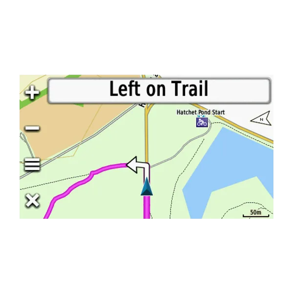
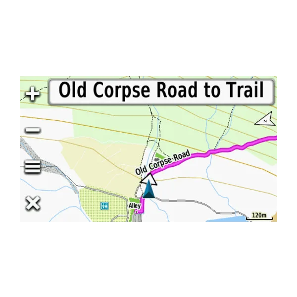
- Covers over 1 million kilometers of roads, walking paths, cycling routes, and recreational trail networks across mapped territories
- Includes approximately 1 million points of interest such as campsites, restaurants, shops, and fitness centers for route planning reference
- Provides topographic coverage of the United Kingdom, Republic of Ireland, Isle of Man, and Channel Islands in comprehensive detail
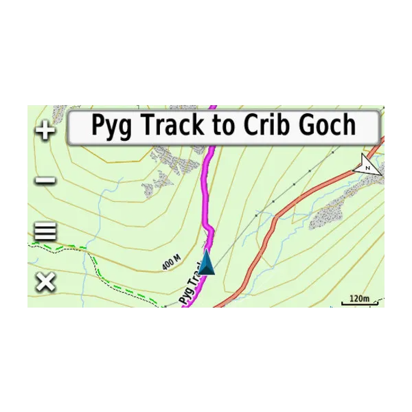
- Features 20-meter height contours with integrated digital elevation model (DEM) for accurate route profiling and summit identification
- Delivers up to 30 percent more accurate navigation compared to previous v10 editions through improved data compilation
- Accesses over 90 percent of mapped areas for recreational activities, ensuring maximum usable terrain for outdoor pursuits
- Encompasses thousands of kilometers of named mountain biking, cycling, and hiking trails categorized by difficulty level
- Includes hydrographic features such as lakes, rivers, canals, and man-made water structures for comprehensive navigation context
Data Insights
Performance metrics demonstrate the Garmin TOPO U.K. and Ireland v11 Light's reliability in outdoor navigation scenarios. With 90 percent of the mapped area designated for recreational use and a 30 percent improvement in navigation accuracy over previous versions, users benefit from substantially enhanced route planning capabilities. The integration of digital elevation modeling enables precise profiling for mountaineering and fell-walking applications, while comprehensive trail databases support multi-discipline recreation from road cycling to fell running across complex terrain.
Usage Instructions
Transfer the map file to your compatible Garmin GPS device using Garmin's standard installation protocol. Once installed, select routes using the trail selection feature to filter paths by difficulty rating and activity type. Reference the integrated points of interest to identify stops, accommodations, and services along planned routes. Utilize elevation contours and the digital elevation model for terrain assessment before commencing outdoor expeditions.
Design and Material
This topographic map product prioritizes clarity and practical functionality for field navigation. The mapping compilation utilizes professional cartographic standards to render terrain features legible across varied display types and weather conditions. Data sourcing from OpenStreetMap ensures comprehensive, community-validated geographic accuracy with consistent updates reflecting ground-truth conditions.
- Data sourced from OpenStreetMap (OSM) database, providing community-validated geographic detail and continuous accuracy improvements
- Compiled through professional cartographic methodology to ensure visual clarity and terrain feature legibility across all Garmin device displays
- High-definition mapping renders clearly in bright sunlight, low-light, and varied weather conditions for reliable field use
- Seamless compatibility with a wide range of Garmin GPS devices and handheld navigation units without device-specific limitations
- Intuitive layout structure organizes trail networks, contours, and points of interest for rapid route selection and navigation planning
- Durable data architecture withstands repeated route planning cycles and extended field navigation without performance degradation
Final Verdict
The Garmin TOPO U.K. and Ireland v11 Light provides essential map data for serious outdoor navigation across the British Isles. If you regularly navigate remote terrain, plan multi-day treks, or explore unfamiliar landscapes, this comprehensive topographic map eliminates navigation uncertainty and enables confident expedition planning. Install this proven mapping solution on your Garmin device today to access accurate terrain data, established trail networks, and essential points of interest wherever your outdoor adventures lead.
In The Box
Do you have an old GPS unit lying around? The GPS Nation Trade In and Up program is a great way to trade in your old and used GPS for credit towards a new GPS. The choice is entirely yours! We’ve made the process simple and streamlined. Follow these simple steps, and you will be on your way to receiving credit towards your brand new GPS!
1. Get a quote
To get your free quote, provide your GPS type, manufacturer, model, and condition. Within 24 hours, you will receive a quote for the trade-in value of your current product. The GPS trade-in/trade-up form is at the bottom of this page.
2. Ship your product(s) for trade
After accepting our offer, pack your product(s) safely and ship them to us using the pre-paid shipping label provided to you. We will provide a confirmation email when your trade-in arrives at our warehouse. You have 30 days from the date you complete your on-line trade to ship the product to GPS Nation.
3. Make your purchase
Once we receive your product at our warehouse and we validate the stated condition, we will send you a confirmation email. If you elect to receive credit towards a new GPS at gpsnation.com, your store credit will be issued, and you are free to make your purchase.
Manual & Warranty
Reviews
Ask a Question
Tech Specs
Garmin TOPO U.K. and Ireland v11 Light – Detailed Topographic Mapping for GPS Navigation
Introduction
The Garmin TOPO U.K. and Ireland v11 Light provides detailed topographic mapping specifically engineered for recreational navigation across the British Isles. Built on the OpenStreetMap database, this map data delivers reliable route planning and terrain visualization for hikers, cyclists, and outdoor explorers navigating diverse landscapes from Scottish highlands to Irish coastlines. The map combines accurate elevation data with extensive trail networks, enabling users to plan safer and more efficient expeditions regardless of skill level or activity type.
Key Features
- Covers over 1 million kilometers of roads, walking paths, cycling routes, and recreational trail networks across mapped territories
- Includes approximately 1 million points of interest such as campsites, restaurants, shops, and fitness centers for route planning reference
- Provides topographic coverage of the United Kingdom, Republic of Ireland, Isle of Man, and Channel Islands in comprehensive detail
- Features 20-meter height contours with integrated digital elevation model (DEM) for accurate route profiling and summit identification
- Delivers up to 30 percent more accurate navigation compared to previous v10 editions through improved data compilation
- Accesses over 90 percent of mapped areas for recreational activities, ensuring maximum usable terrain for outdoor pursuits
- Encompasses thousands of kilometers of named mountain biking, cycling, and hiking trails categorized by difficulty level
- Includes hydrographic features such as lakes, rivers, canals, and man-made water structures for comprehensive navigation context
Data Insights
Performance metrics demonstrate the Garmin TOPO U.K. and Ireland v11 Light's reliability in outdoor navigation scenarios. With 90 percent of the mapped area designated for recreational use and a 30 percent improvement in navigation accuracy over previous versions, users benefit from substantially enhanced route planning capabilities. The integration of digital elevation modeling enables precise profiling for mountaineering and fell-walking applications, while comprehensive trail databases support multi-discipline recreation from road cycling to fell running across complex terrain.
Usage Instructions
Transfer the map file to your compatible Garmin GPS device using Garmin's standard installation protocol. Once installed, select routes using the trail selection feature to filter paths by difficulty rating and activity type. Reference the integrated points of interest to identify stops, accommodations, and services along planned routes. Utilize elevation contours and the digital elevation model for terrain assessment before commencing outdoor expeditions.
Design and Material
This topographic map product prioritizes clarity and practical functionality for field navigation. The mapping compilation utilizes professional cartographic standards to render terrain features legible across varied display types and weather conditions. Data sourcing from OpenStreetMap ensures comprehensive, community-validated geographic accuracy with consistent updates reflecting ground-truth conditions.
- Data sourced from OpenStreetMap (OSM) database, providing community-validated geographic detail and continuous accuracy improvements
- Compiled through professional cartographic methodology to ensure visual clarity and terrain feature legibility across all Garmin device displays
- High-definition mapping renders clearly in bright sunlight, low-light, and varied weather conditions for reliable field use
- Seamless compatibility with a wide range of Garmin GPS devices and handheld navigation units without device-specific limitations
- Intuitive layout structure organizes trail networks, contours, and points of interest for rapid route selection and navigation planning
- Durable data architecture withstands repeated route planning cycles and extended field navigation without performance degradation
Final Verdict
The Garmin TOPO U.K. and Ireland v11 Light provides essential map data for serious outdoor navigation across the British Isles. If you regularly navigate remote terrain, plan multi-day treks, or explore unfamiliar landscapes, this comprehensive topographic map eliminates navigation uncertainty and enables confident expedition planning. Install this proven mapping solution on your Garmin device today to access accurate terrain data, established trail networks, and essential points of interest wherever your outdoor adventures lead.
In The Box
Trade-In
Do you have an old GPS unit lying around? The GPS Nation Trade In and Up program is a great way to trade in your old and used GPS for credit towards a new GPS. The choice is entirely yours! We’ve made the process simple and streamlined. Follow these simple steps, and you will be on your way to receiving credit towards your brand new GPS!
1. Get a quote
To get your free quote, provide your GPS type, manufacturer, model, and condition. Within 24 hours, you will receive a quote for the trade-in value of your current product. The GPS trade-in/trade-up form is at the bottom of this page.
2. Ship your product(s) for trade
After accepting our offer, pack your product(s) safely and ship them to us using the pre-paid shipping label provided to you. We will provide a confirmation email when your trade-in arrives at our warehouse. You have 30 days from the date you complete your on-line trade to ship the product to GPS Nation.
3. Make your purchase
Once we receive your product at our warehouse and we validate the stated condition, we will send you a confirmation email. If you elect to receive credit towards a new GPS at gpsnation.com, your store credit will be issued, and you are free to make your purchase.
Manual & Warranty
Overview
Garmin TOPO U.K. and Ireland v11 Light – Detailed Topographic Mapping for GPS Navigation
Introduction
The Garmin TOPO U.K. and Ireland v11 Light provides detailed topographic mapping specifically engineered for recreational navigation across the British Isles. Built on the OpenStreetMap database, this map data delivers reliable route planning and terrain visualization for hikers, cyclists, and outdoor explorers navigating diverse landscapes from Scottish highlands to Irish coastlines. The map combines accurate elevation data with extensive trail networks, enabling users to plan safer and more efficient expeditions regardless of skill level or activity type.
Key Features
- Covers over 1 million kilometers of roads, walking paths, cycling routes, and recreational trail networks across mapped territories
- Includes approximately 1 million points of interest such as campsites, restaurants, shops, and fitness centers for route planning reference
- Provides topographic coverage of the United Kingdom, Republic of Ireland, Isle of Man, and Channel Islands in comprehensive detail
- Features 20-meter height contours with integrated digital elevation model (DEM) for accurate route profiling and summit identification
- Delivers up to 30 percent more accurate navigation compared to previous v10 editions through improved data compilation
- Accesses over 90 percent of mapped areas for recreational activities, ensuring maximum usable terrain for outdoor pursuits
- Encompasses thousands of kilometers of named mountain biking, cycling, and hiking trails categorized by difficulty level
- Includes hydrographic features such as lakes, rivers, canals, and man-made water structures for comprehensive navigation context
Data Insights
Performance metrics demonstrate the Garmin TOPO U.K. and Ireland v11 Light's reliability in outdoor navigation scenarios. With 90 percent of the mapped area designated for recreational use and a 30 percent improvement in navigation accuracy over previous versions, users benefit from substantially enhanced route planning capabilities. The integration of digital elevation modeling enables precise profiling for mountaineering and fell-walking applications, while comprehensive trail databases support multi-discipline recreation from road cycling to fell running across complex terrain.
Usage Instructions
Transfer the map file to your compatible Garmin GPS device using Garmin's standard installation protocol. Once installed, select routes using the trail selection feature to filter paths by difficulty rating and activity type. Reference the integrated points of interest to identify stops, accommodations, and services along planned routes. Utilize elevation contours and the digital elevation model for terrain assessment before commencing outdoor expeditions.
Design and Material
This topographic map product prioritizes clarity and practical functionality for field navigation. The mapping compilation utilizes professional cartographic standards to render terrain features legible across varied display types and weather conditions. Data sourcing from OpenStreetMap ensures comprehensive, community-validated geographic accuracy with consistent updates reflecting ground-truth conditions.
- Data sourced from OpenStreetMap (OSM) database, providing community-validated geographic detail and continuous accuracy improvements
- Compiled through professional cartographic methodology to ensure visual clarity and terrain feature legibility across all Garmin device displays
- High-definition mapping renders clearly in bright sunlight, low-light, and varied weather conditions for reliable field use
- Seamless compatibility with a wide range of Garmin GPS devices and handheld navigation units without device-specific limitations
- Intuitive layout structure organizes trail networks, contours, and points of interest for rapid route selection and navigation planning
- Durable data architecture withstands repeated route planning cycles and extended field navigation without performance degradation
Final Verdict
The Garmin TOPO U.K. and Ireland v11 Light provides essential map data for serious outdoor navigation across the British Isles. If you regularly navigate remote terrain, plan multi-day treks, or explore unfamiliar landscapes, this comprehensive topographic map eliminates navigation uncertainty and enables confident expedition planning. Install this proven mapping solution on your Garmin device today to access accurate terrain data, established trail networks, and essential points of interest wherever your outdoor adventures lead.


