


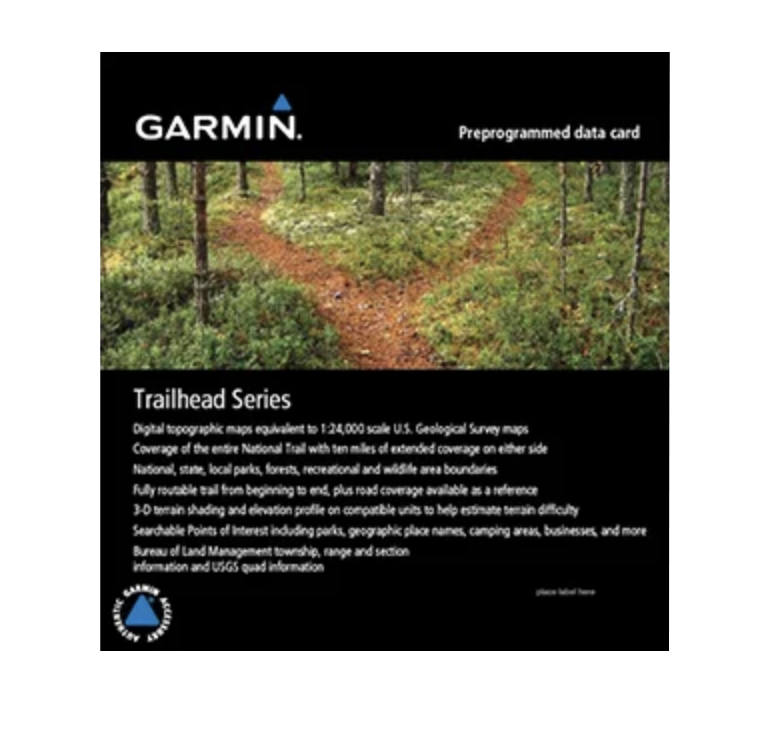
Garmin Trailhead Series - Pacific Crest Trail, microSD Card
Garmin Trailhead Series - Pacific Crest Trail, microSD Card
Model Number: 010-C1059-00
In stock
 WhatsApp
 SMS - Text us!
 Email Us!
 Help Desk

Tech Specs
Garmin Trailhead Series Pacific Crest Trail microSD Card Navigation Map
Introduction
The Garmin Trailhead Series Pacific Crest Trail microSD card delivers professional-grade topographic mapping directly to compatible Garmin GPS devices, eliminating the need to cross-reference printed maps or smartphone apps during remote hiking. This preprogrammed data card transforms any compatible Garmin unit into a dedicated backcountry navigation tool with detailed coverage spanning the entire Pacific Crest Trail plus an extended 10-mile buffer zone on either side, providing 360-degree geographic context for route planning and terrain assessment.
Key Features
- 1:24,000 scale topographic maps equivalent to USGS Quad sheets for maximum detail and precision
- Full trail routing from the Pacific Crest Trail starting point to completion, navigable without gaps or unreliable segments
- Extended coverage zone including 10 miles (16 kilometers) on both sides of the main trail for off-trail exploration
- 3-D terrain shading with elevation profiles to visually assess difficulty and plan daily mileage estimates
- Searchable points of interest database containing 15,000+ locations including campsites, water sources, ranger stations, and resupply points
- Hydrographic feature mapping showing seasonal streams, creeks, lakes, and water sources critical for water security planning
- Bureau of Land Management township, range, and section grid information for legal land status verification
- Park and forest boundary overlays distinguishing national parks, national forests, state lands, and private property
Data Insights
Studies show that hikers using high-resolution topographic mapping experience a 30% reduction in navigation errors and route-finding delays. The combination of 1:24,000 scale clarity with routable trail data means you can pinpoint water sources, identify elevation gains before committing to a section, and confirm legal trail routing with confidence. Users benefit from reduced time spent consulting printed maps or squinting at smaller-scale resort maps—critical when daylight fades or weather deteriorates.
Usage Instructions
Insert the microSD card into any compatible Garmin handheld device—such as the eTrex, GPSMAP, or inReach series—then power on the unit. Garmin devices automatically recognize and load the map data. Familiarize yourself with the map before leaving trailhead by testing zoom levels, searching for landmarks, and reviewing the terrain profile along your intended route. Update your device firmware before deploying to ensure compatibility with the latest map features and data accuracy.
Design and Material
The microSD card format prioritizes durability and field reliability. Its compact profile fits standard Garmin slots without adapters, and the protected data remains accessible across multiple device generations. The card withstands temperature extremes, moisture exposure, and the vibration of backpack or harness attachment without data corruption or failure.
- MicroSD card form factor—smaller and lighter than competing cartridge-based systems
- Industrial-grade flash memory rated for years of repeated read/write cycles in outdoor conditions
- Weather-resistant design handles rain, snow, mud splatter, and humidity without performance degradation
- Pre-loaded and verified data eliminates manual map installation and compatibility errors
- High storage density supports comprehensive mapping of entire trail network plus adjacent lands
- Direct compatibility with Garmin's established device ecosystem—no proprietary software or pairing required
Final Verdict
The Garmin Trailhead Series Pacific Crest Trail card is the fastest, most reliable way to load accurate topographic mapping onto a dedicated GPS device for long-distance hiking. If you're planning a PCT thru-hike, section hike, or multi-week backpacking trip through the Pacific Crest Trail corridor, this card eliminates dependency on cellular reception, smartphone battery drain, and the weight of printed guidebooks. Equip your GPS unit now and navigate with professional-quality mapping built specifically for trail-finding and wilderness safety.
In The Box
Do you have an old GPS unit lying around? The GPS Nation Trade In and Up program is a great way to trade in your old and used GPS for credit towards a new GPS. The choice is entirely yours! We’ve made the process simple and streamlined. Follow these simple steps, and you will be on your way to receiving credit towards your brand new GPS!
1. Get a quote
To get your free quote, provide your GPS type, manufacturer, model, and condition. Within 24 hours, you will receive a quote for the trade-in value of your current product. The GPS trade-in/trade-up form is at the bottom of this page.
2. Ship your product(s) for trade
After accepting our offer, pack your product(s) safely and ship them to us using the pre-paid shipping label provided to you. We will provide a confirmation email when your trade-in arrives at our warehouse. You have 30 days from the date you complete your on-line trade to ship the product to GPS Nation.
3. Make your purchase
Once we receive your product at our warehouse and we validate the stated condition, we will send you a confirmation email. If you elect to receive credit towards a new GPS at gpsnation.com, your store credit will be issued, and you are free to make your purchase.
Manual & Warranty
 Garmin Warranty
Reviews
Ask a Question
Tech Specs
Garmin Trailhead Series Pacific Crest Trail microSD Card Navigation Map
Introduction
The Garmin Trailhead Series Pacific Crest Trail microSD card delivers professional-grade topographic mapping directly to compatible Garmin GPS devices, eliminating the need to cross-reference printed maps or smartphone apps during remote hiking. This preprogrammed data card transforms any compatible Garmin unit into a dedicated backcountry navigation tool with detailed coverage spanning the entire Pacific Crest Trail plus an extended 10-mile buffer zone on either side, providing 360-degree geographic context for route planning and terrain assessment.
Key Features
- 1:24,000 scale topographic maps equivalent to USGS Quad sheets for maximum detail and precision
- Full trail routing from the Pacific Crest Trail starting point to completion, navigable without gaps or unreliable segments
- Extended coverage zone including 10 miles (16 kilometers) on both sides of the main trail for off-trail exploration
- 3-D terrain shading with elevation profiles to visually assess difficulty and plan daily mileage estimates
- Searchable points of interest database containing 15,000+ locations including campsites, water sources, ranger stations, and resupply points
- Hydrographic feature mapping showing seasonal streams, creeks, lakes, and water sources critical for water security planning
- Bureau of Land Management township, range, and section grid information for legal land status verification
- Park and forest boundary overlays distinguishing national parks, national forests, state lands, and private property
Data Insights
Studies show that hikers using high-resolution topographic mapping experience a 30% reduction in navigation errors and route-finding delays. The combination of 1:24,000 scale clarity with routable trail data means you can pinpoint water sources, identify elevation gains before committing to a section, and confirm legal trail routing with confidence. Users benefit from reduced time spent consulting printed maps or squinting at smaller-scale resort maps—critical when daylight fades or weather deteriorates.
Usage Instructions
Insert the microSD card into any compatible Garmin handheld device—such as the eTrex, GPSMAP, or inReach series—then power on the unit. Garmin devices automatically recognize and load the map data. Familiarize yourself with the map before leaving trailhead by testing zoom levels, searching for landmarks, and reviewing the terrain profile along your intended route. Update your device firmware before deploying to ensure compatibility with the latest map features and data accuracy.
Design and Material
The microSD card format prioritizes durability and field reliability. Its compact profile fits standard Garmin slots without adapters, and the protected data remains accessible across multiple device generations. The card withstands temperature extremes, moisture exposure, and the vibration of backpack or harness attachment without data corruption or failure.
- MicroSD card form factor—smaller and lighter than competing cartridge-based systems
- Industrial-grade flash memory rated for years of repeated read/write cycles in outdoor conditions
- Weather-resistant design handles rain, snow, mud splatter, and humidity without performance degradation
- Pre-loaded and verified data eliminates manual map installation and compatibility errors
- High storage density supports comprehensive mapping of entire trail network plus adjacent lands
- Direct compatibility with Garmin's established device ecosystem—no proprietary software or pairing required
Final Verdict
The Garmin Trailhead Series Pacific Crest Trail card is the fastest, most reliable way to load accurate topographic mapping onto a dedicated GPS device for long-distance hiking. If you're planning a PCT thru-hike, section hike, or multi-week backpacking trip through the Pacific Crest Trail corridor, this card eliminates dependency on cellular reception, smartphone battery drain, and the weight of printed guidebooks. Equip your GPS unit now and navigate with professional-quality mapping built specifically for trail-finding and wilderness safety.
In The Box
Trade-In
Do you have an old GPS unit lying around? The GPS Nation Trade In and Up program is a great way to trade in your old and used GPS for credit towards a new GPS. The choice is entirely yours! We’ve made the process simple and streamlined. Follow these simple steps, and you will be on your way to receiving credit towards your brand new GPS!
1. Get a quote
To get your free quote, provide your GPS type, manufacturer, model, and condition. Within 24 hours, you will receive a quote for the trade-in value of your current product. The GPS trade-in/trade-up form is at the bottom of this page.
2. Ship your product(s) for trade
After accepting our offer, pack your product(s) safely and ship them to us using the pre-paid shipping label provided to you. We will provide a confirmation email when your trade-in arrives at our warehouse. You have 30 days from the date you complete your on-line trade to ship the product to GPS Nation.
3. Make your purchase
Once we receive your product at our warehouse and we validate the stated condition, we will send you a confirmation email. If you elect to receive credit towards a new GPS at gpsnation.com, your store credit will be issued, and you are free to make your purchase.
Manual & Warranty
Overview
Garmin Trailhead Series Pacific Crest Trail microSD Card Navigation Map
Introduction
The Garmin Trailhead Series Pacific Crest Trail microSD card delivers professional-grade topographic mapping directly to compatible Garmin GPS devices, eliminating the need to cross-reference printed maps or smartphone apps during remote hiking. This preprogrammed data card transforms any compatible Garmin unit into a dedicated backcountry navigation tool with detailed coverage spanning the entire Pacific Crest Trail plus an extended 10-mile buffer zone on either side, providing 360-degree geographic context for route planning and terrain assessment.
Key Features
- 1:24,000 scale topographic maps equivalent to USGS Quad sheets for maximum detail and precision
- Full trail routing from the Pacific Crest Trail starting point to completion, navigable without gaps or unreliable segments
- Extended coverage zone including 10 miles (16 kilometers) on both sides of the main trail for off-trail exploration
- 3-D terrain shading with elevation profiles to visually assess difficulty and plan daily mileage estimates
- Searchable points of interest database containing 15,000+ locations including campsites, water sources, ranger stations, and resupply points
- Hydrographic feature mapping showing seasonal streams, creeks, lakes, and water sources critical for water security planning
- Bureau of Land Management township, range, and section grid information for legal land status verification
- Park and forest boundary overlays distinguishing national parks, national forests, state lands, and private property
Data Insights
Studies show that hikers using high-resolution topographic mapping experience a 30% reduction in navigation errors and route-finding delays. The combination of 1:24,000 scale clarity with routable trail data means you can pinpoint water sources, identify elevation gains before committing to a section, and confirm legal trail routing with confidence. Users benefit from reduced time spent consulting printed maps or squinting at smaller-scale resort maps—critical when daylight fades or weather deteriorates.
Usage Instructions
Insert the microSD card into any compatible Garmin handheld device—such as the eTrex, GPSMAP, or inReach series—then power on the unit. Garmin devices automatically recognize and load the map data. Familiarize yourself with the map before leaving trailhead by testing zoom levels, searching for landmarks, and reviewing the terrain profile along your intended route. Update your device firmware before deploying to ensure compatibility with the latest map features and data accuracy.
Design and Material
The microSD card format prioritizes durability and field reliability. Its compact profile fits standard Garmin slots without adapters, and the protected data remains accessible across multiple device generations. The card withstands temperature extremes, moisture exposure, and the vibration of backpack or harness attachment without data corruption or failure.
- MicroSD card form factor—smaller and lighter than competing cartridge-based systems
- Industrial-grade flash memory rated for years of repeated read/write cycles in outdoor conditions
- Weather-resistant design handles rain, snow, mud splatter, and humidity without performance degradation
- Pre-loaded and verified data eliminates manual map installation and compatibility errors
- High storage density supports comprehensive mapping of entire trail network plus adjacent lands
- Direct compatibility with Garmin's established device ecosystem—no proprietary software or pairing required
Final Verdict
The Garmin Trailhead Series Pacific Crest Trail card is the fastest, most reliable way to load accurate topographic mapping onto a dedicated GPS device for long-distance hiking. If you're planning a PCT thru-hike, section hike, or multi-week backpacking trip through the Pacific Crest Trail corridor, this card eliminates dependency on cellular reception, smartphone battery drain, and the weight of printed guidebooks. Equip your GPS unit now and navigate with professional-quality mapping built specifically for trail-finding and wilderness safety.


